October - December 2004
October - December 2004 |
||||||||
|
|
||||||||
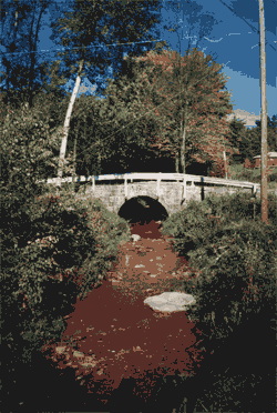
Coal mining activities in the Clarion River basin, located in northwestern Pennsylvania, have left scars on the landscape and severely polluted many streams in the basin. The area suffers from an environmental problem commonly associated with coal mining—acid mine drainage (AMD). Acid mine drainage results from the chemical reactions of sulfide minerals, principally pyrite. These minerals contain sulfur and iron and occur naturally in and around coal seams. When pyrite comes in contact with air and water, sulfuric acid, iron oxides, and hydroxides are produced. These pollutants are continuously released at surface mining sites that are exposed to rain and other surface water. In the Clarion River basin, tributary watersheds contribute approximately 72 tons of acid pollution each day. The Toby Creek subbasin is one of the six polluted watersheds in the 200-square-mile Clarion River basin. Toby Creek rises in Farmington Township in northeastern Clarion County. It extends approximately 13 miles southwest and enters the Clarion River just north of the city of Clarion. Fed by many smaller tributaries, such as Engle Run, Little Toby, Step Creek, and Rapp Run, the 37-square-mile subbasin is long and narrow with an average width of 2.5 miles. It is characterized by steep hillsides and valleys in the south that give way to broad hilltop plateaus along the western perimeter and moderately rolling hills toward the north. Drainage patterns for the basin are typically dendritic (i.e., irregularly branching). The central portion of the basin is heavily vegetated with brush and forest. Strip mines and farms are located on the subbasin perimeter. This watershed has been the subject of intensive mineral resource recovery operations since the early 1800s. These activities have included surface and underground extraction of bituminous coal and drilling for petroleum and natural gas. Portions of the watershed are affected by severe AMD that originates from several surface coal strip mines and a few abandoned deep shaft mines. Although mining activity ceased in the late 1930s, water quality problems persist to this day at several locations. Headwater stream reaches unaffected by mining activity have near-neutral pH and normal water quality characteristics that sustain modest populations of small native brook trout. The total absence of fish and other aquatic life in lower reaches of the stream is caused by the low pH values and very high iron and total dissolved solids content. The stream remediation process needs to be organized based on stream location, pollutant levels, and contaminant concentrations. GIS provided a means for bringing spatial and informational data together to simplify prioritization of the stream remediation process. The outcome was a series of maps summarizing different stream conditions that suggested an intervention plan based on the concentration levels of stream pollutant factors.
For the project, a geographic database was built for streams that were sampled. Geographic database design was done using ArcGIS 8.3 and Microsoft Access. United States Geological Survey (USGS) topographic maps of the region were used as basemaps. The data collected from predefined locations included stream discharge; temperature; acidity level (pH); conductivity; and iron (Fe), sulfate, and nitrate concentrations. Preliminary interpretation of the collected data showed interesting relationships to drought conditions, excess precipitation, and normal seasonal fluctuations in the water budget. In addition, the boundaries of Toby Creek watershed were queried and exported from a larger dataset downloaded from the Pennsylvania Spatial Data Access Web site. The resulting polygons were used to extract the study area from the datasets in the database. Hydrology maps were downloaded from the Geography Network Web site, clipped to the study area, compared with USGS topographic maps, and refined to fit the purposes of the study. Common stream data preparation operations, including checking the connectivity between line segments, adding missing streams, adjusting the stream lines to to fit the topographic map, and ensuring all datasets shared a common coordinate system, were performed. Finally, sampling points were interpolated to present the collected water samples on the prepared stream segments. Accordingly, water sample reading attributes were assigned to each stream segment using table joins. Levels of acidity and iron concentration were classified as high, medium, or low. Because stream segments with high levels of both acidity and iron are extremely high priority sites for remediation, a subclass was created that combined iron concentration with pH classes. Another field for remediation class identification (class_id) was added to the streams attribute table for prioritizing segments using different levels of acidity and iron concentration classes. Using this method, four streams were ranked extremely high, six very high, and nine high for intervention. In this study, GIS enabled researchers to prepare spatial information and join the field data collected to the streams attribute table. Querying each stream for different acidity levels and iron concentrations provided a simple and efficient method for selecting and categorizing stream segments that require immediate intervention. The resultant maps show the location and the type of pollution of different stream segments that are prioritized for future remediation or urgent action. The development of a full watershed remediation plan should involve focusing on the details of implementing projects at identified sites, which might include considering the cost associated with different treatment methods, the effectiveness of each method for treating site conditions, and the presence of other elements and factors that might affect the water condition such as the direction of water discharge; rainfall; and aluminum, manganese, and sulfate concentrations. In addition, socioeconomic factors that impact local residents, landownership, and other legal aspects might be assessed in relation to a larger watershed remediation plan. For more information, contact Yasser Ayad, Assistant Professor
|
||||||||||||||||||||||||||||||||||||||||||||||||||||||||||||||||||||||||||||||||||||||