ArcWatch: GIS News, Views, and Insights
January 2012
Diving into Esri's Ocean and Natural Science Initiatives
Dawn J. Wright Sets Course as Esri's New Chief Scientist
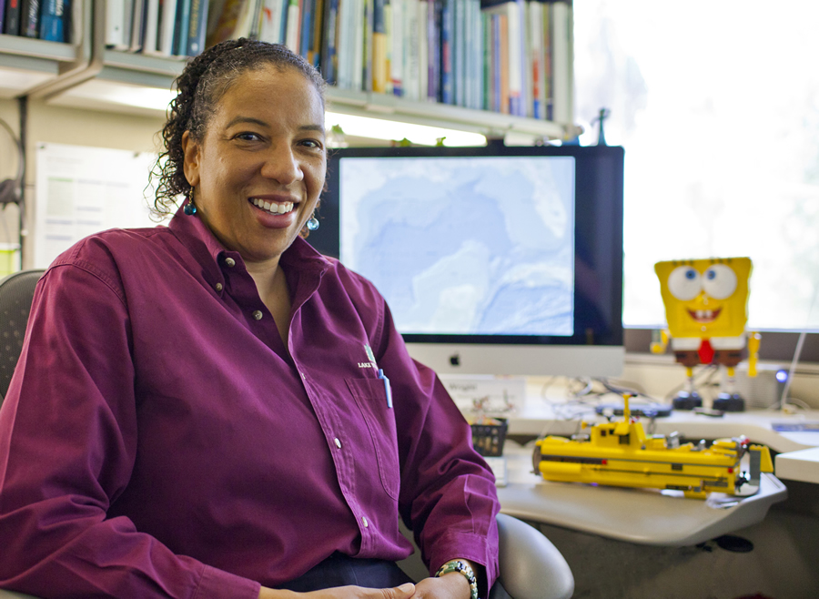
Wright, pictured in her new office at Esri, will help spearhead Esri's ocean and science initiatives. In the background are some of the LEGOs that she has built, including an underwater vehicle.
Oceanographer and geographer Dawn J. Wright recently came on deck as chief scientist at Esri, signaling the company's deepening commitment to support work in the natural sciences, including oceanography.
Esri president Jack Dangermond appointed Wright to the post. Her duties include overseeing a new ocean GIS initiative, helping to craft a strategy for how to best serve the science community, and offering input and advice to Esri staff members as they develop geospatial technology for scientists. She will also represent Esri in interactions with the national and international scientific communities, serving on organizations such as the National Academy of Sciences Ocean Studies Board and the National Oceanic and Atmospheric Administration (NOAA) Science Advisory Board.
An Oregon State University (OSU) professor of oceanography and geography known to many as "Deepsea Dawn," Wright brings a rarely matched passion and enthusiasm for using geographic information system (GIS) technology to map and analyze the marine environment. She has participated in many research expeditions to study and map the seafloor and went on several dives in the submersible Alvin.
Esri marketing writer Carla Wheeler recently visited with Wright at her office in Redlands, California. They talked about what inspired Wright's fascination with the oceans at a young age, the growing role of GIS as a technology to support scientific research, and what she's doing to get her feet wet as she starts to spearhead Esri's ocean and science initiatives.
Wheeler: Why do you think you were tapped to be Esri's chief scientist?
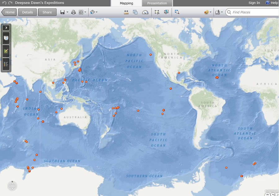
Wright has traveled to many locations throughout the world on research expeditions over the last 20 years.
Wright: You'll have to ask Jack that one to get the full story, but I think one of the reasons is that Esri is in the midst of an ocean GIS initiative. Jack has said very clearly that he would like Esri products to serve the ocean community better. Esri has been working toward that, but in recent years, especially with climate change and how oceans are now seen as more important for so many different reasons, the time has come for the company to focus more intently on oceans.
Wheeler: You grew up on Maui, Hawaii. How did that Maui experience influence you?
Wright: It's totally responsible for my interest in the oceans. When I was eight, I started thinking about what I wanted to do when I grew up. I was doing a lot of reading at the time-novels like Treasure Island and 20,000 Leagues Under the Sea and just loving that and being in the ocean every day. At that time, the Undersea World of Jacques Cousteau was a fixture on TV. So I really got enamored with the ocean. At first it was underwater photography because one thing about Jacques Cousteau that I don't think a lot of us realize is that he really was an underwater photographer and a videographer. He was not as much of a scientist. He was a wonderful conservationist, but what he did with all of his footage was to open up the whole world of the oceans to millions of people. I think a lot of us were influenced to find out more about ocean science as a result of him.
Wheeler: Oceans make up about 71 percent of the earth's surface. How much of that remains unexplored?
Wright: About 5 to 10 percent of the ocean floor remains unexplored and unmapped in great detail. In addition, 97 percent of the planet's water is in the oceans, and only about 5 percent of that vertical element has been explored thoroughly as well.
Wheeler: We've spent so much time mapping the land surface. Why have we ignored the oceans?
Wright: We live on the land, and we're able to traverse the land and see the land, but the oceans are more difficult to explore. We have all this wonderful imagery from satellites, but satellites cannot see down into the water. To see into the ocean, you need acoustics [sound energy]. And to do this at sea takes more time and a tremendous amount of money.
Wheeler: I think a lot of people don't even think about the oceans and what lies beneath the surface, such as the Mid-Atlantic Ridge.
Wright: A lot of people don't know what the continental shelf looks like right off of their own shoreline. Many people are unfamiliar with the huge Monterey Bay Canyon that extends offshore of central California. Many are unaware of the canyons that are right offshore here in Southern California. We are very familiar with the San Andreas fault. But there is also a huge fault system offshore of Oregon, where we will likely have a major earthquake within the next 50 years. All faults are essentially cracks, and the San Andreas fault is a crack where one side is slipping past the other. Offshore of Oregon, the motion at the crack is different because one piece of the earth is sliding underneath the other instead of slipping laterally. That can cause earthquakes that are just as big as those that can occur on the San Andreas fault, if not bigger. If you have an earthquake like that offshore, it may generate a tsunami, not unlike the big Japanese tsunami that occurred in March 2011.
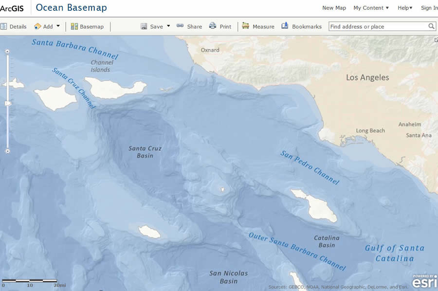
Designed as a basemap for GIS professionals, the Ocean Basemap from Esri also serves as a great reference for anyone interested in learning more about the world's oceans.
Wheeler: What are some ocean-related issues of concern to you that could be studied and better understood by using GIS?
Wright: Pollution has been a problem because people have believed that if you throw something into the ocean, then it's out of sight, out of mind; the oceans will absorb it and you won't have to worry about it anymore. But over many centuries of doing this, we now have huge garbage patches in the oceans. There are international laws that restrict or outlaw dumping, but it's still a major problem.
Wheeler: What are some other issues we face in ocean management that would benefit from using geospatial technology for decision making?
Wright: We're facing many crises in the oceans with regard to fisheries. Species that we love to eat are getting overfished. There's not enough to sustain that critical part of our economy. What can we do to reverse this? We have also had the [Gulf of Mexico] oil spill. I think that's the biggest cautionary tale of all right now, in terms of our use of the oceans. Perhaps this is a geodesign issue, because if the way that we have tried to design how we take resources from the oceans is faulty, and we have a disaster as with the gulf oil spill, look at the terrible implications for the economy, people's livelihoods, and all of those species and wetlands that have been damaged.
Wheeler: What is being done to address these issues?
Wright: President [Barack] Obama is the first president in US history to create a national ocean policy [that] directs the government in terms of how we are to manage the oceans properly.
[See Final Recommendations of the Ocean Policy Task Force, which the White House says establishes a national policy for the stewardship of the ocean, coasts, and Great Lakes and creates a National Ocean Council to strengthen ocean governance and coordination.] The idea is to better manage the use of our oceans among various stakeholders. Oceans are used by fishermen, for shipping, for telecommunications-just as we have land-use planning, [ocean] planning needs to take place to better manage these competing interests.
Wheeler: That leads us into the science-based initiatives Esri is pursuing.
Wright: To assist in ocean-use planning, the Center for Marine Assessment and Planning at the University of California, Santa Barbara [UCSB] is currently developing a decision support tool called SeaSketch with assistance from Esri Professional Services. It's a geodesign tool for the oceans that will use Esri software for geospatial analysis and visualization. It's a really wonderful project that grew out of an existing initiative and an existing tool on the web called MarineMap, which integrates a whole bunch of wonderful GIS data for oceans and coasts. If you are a fisherman, a resource manager, or someone who lives along the coast, all of you can either get in a room together or collaborate over the web and work with this tool to map out the data and try to design new areas that should be protected or used sustainably. The SeaSketch tool will also leverage Esri-friendly tools that have been built by others, including Pat Halpin's Marine Geospatial Ecology Lab at Duke University. The Marine Geospatial Ecology Lab has built statistical tools for the oceans [as well as] tracking tools and ecological analysis tools that can run in ModelBuilder (a visual programming technology available in ArcGIS) or on the web.
Wheeler: Earlier this year, Esri released the Ocean Basemap, which includes bathymetry, surface and subsurface feature names, and derived depths. Were you involved in its development?
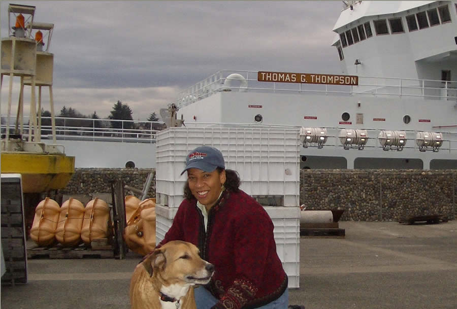
Wright poses with her dog Lydia in front of the research vessel Thomas G. Thompson.
Wright: The project was headed by Esri's Rafael Ponce and Beata Van Esch on the maritime team. Though I was not involved in the basemap's development, I will offer input and support from here forward. There has been a great need for a cartographically sound, beautiful ocean basemap. We now have the data along with the place-names to create a fairly detailed, usable basemap upon which we can overlay other datasets. The Ocean Basemap is continually being improved, with more data being added all the time. The maritime team members are working on the coarser resolution right now, but at some point they'll be working on the finer resolution, getting it down to a 1:36,000 map scale, I believe.
Wheeler: Any other interesting science initiatives that Esri plans to support?
Wright: Marine ecologists at UCSB are working with Conservation International, Radical Media, the Communication Partnership for Science and the Sea [COMPASS], Esri, and others, to develop an ocean health index [OHI]. The OHI is designed to "take the pulse of the ocean" to provide a quick set of vital signs [i.e., indicators that measure the intensity of the most urgent ocean stressors, including climate change, ocean acidification, overfishing, habitat degradation, invasive species, loss of biodiversity, pollution, and eutrophication]. These will help managers, policy makers, and the public quickly diagnose where problems lie and identify possible solutions. The project seeks to bridge the science/policy maker divide. Esri is currently working on an interactive atlas viewer that will map out ocean health index data for selected regions of the world. The viewer will use a customization of the Ocean Basemap.
Wheeler: Define your role as chief scientist beyond the ocean initiatives.
Wright: The idea is to help Jack and the company's directors with science strategy. That science strategy includes the oceans, but it also includes other natural sciences that have been really important parts of the Esri community: climate science, forest science, agricultural science, landscape and seascape ecology, conservation biology, hydrology, geology, and more.
Esri supports these science communities with products and works in concert with scientists at universities and government agencies. My role is to help foster those partnerships and also to stay abreast of trends in these sciences as Esri grows with its products and services. The company also really needs to know, what is the cutting edge out there? To help answer this, I work very closely with the National Academy of Sciences, the National Science Foundation, and scores of scientists in the academic community. I've also just been appointed to the NOAA Science Advisory Board. This is the board that gives direct advice to NOAA administrator Jane Lubchenco.
Wheeler: Why did you decide to leave academia, at least for the time being?
Wright: I haven't completely left academia because I am still on the faculty at OSU and have four graduate students finishing [its] program. But the request from Jack and Esri director of software development Scott Morehouse to take on the role of chief scientist came at just the right time for me. I was looking for a change of pace from my current academic job and wanted to do something a bit different. Helping out with the ocean GIS initiative as part of the job was extremely attractive to me, as I have been involved with Esri for many years as an ocean GIS user and advocate. I can't think of a better position to be in now to help move that along.
I'm also very excited by the opportunities the position affords in terms of getting involved with exciting projects and initiatives across the board in geoscience and the other environmental sciences, as well as working with leaders in business, government, and conservation nongovernmental organizations. I can do this as an academic but not nearly as quickly and readily as I can as Esri's chief scientist. Esri is also on the ground, in the trenches, with the ability to make immediate and practical impacts in terms of translating scientific knowledge into action, and perhaps even connecting science to decision making and to policy. Esri has always been the shining light on the hill to so many of us out in the academic user community, so it is a real honor and privilege for me to be here within the company and doing my best to contribute.
To hear Wright talk more about her new role at Esri and the company's ocean and natural science initiatives, view this video.