Quickly Measure Lines and Areas
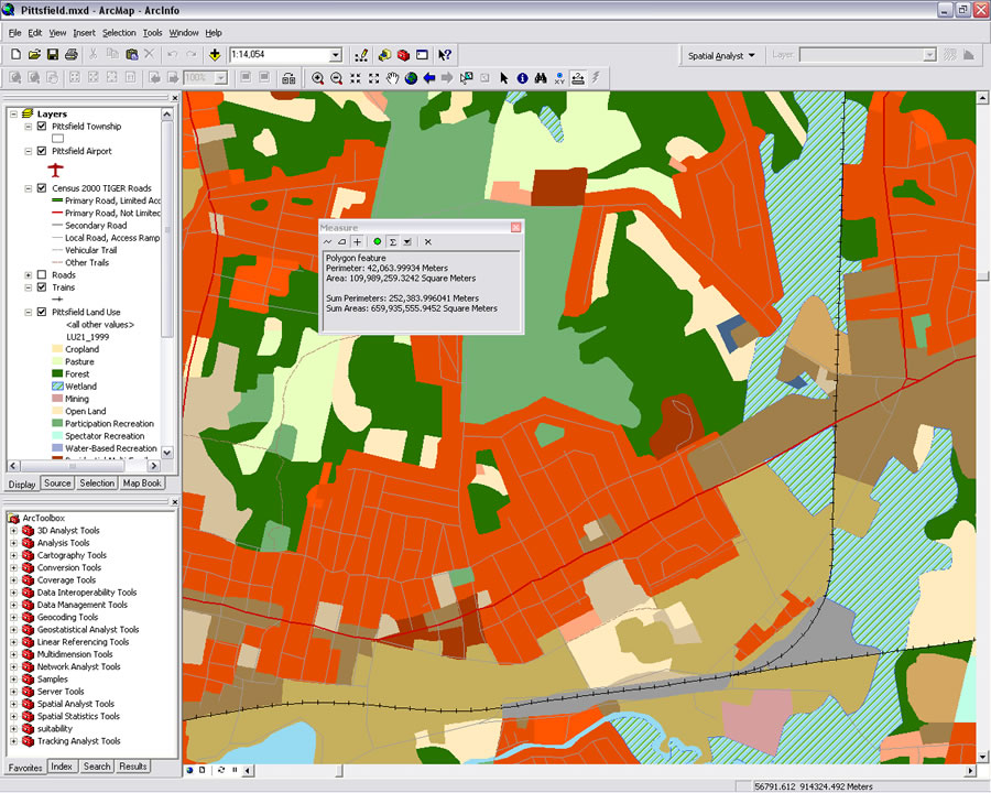 Measure polygon areas with one click and keep a running total of the area and perimeter. |
Get the length of a line or the area of a polygon with a single click using one of several enhancements to the Measure tool. These enhancements are available in latest version of ArcMap and ArcReader applications in ArcGIS 9.2 Desktop with Service Pack 3.
Clicking on the Measure tool in the Tools toolbar invokes the Measure dialog box which contains buttons for measuring a line, measuring an area, clicking on a feature to measure its length or its x,y location or measure its perimeter and area. This dialog box also contains buttons to turn on the snap-to-feature mode, turn on a running total for all measurements made, and choose distance and area units. The dialog box makes it easy to copy and paste the information it generates and use that information in other applications.
The Measure tool is much easier to use now. Clicking on a feature to learn its measurements is particularly convenient because there is no need to trace over features. The snap-to-measure mode is set to eight pixels and automatically snaps the line used to measure a feature to the nearest vertices of a line or polygon. To snap to a point anywhere along a line or polygon, rather than just to vertices, hold down the Ctrl key while drawing the measuring line.
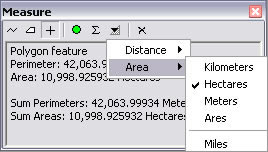 Set area and linear units that will be used in measurement calculations. |
By default, if the map document data frame uses a projected coordinate system, ArcMap will calculate distances using two-dimensional Cartesian mathematics. Measurements will reflect the projection of three-dimensional data onto a two-dimensional surface and will not take into account the curvature of the earth. Hold down the Shift key while measuring to obtain the geodesic distance. This distance will be calculated using the spheroid/ellipsoid specified for the projected coordinate system. If the data frame uses a geographic coordinate system and the display units are linear, measurements are geodesic by default.