GIS Teams Map the Zaca Fire
By Jesse Theodore, Esri Writer
Santa Barbara—The day California governor Arnold Schwarzenegger declared a state of emergency in Santa Barbara County because of the Zaca fire, Zacharias Hunt swung into action. As the county's geographic information officer, Hunt had to quickly assemble a GIS team to provide the spatial information about the fire that county officials, firefighters, and other emergency responders needed.
Three separate GIS teams operated during the Zaca Fire. The Santa Barbara County GIS team, headed by Hunt, quickly set up shop inside the Santa Barbara County Emergency Operations Center (EOC)-three modular temporary buildings normally used for classroom training. The ECO would become the county's management nerve center overseeing the Zaca fire emergency. Team members included Kevin Donnelly from the county's Public Works Department and Cory Gallipeau from the county's Planning and Development Department.
Quickly Assembling Multiple GIS Teams
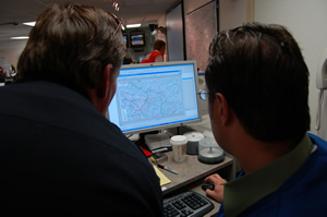
Dozens of staff worked at a frantic pace inside a large windowless room that was covered wall to wall with maps and marker-filled white boards. Sections of the room were portioned off for operations, planning, logistics, the Red Cross, and other groups. Each worked at independent tables covered with computers, books, and paper documents.
Stationed at the EOC, Hunt's first job on August 3, 2007, was to assess potential software, hardware, data and staffing needs and put in place an enterprise GIS technology environment. "I was rushing that whole weekend to get all the resources into the EOC," says Hunt. "For example, we had to get a couple of high-end computer workstations and plotters operational to make maps. I also had to quickly assemble a GIS staff. I was fortunate to be able to work with two technicians from other county departments [Donnelly and Gallipeau]. We began generating data and making it available via an internal server."
The Santa Barbara County GIS team, already an Esri software user, approached Esri for additional assistance. The latest ArcGIS 9.2 software, including ArcInfo; ArcGIS extensions 3D Analyst, Spatial Analyst, Tracking Analyst, and Network Analyst; and ArcPad, were quickly shipped by Esri and deployed by the team. For cartographic output of GIS-generated maps, the County GIS staff used 3 plotters: a 44-inch Epson plotter and two 36-inch Hewlett Packard plotters. The team produced up to several dozen maps every day showing the fire's progress, containment lines, and how close the fire was to populated areas.
A second team consisted of GIS professionals from federal and state agencies, deployed any time a major fire occurs. They worked out of trailers at two incident command posts on opposite sides of the fire in the Santa Barbara County area adjacent to the Los Padres National Forest.
The command posts, known as the Live Oak and Richardson base camps, provided a staging area for front line firefighters, pilot crews, and personnel working to create firelines-large areas of cleared vegetation that can act as a barrier to prevent the fire from spreading.
Inside the trailers, people worked in shifts side-by-side at computer terminals stretched out over long, rectangular foldout tables.
Each staff member worked to generate maps showing constantly updated perimeter data that was captured from daily helicopter flights. Pilots and GIS technicians would fly around the fire and use high-tech infrared cameras that captured x,y coordinates through the fire's dense smoke. The data, fed to a laptop computer with desktop GIS software, was automatically georeferenced to points on the ground.
This point data, saved on CDs, would be handed off to the GIS team and uploaded to ArcGIS software back at the trailer. Staff would move the data to an FTP site that was password protected and accessible by Hunt's team.
"They're geared toward supporting the firefighters in the field, so their primary responsibility was making operation maps and public information maps," says Hunt. "They were the ones receiving the daily information with infrared data, mapping the new perimeters, and pushing that out."
A third GIS crew, consisting of California Department of Forestry and Fire Protection (CAL FIRE) GIS professionals, provided assistance as well. They helped county emergency personnel with longer-term strategic planning to generate a staged evacuation plan for the entire South Coast area of Santa Barbara County. "The state team was responsible for developing a geographic breakdown of assignments and resources if the fire came over the mountains and into our coastal cities," says Hunt. "They outlined the area into five branches and then the branches were actually split up into divisions."
Approximately 30 to 40 different layers of spatial information provided from city, county, and state sources, as well as data captured from the field, were maintained and used at various times by the GIS groups. Teamwork and coordination were at the heart of the operation, along with ArcGIS software, which was used 24/7 as an information resource by all the GIS professionals supporting the firefighters and other emergency responders who worked long and hard to snuff out the Zaca fire.
See also "Enterprise GIS Helped Agencies Battle California's Zaca Fire."
