GIS Enhances Oil Recovery
By Jessica Wyland, Esri writer
Anadarko Petroleum Corporation manages its enhanced oil recovery (EOR) projects as well as infrastructure and operations as meticulously as possible with geographic information system (GIS) technology.
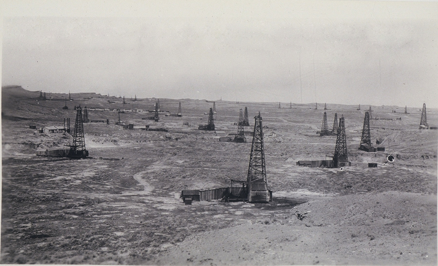 The Salt Creek field was discovered north of Casper, Wyoming, in the early 1900s and celebrated its 100th year of production in 2008. |
GIS links crucial data to physical locations, which is essential for Anadarko, the largest independent deepwater resource producer in the Gulf of Mexico with additional production and exploration sites in Alaska, Algeria, Brazil, China, Ghana, Indonesia, and Mozambique. Anadarko also operates an EOR project at Salt Creek field in Wyoming.
"We use GIS to map every piece of infrastructure, from the flow lines and pipelines we use to move the CO2 to our buildings and wells," said Ken Michie, Anadarko's subsurface manager. "The Salt Creek wells are so old, and the survey techniques have evolved so significantly, that a lot of the old mapped locations didn't match the field. We've used GIS to remap those wells along with our pipes, so we know the exact locations of our pieces of infrastructure."
Required infrastructure for EOR includes natural gas treatment facilities for CO2 capture, pipelines, compression equipment, transportation, distribution lines, flow lines, and wells for injection. Anadarko uses GIS to track pipeline maintenance, view land reclamation, and keep up with revegetation of native grasses. GIS gives operators an up-to-date picture for site and route planning, asset management, field crew deployment, and decision making. By calling up layers on a GIS-based map, designers can look at wildlife habitat, protected species development, and archaeological sites.
"The ability to manage, correlate, predict, model, and share volumes of data in an interactive digital map makes GIS an essential analytic tool," said Robert Brook, pipeline and gas industry manager for GIS developer Esri.