ArcWatch: GIS News, Views, and Insights
February 2012
Esri Developer Summit: Where Developers Get a Jump on the Future of GIS
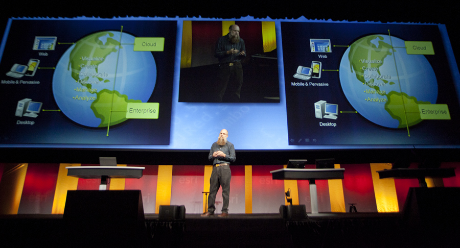
Scott Morehouse, Esri's director of software development, talks about web, cloud, and mobile technology at the DevSummit.
With more than 60 technical sessions on how to work with Esri's ArcGIS, and with direct access to the teams that build this technology, the Esri Developer Summit (DevSummit) draws developers from around the world year after year.
While the average 80-degree daytime temperatures during the March 26-29 event are a plus, it's the valuable technical information about GIS technology that makes this event so popular. More than 1,350 people went to DevSummit in 2011, and attendance is expected to be excellent this year as well.
"Developers and GIS professionals will get the unique opportunity to speak one-on-one with the engineers and developers who design and build Esri's ArcGIS technology," said Jim Barry, Esri Developer Network program manager and the DevSummit's lead planner. Esri staff will be available to help attendees troubleshoot issues and answer questions.
Attendees will gain insight into new technologies at the plenary and technical sessions, network with each other, and share some of the projects or designs they have been working on throughout the year. The main focus of this year's event will be ArcGIS 10.1, which will be released to the developer community prior to the DevSummit.
Developers will get a chance to work with this newest release; a complete geospatial system for the desktop, enterprise, mobile devices, web, and the cloud. They will have the ability to upgrade their applications before end users receive the new release. Barry said that one particular "wow" factor for the release will be ArcGIS 10.1 for Server. The fundamental architecture of ArcGIS for Server has been redesigned. Gone is the server object container-server object manager (SOC-SOM) model, which is being replaced by the ArcGIS for Server site. This change will give administrators more control as it simplifies and streamlines ArcGIS for Server administration.
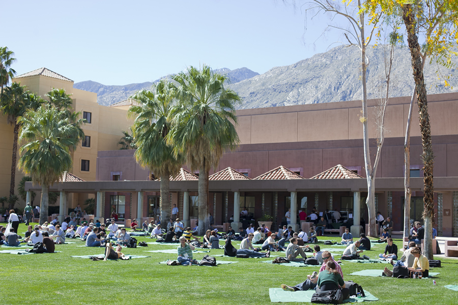
DevSummit attendees take a break from the technical sessions in Palm Springs, California.
ArcGIS for Server product manager Ismael Chivite will introduce this information in the session ArcGIS 10.1 for Server for Administrators, which will follow the plenary on March 27.
Barry said that there will also be several sessions geared for developers based on their interests, the applications they build with GIS, and their levels of expertise.
For example, attendees who are just starting to use developer tools can attend hands-on training classes during the presummit seminars on March 26. For a fee, they can sign up for eight-hour, instructor-led introductory courses for JavaScript, Python, and Dojo. Seats are limited, so interested developers should act fast before they sell out. (All other sessions and activities are included in the base registration.) Instruction will be held concurrently with 11 other presummit sessions that, for the first time, will be focused on the use of ArcGIS in particular industries. These 75-minute sessions will be of great use to those who work on applications and systems for local government, water utilities, transportation organizations, emergency operations centers, and defense agencies.
Experienced developers who are new to mapping and GIS will not want to miss Introduction to GIS for Developers on March 26. This complimentary, eight-hour technical workshop will cover topics such as GIS data basics, an introduction to the geodatabase, and the building blocks of electronic maps. "This session will help [users] get up to speed with concepts such as feature geometry, raster and imagery data, spatial data editing, geoprocessing and modeling, map projections, and coordinate systems," Barry said. "It will also cover basic techniques for including interactive mapping in websites and mobile devices."
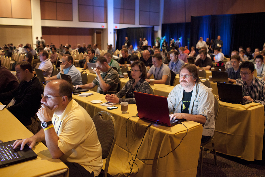
The plenary session attracts a large crowd.
Another highly recommended session is Building Applications with the ArcGIS Runtime SDK for WPF (parts I and II). Senior engineers behind this new developer toolkit will take you from zero (knowledge) to hero, showing you everything you need to know to get started, including the resources available for success. "ArcGIS Runtime provides a strong set of GIS capabilities that developers can embed into relatively lightweight, easy-to-deploy Windows applications," Barry explained. "For three hours on March 27, [users] will learn how to get started, how to build applications, and about the full capabilities of this new developer toolkit. There will also be similar two-part ArcGIS Runtime sessions for developers using Java, as well as runtime SDKs for Android, Windows Phone, and iOS developers."
Barry said there will also be, for the first time, a Methodologies track at DevSummit. Previous DevSummit attendees have asked for a track where they can step away from ArcGIS and learn from one another about topics of interest to all developers, including such software development methodologies as design, coding, testing, deployment, and product management. These technical sessions will dive into strategies, techniques, and best practices for the development cycle. These sessions include Agile Software Development, Software Development and Design Using MVVM, Software Testing in the Agile World, and Development Process: Source Code and Build Management.
A new addition to the DevSummit's successful User Presentation Track (where the developer community decides what it wants to see presented) will be the Lightning Talk session on Tuesday, March 27. Lightning Talks offer the audience ultrashort presentations; the motto is "be brief, be interesting, be gone." Eighteen presenters from the user community will have only five minutes each to present an idea or topic of interest. DevSummit attendees will have the opportunity to hear 18 fresh ideas in one evening.
The dodgeball tournament will be back too, along with the Meet the Teams gathering on March 27 and the Developer Summit party on March 28. All these events are designed to get everyone socializing, mingling, and networking with the ArcGIS engineering teams.