Manage and Shape Our Changing World with GIS
By Jack Dangermond, Esri President
GeoWeb Helps People Forge Solutions to Planet's Problems
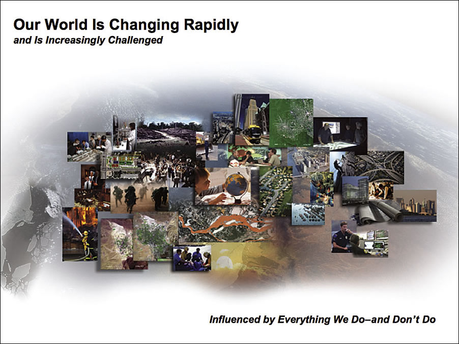
Our world is changing rapidly, increasingly influenced by virtually everything we do—and don't do.
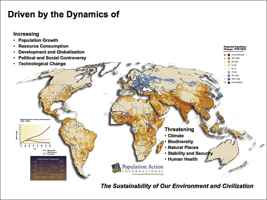
 The dynamics driving this transformation include the population boom, the consumption of resources, development and globalization, and political and social conflict. Furthermore, technological change, particularly in the information field, is growing and expanding our access to knowledge. We are becoming an information-rich society.
Population growth and related natural resource consumption are two of our greatest concerns, leading to threats to our climate and biodiversity, our natural places, our stability and security, and human health. Some people suggest these ongoing changes will affect our ability to sustain our environment and, ultimately, civilization itself. Clearly, we face a challenging future in which geographic information system (GIS) technology, particularly on the Web, will play a critical role.
To address these changes, we all need to participate. We need to have greater understanding of each other—more empathy. We need to share responsibility for what's happening on our planet and have the courage and will to act. On many fronts, we need more collaborative efforts and stronger leadership that consider all the factors related to policy and decision making.
Growth of the "GeoWeb"
We also need geographic science as a framework for responding to these changes. GIS is beginning to fulfill a significant role, supporting our personal and collective efforts within organizations and society. In addition, more and more people are turning to the Web, where GIS technology is rapidly evolving and making geographic knowledge easier to access and more available.
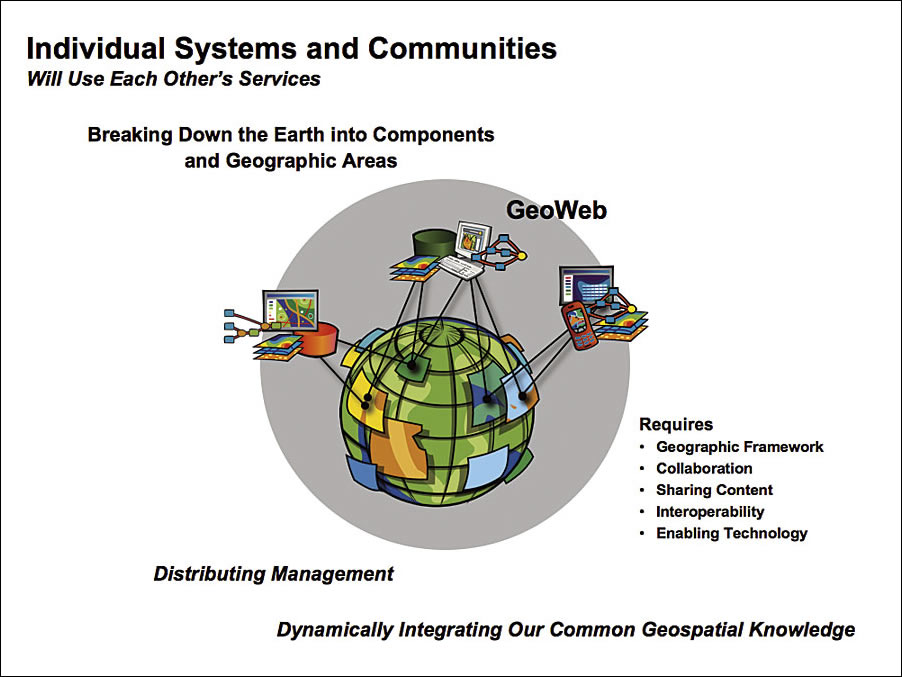
 As the natural and cultural processes of the planet become more "wired" or "connected," we will increasingly see new geographic information services and communities of users who incorporate these services into their daily decision making. Some have called this new environment the GeoWeb—a geospatial dimension of the cyberinfrastructure.
The GeoWeb will provide many new possibilities for sharing, integrating, and leveraging geographic knowledge. GIS professionals will increasingly publish their data, maps, spatial analysis models, and 3D visualizations as services for others to access and use. This will create a new way of thinking about GIS.
Our combined services will provide a new distributed GIS that is open, interoperable, and dynamic. Individual systems and communities will use each other's services, breaking down the earth into components and allowing the dynamic integration of knowledge.
The management of this knowledge will be distributed. Services will be interconnected to create new services, and as a result, various parts of organizations will become increasingly collaborative and interdependent. Eventually, these services will provide a global network of geographic knowledge for the planet that is widely accessible and reflects the dynamic changes occurring.
The GeoWeb requires the common georeferencing framework provided by geography. It also requires collaborative thinking and planning, as well as policies for openly and freely sharing content. It will require creative efforts by many to design and build a class of Web-based applications. Finally, it requires enabling technology that is open and interoperable.
Enabling technology is also evolving rapidly with faster computers, increased bandwidth, larger storage, Web services standards, mobile technologies, real-time server networks, and GIS software that is designed to work on the Web. Web-based GIS represents a generation of technology that will dramatically change GIS professionals' ability to share and integrate their geoinformation.
The Appeal of GIS
 GIS is being used to model the physical and cultural knowledge of our world, breaking it down into components and subsystems, providing us with systematic knowledge, an integrative framework, analytic methods, and intuitive visualization. People find GIS attractive because it responds to both the cognitive as well as intuitive dimensions of understanding. GIS creates order and meaning. It helps us define interconnections and interdependencies, and it provides a broad understanding of nature and human ecology.
GIS influences how we see things and how we respond. It is helping us build a common understanding, creating a sense of engagement, providing greater science and logic, and improving accuracy and realism. Finally, because GIS is integrating with real-time data or "sources," it provides immediacy.
Collaboration Leads to Solutions
Many have characterized GIS as one of the most powerful of all information technologies because it focuses on integrating knowledge from multiple sources and creating a cross-cutting environment for collaboration. The work of GIS professionals around the world has clearly demonstrated the value of using geographic knowledge and GIS tools for applications in almost every discipline and field. Their efforts, together with the underlying technology, have stimulated a new geography-based approach to problem solving and thinking about our world.
GIS professionals are central to this mission. Their work is helping advance many aspects of science. They are helping societies design a better future by considering all the factors of nature. They are helping improve human health, mitigate conflicts, and support business to become more productive and efficient. In almost every dimension, the work our users and partners are doing is improving the way that we communicate and manage our world.
Our world is changing, presenting many challenges. GIS professionals, working together, will author and share the knowledge that will make a difference. I strongly believe that this collaboration will help us bring peace and prosperity as well as a more sustainable world.