A Perfect Place for Professionals to Gain GIS Knowledge and Skills
By Allyson Lawson, Esri Writer
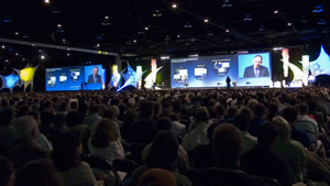 Thousands of people fill a hall to hear Esri president Jack Dangermond speak at the Esri International User Conference. |
"There's something for everyone and anyone in the world of GIS."
So says Jane Schafer-Kramer, a GIS analyst from the California Department of Water Resources, in discussing why she likes to attend the Esri International User Conference (Esri UC), a yearly gathering of like-minded Esri software users interested in learning about the latest geospatial technology. "It's the most value-packed conference I have ever attended."
Designed to serve as an invaluable resource for GIS users, Esri UC will return July 13-17, 2009, to the San Diego Convention Center in San Diego, California.
Esri UC gives thousands of attendees from across the globe access to information about GIS and related technologies. Learning and networking opportunities abound. From preconference seminars and software demonstrations to the massive Exhibit Pavilion, Esri UC provides many opportunities for visitors to learn about GIS alongside their peers and industry leaders.
"When we first started this event, we were aiming for a gathering that did just that—bring together our users and staff in one place for community and collaboration," says Esri president Jack Dangermond.
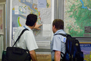 Attendees enjoy a visit to the Map Gallery. |
GIS has become more than a technology, developing into a movement of people dedicated to problem solving, making better decisions, making the most of scarce resources, and finding success in changing markets and a changing world.
The conference agenda is geared toward these goals of the GIS community, providing a variety of helpful and focused sessions, activities, and events.
Conference week kicks off with an energetic and inspirational Plenary Session, with Dangermond addressing future GIS trends and Esri's technical staff providing important technology updates and demonstrations. Attendees will want to stay for the entire session to hear from special guests including a renowned keynote speaker, award-winning software users, young people who have learned how to apply GIS, and Esri product managers and teams. From Dangermond's vision for GIS and the road ahead for Esri to a celebratory look at GIS applications worldwide, the issues discussed and projects highlighted are meant to be useful and memorable.
"It was great hearing from others who think the way I do and to learn how folks are reaching out into the communities and our schools to broaden this vision and shape the way GIS data will be used in the future," says Sharon Silver, intelligence analyst, U.S. Department of Defense, Oversight and Compliance, regarding the 2008 Plenary Session.
Contributing to the conference is one of the best ways to soak up the resources available. From submitting maps for the Map Gallery to hosting a Special Interest Group (SIG) or Regional User Group (RUG) meeting, there are many ways to both share and learn about GIS technology. The deadline to submit maps for the Map Gallery is June 15, 2009. SIG and RUG meetings can also be requested online at www.esri.com/uc.
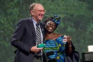 The Esri International User Conference always draws renowned keynote speakers such as Nobel Peace Prize winner Wangari Maathai, seen here with Esri president Jack Dangermond. |
Attendees will want to visit some of the valuable conference offerings including technical workshops and GIS concepts and industry focus sessions, which foster GIS skill building. In the Esri Showcase, attendees can watch demonstrations and get face time with Esri staff including the product development, professional services, technical support, and customer service teams. The Exhibit Pavilion is where more than 300 exhibitors—Esri business partners and users extending the Esri GIS platform—will be available to answer questions about their technologies.
GIS software users from all types of organizations will find ways to build on their GIS experience and projects, connect with key people, and take away tools they can put to work right away.
"By the time I left last year's conference, I was able to install all the software I needed and knew what I needed to do to get the solution into production when I got back to the office," says Eric Niemiec, director of software development, Service Brands International.
Last year's popular new event on remote sensing and GIS will be offered again on Sunday, July 12. During Remote Sensing and GIS 2009, the remote-sensing and imagery community will hear Esri's new vision for integrating remote sensing and GIS and hear from industry leaders on the topic. This all-day meeting will be followed by related sessions and technical workshops later in the week.
Esri will also host three other events July 11-14: The 2009 Esri Education User Conference (EdUC), the Homeland Security GIS Summit, and the Survey & Engineering GIS Summit.
Esri UC is open to all Esri GIS users. For more information and to register, visit www.esri.com/uc or e-mail uc@esri.com.