ArcWatch: Your e-Magazine for GIS News, Views, and Insights
March 2011
California Department of Fish and Game Implements Esri's ArcGIS Server
Statewide Topographic Map and Aerial Image Services Offered via the Web
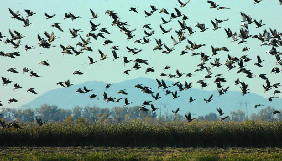
California teems with wildlife, including this skein of geese. Photo courtesy of Dave Feliz, California Department of Fish and Game.
California is a great state for wildlife. Varied topography and climate yield a broad range of habitats that are home to an unusually large and diverse number of species such as mule deer, brown bear, geese, and quail. The foggy and cool conditions of the Napa Valley, the arid heat of the Mojave Desert, the expansive coastline along the Pacific Ocean, and the rich forests of the Sierra Nevada are some of the many environments that host the state's plants and animals. The California Department of Fish and Game (DFG) monitors, maintains, and inventories the state's wildlife and habitats and oversees the use of natural species for recreational purposes, commerce, science, and education. For more than 20 years, DFG has been using GIS to assist with these efforts. Available from DFG's website are GIS-produced maps and downloadable GIS data layers such as
- The California Natural Diversity Database, which provides information about rare, endangered, and special status species
- The Vegetation Classification and Mapping Program, which provides maps and the classification of vegetation and habitats in the state
- The California Wildlife Habitat Relationships, which contains life history, geographic range, habitat relationships, and management information on nearly 700 species of amphibians, reptiles, birds, and mammals in California
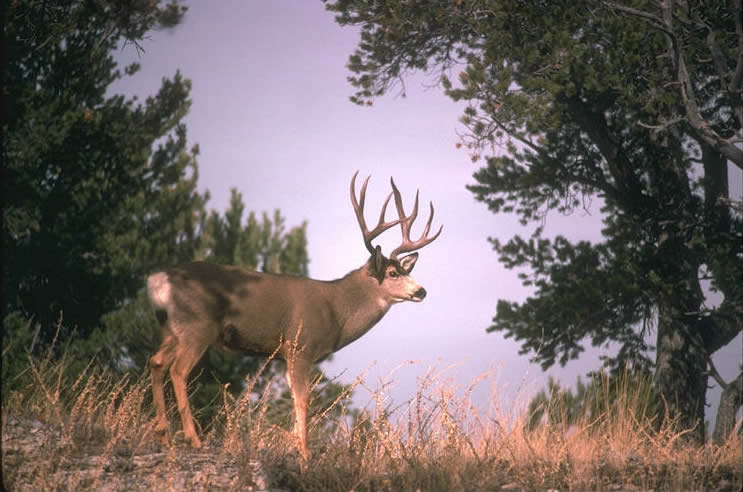
Mule deer are often found in the Sierra Nevada. Photo courtesy of the California Department of Fish and Game.
The website also offers interactive mapping applications that allow visitors to view and query data without having to install GIS applications on their computers. They can study the biodiversity of California and follow species of interest such as the spotted owl. Users can apply the information for assessing conservation and management areas.
DFG is changing the technology it uses to serve map content. For many years, it has been successfully using Esri's ArcIMS, but DFG is now implementing a plan to migrate to Esri's ArcGIS Server for more rapid deployment of map services, faster map service delivery through caching, and easier development of web mapping applications. The ArcGIS Server Image extension mosaicks and directly publishes large image collections without preprocessing them. DFG's migration plan from ArcIMS to ArcGIS Server involves two phases. The already-completed first phase included publishing new statewide map and image services for use as background layers within ArcGIS Desktop and future web mapping applications. The second phase, in progress, involves migrating existing ArcIMS web mapping applications to the ArcGIS Server environment.
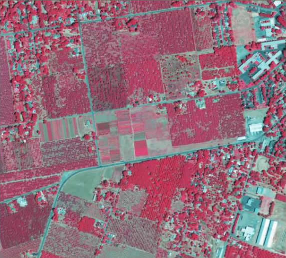
ArcGIS 10 showing NAIP 2009 Color Infrared (CIR) Image Service for California.
The first phase has provided statewide services, listed below, for DFG and public use. For widespread access, these services are offered from ArcGIS Server in both Esri and OpenGIS web map service formats. Some of the services are unique and not available elsewhere.
- Topographic maps-Several map services that are cached for fast display and include seamless U.S. Geological Survey topo maps (Digital Raster Graphics [DRGs]) rendered in different ways, such as grayscale, hillshade background, colors, and transparent background
- Aerial images-Several separate image services that offer various years (2005, 2009) and band combinations of U.S. Department of Agriculture (USDA) National Agriculture Imagery Program (NAIP)-related aerial imagery, including four-band, color infrared (CIR), natural color, and Normalized Difference Vegetation Index (NDVI)
During the second phase, the following DFG interactive mapping applications will migrate to ArcGIS Server:
- Biogeographic Information and Observation System (BIOS), with its own catalog of hundreds of layers of biogeographic and habitat data that can be added as needed into its map viewer
- An online fishing guide, which provides a map viewer for finding recommended fishing spots and related services and facilities
- DFG Properties viewer, which provides users with the ability to explore DFG lands and facilities throughout the state
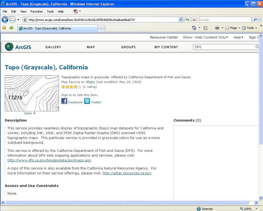
ArcGIS Online showing a Unique Topo Service for California in Grayscale.
DFG offices are located throughout California, but some locations have limited network bandwidth and capability to use online GIS resources. From an enterprise GIS perspective, it has been challenging to deliver data, such as specific aerial imagery, to those who need it. One solution has been to copy the imagery onto portable drives and ship them to the offices so that users can make a local copy. However, with imagery storage requirements growing to terabyte levels, this process has become cumbersome. Fortunately, after implementing the ArcGIS Server Image extension, DFG can host aerial imagery in one office and serve it on demand through image services to other offices. The image services also have compression settings that can be adjusted by end users to reduce bandwidth requirements.
DFG's topo map and aerial image services have been cataloged in ArcGIS Online for easy discovery along with content published by other contributors. In the future, DFG plans to use other already-published services, such as those from Esri, whenever possible to reduce the need to develop its own services.
The author would like to thank the Department of Fish and Game's server team for their work on this project.