ArcWatch: GIS News, Views, and Insights
March 2012
GIS in Education: The Web and Beyond
Pinde Fu, Senior Applications Developer at Esri, Discusses the Future of Web GIS
The web is rapidly changing the face of GIS. Web services and new tools make it easier to develop geospatial applications for the web, share geographic content, and collaborate on projects. Web GIS also makes conducting research and classroom instruction easier because the vast resources available on the Internet are more readily accessible.
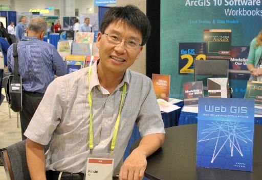
Esri's Pinde Fu co-authored Web GIS: Principles and Applications.
Esri writer Jim Baumann recently spoke about the future of web GIS with Dr. Pinde Fu, who coauthored the book Web GIS: Principles and Applications (Esri Press, 2011) with professor Jiulin Sun.
Fu is a senior application developer and project lead with Esri's Professional Services Division. He joined Esri in 2000 with a PhD in geography from the University of Kansas and a master of science degree in geography from the Chinese Academy of Sciences. He has more than 15 years of GIS experience. Fu has developed web GIS applications for emergency response, geoportals, green energy and buildings, urban facilities, natural resource management, planning, and environment monitoring.
Baumann: How has web GIS changed over the last several years?
With a virtual world implemented on top of a virtual globe, people can get the real work done in a virtual world environment. For example, emergency response staff can take part in a disaster training drill online.
Fu: Today, the web GIS programming environment is filled with easy-to-use development tools. REST-ful web services have attracted broad support because of their simplicity and support for programmers to easily remix services to create new applications. Browser-side GIS APIs, such as ArcGIS API for JavaScript, ArcGIS API for Flex, and ArcGIS API for Silverlight, have greatly simplified web GIS application development. This has attracted a surge of interest from both professional and casual GIS users to remix the available web resources and build mashup applications. The web has become a read/write platform that features a bottom-up information flow with increasingly rich volunteered geographic information. The public's growing desire for mobility and convenience has driven the proliferation of mobile web devices, led by the smartphone, which is rapidly becoming a strategic platform as a web GIS client.
Baumann: How is web GIS used in research today?
Fu: Web GIS provides a new infrastructure for research. With the evolution of web technology and the expanding use of web GIS, tremendous amounts of remote-sensing data, volunteered geographic information, and analytic web services are published daily. In addition, there is an exponential increase in the number of sensors directly connected to the web, providing rich, real-time datasets. As large enterprise organizations offer geospatial computing in the cloud through their web services and small organizations and the general public add geospatial services to the web, there is a growing wealth of powerful analytic capabilities available to scientists. They can now assemble the resources they need through web programming interfaces without being highly trained specialists in federated computing, requiring the access to disparate databases to create virtual ones. With the web as an infrastructure for e-science, the entry costs to working digitally have been greatly reduced, making it more readily available to the scientific community.
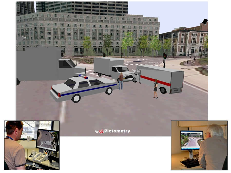
Loma Linda University Medical Center's Advanced Emergency GIS Application is a mashup application that dynamically integrates a variety of geospatial web resources.
Baumann: Briefly describe web GIS within the context of GIS education today.
Fu: While GIS technology has made significant advances during the past decade, university curricula for GIS are often unable to keep pace with these developments. I believe there is a fundamental need to update GIS teaching materials to reflect the prominence of web GIS today and promote web GIS within the university curricula. Without this, graduates will leave the university lacking a full understanding of the capacity of GIS as well as the current technology used in the workplace.
Web GIS is a cost-effective way to expand GIS education. In many fields of study, there is an increasing amount of free data, map services, analysis services, and applications available over the web. This allows professors who are not GIS specialists to easily use these online resources.
It is important to remember that today's university students are "digital natives." They were born into the digital world, and web-based learning comes naturally to them. Web GIS can engage students in a variety of fields and improve teaching and learning effectiveness.
Baumann: What are some of the benefits that college students receive from taking classes that incorporate web GIS technology?
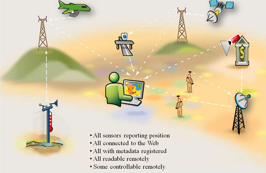
A sensor web includes a network of sensors that can be discovered and accessed over the web.
Fu: There are two considerations: web GIS education and web GIS-based education. Web GIS education focuses on web GIS technologies, principles, and applications. An understanding of web GIS provides students with a competitive advantage in today's tough job market. Web GIS has immense value and applicability to e-government, e-business, e-science, e-health, et cetera. Harnessing the power of web GIS will greatly benefit or even determine the future of many organizations. The demand for good web GIS professionals continues to increase. Students with a solid understanding of web GIS have broader choices in their career selections.
Web GIS-based education can enrich those subjects containing spatial content from elementary through graduate school. With intuitive web maps, geospatial analytic power, and diverse applicability, web GIS-based education can foster geospatial thinking and help students address real-world challenges.
Baumann: Which university subjects do you think are the most appropriate for teaching web GIS technology?
Fu: Certainly GIS and geography, but web GIS has great potential in a broader range of subjects, such as computer science, business management, environmental studies, economics, regional planning and design, health care, human services, journalism, public administration, and social welfare.
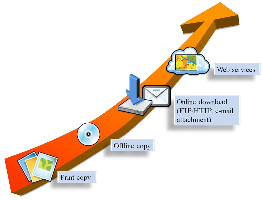
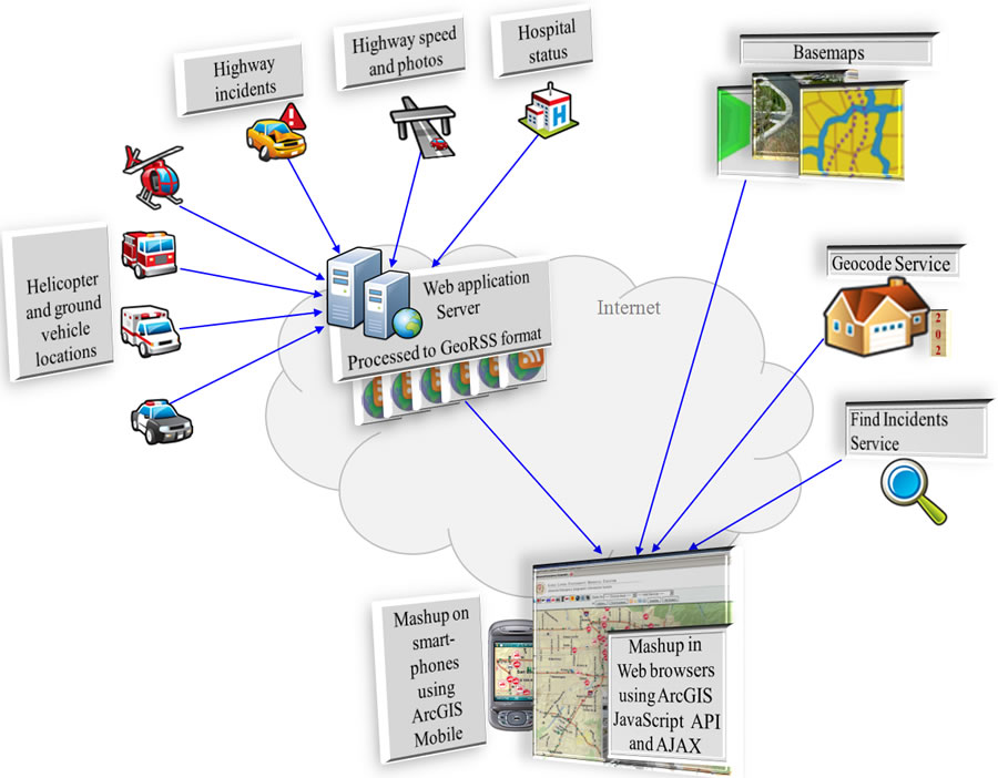
Geospatial information can be shared by a variety of means. The use of web services is an increasingly popular way to share information.
However, the greatest use of web GIS today is in government. It is used to deliver services to local residents, streamline government operations, coordinate activities among agencies, and sustain successful Gov 2.0 programs, which bring transparency to the government decision-making process.
Although awareness of the value of mapping has greatly increased in the business community during the past several years, many companies still have a narrow appreciation of the competitive advantages GIS can provide. Web GIS and its Software as a Service [SaaS] model offer the benefits of GIS while eliminating the need for capital investments in hardware, software, geospatial data, and skilled personnel.
In the near future, I expect to see broad and successful adoption of web GIS in banking and financial services, facilities management, insurance, media and press, real estate, and retail sales.
Baumann: What are some of the advances that we will see in web GIS in the next few years?
Fu: It is difficult to predict exactly where web GIS will be in the next few years, but past successes and lessons clearly point to the following directions:
- Open and easy geospatial web services will be widely adopted. More organizations will contribute to and make use of the web services ecosystem on which the next generation of spatial data infrastructure [SDI] will be built and where new, innovative applications will thrive.
- Future web clients will deliver a much more expressive, intuitive, fun, and fast-responding user experience than today's web clients, due to the advances in web browser technology, plug-in technology, and computing power.
- Cloud-based GIS will become a primary way in which GIS is delivered, though it's not realistic to expect that all needed data, maps, and functions will be available, particularly while there are many security and privacy issues yet to resolve.
- Mobile devices will surpass desktops and notebooks as the primary client platform for web GIS. Expect to see an expansion of location-based services for both corporations and consumers.
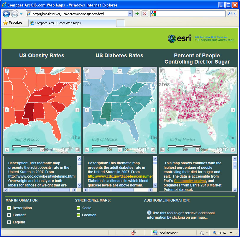
Users can create web GIS applications using geospatial resources available from the cloud. Here is an application showing the relationship among the obesity rate, diabetes rate, and percentage of people controlling their diet for sugar in the US. This application is constructed using the map services and application templates available for free on ArcGIS Online.
I have worked on a number of GIS applications in a variety of fields during the past several years. Almost all my recent projects have been web based or at least have had a web GIS front end. Clearly, the web is becoming central to GIS use and will be a dominant platform in the future. Web GIS will be ubiquitously available on our computers, smartphones, GPS navigators, and other personal computing devices—anywhere, anytime. Web GIS is becoming an indispensable part of many people's lives, and it will eventually deliver a truly societal GIS.