Discover New Business Opportunities at the 2009 Esri Survey & Engineering GIS Summit
By Matthew Freeman, Esri Writer
With today's tight budgets, maintaining service levels for customers inside and outside your organization can be challenging. Now more than ever, GIS technology serves as a fundamental tool for building new opportunities in the survey and engineering industries.
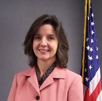 Juliana Blackwell, director of the National Geodetic Survey at NOAA, will be the keynote speaker at the 2009 Esri Survey & Engineering Summit in San Diego this summer. |
The 2009 Esri Survey & Engineering GIS Summit, July 11-14 in San Diego, California, will provide the perfect platform for you and more than 400 of your colleagues to see the latest in GIS technology as well as discuss geospatial trends, challenges, and solutions with other experts.
The keynote speaker will be Juliana Blackwell, director of the National Geodetic Survey at the National Oceanic and Atmospheric Administration (NOAA).
The summit will offer opportunities to
Network with peers: Find out how your fellow GIS users are leveraging GIS by mapping, modeling, creating new data, and integrating all types of data, including CAD and imagery, into surveying and engineering workflows.
Hear from Esri staff and industry leaders: In addition to listening to Blackwell, attendees will get to participate in panel discussions. They will also be able to set up one-on-one meetings with Esri staff to learn about the direction of GIS and how it is playing a significant role in maintaining and developing infrastructures.
Explore the latest technology: Visit the summit's EXPO and discuss innovative GIS uses for surveying and engineering projects of any size. Esri staff and business partners will be on hand to demonstrate product capabilities and explain added functionality.
Bring the knowledge home and put it to work right away: Whatever your specialty, organization, or experience with GIS, you will leave with ideas, tools, and resources you can use as soon as you return to the field or office.
The summit will be held concurrently with the 2009 Esri International User Conference (Esri UC) at the San Diego Convention Center. Both events will be ideal places to interact with GIS and mapping professionals from around the world.
To learn more about the summit and to register online, visit www.esri.com/segsummit.