ArcWatch: Your e-Magazine for GIS News, Views, and Insights
April 2011
Improve Your Community
Map Neighborhood Concerns with ArcGIS Explorer Online
Using the new version of ArcGIS Explorer Online, you can quickly and collectively report on community problems in your neighborhood using Citizen Requests templates.
If you want to map and report, for example, a flood or water main break in your community, you can use built-in editing tools in ArcGIS Explorer Online that let you create points on your map showing the locations of the broken main or the flooding.
No GIS software or data is needed to create a visually appealing map that highlights such incidents in your community. Additional tools are also available to mark up and add text to your map. When you're done, you can share it on ArcGIS Online in a variety of ways. It can be e-mailed, posted on a social networking site, or saved in an ArcGIS Online group. These groups can be public or shared by a select organization such as a city.
It's easy to create a map using ArcGIS Explorer Online. All you need is a web browser.
Step 1. Open your favorite web browser, go to ArcGIS Online, and sign in to ArcGIS Online by clicking the Sign In link at the top right of the page. If you don't have an account, you'll need to create one. It's free.
Step 2. Click the Start ArcGIS Explorer Online link to get started.
Step 3. Click the New Map button and search for your address or location in the Find Places box at the top right of the page. You can optionally change the basemap to Imagery or Aerial from the Basemap gallery. It's the tool on the Mapping toolbar next to the Print icon. The Bing Maps Aerial and Imagery basemaps are good options to use for Citizen Requests.
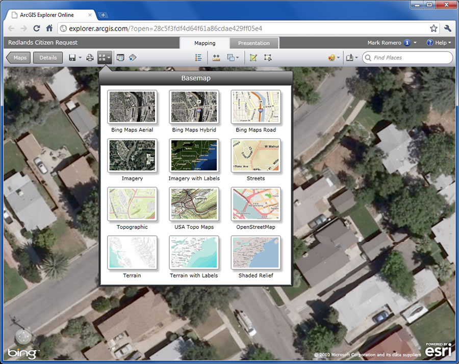
Use Esri's basemaps or your own.
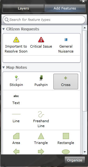
Step 4. Click the Create Features button ![]() on the Mapping toolbar to begin creating a point that represents the broken water main or other incident you want to map. In the new window that appears at the bottom, click the More button to select a new editing template.
on the Mapping toolbar to begin creating a point that represents the broken water main or other incident you want to map. In the new window that appears at the bottom, click the More button to select a new editing template.
Step 5. Select Citizen Requests in the list and click Create Layer.

Add features based on a variety of built-in templates.
A new category for Citizen Requests is added to the Map Contents window.
Use the Map Contents window to pick the feature to map.
Step 6. To add an incident, such as the water main problem, to the map, locate and select one of the features (important to Resolve Soon, Critical Issue, or General Nuisance) from the Citizen Requests template, then click the spot on the map to pinpoint the incident. A symbol will appear that shows the location of the problem. Add additional points that represent other types of incidents if they exist. This could be additional markups or other features from a different built-in template. These include Park Planning, Civic Events, and Recreation.
Note: If you want to modify the template, click the Organize button at the bottom to add, delete, or modify the incidents.
Step 7. In the map, you can add descriptive content to the incidents with a name, a description, or even a photograph of the problem. If you've taken a picture of the broken water main, for example, you can add that to the pop-up window as long as you've uploaded it to a web album such as Flickr or Picasa. Click the incident in the map. The pop-up window will open. Select Edit, then click Edit Pop-up. From there, you can add a title, tags, a description, and your link to the picture. Click OK. When someone clicks your incident on the map, a pop-up window will appear with the information you added.
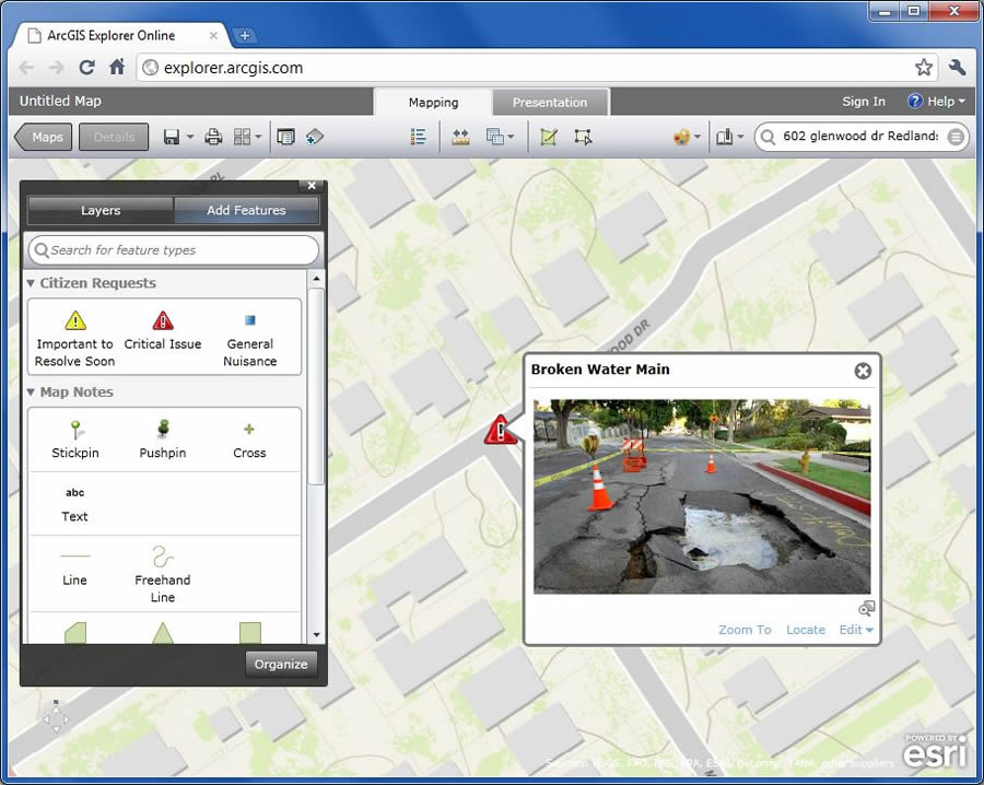
Pop-up windows provide great content and bring the map to life.
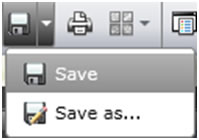
Step 8. All that's left to do is save your map and share it with an ArcGIS Online group or the public. Click the Save button and fill out the necessary fields.
Step 9. To share the map, click the Maps button on the Mapping toolbar. At the bottom of the gallery, click the My Maps button, then click the Details link for your newly created map. Click Share. You can copy and paste the link to your map in an e-mail, document, or Instant Message (IM); post it to Facebook or Twitter; or share it with an ArcGIS Online group that your neighborhood or city may have created.
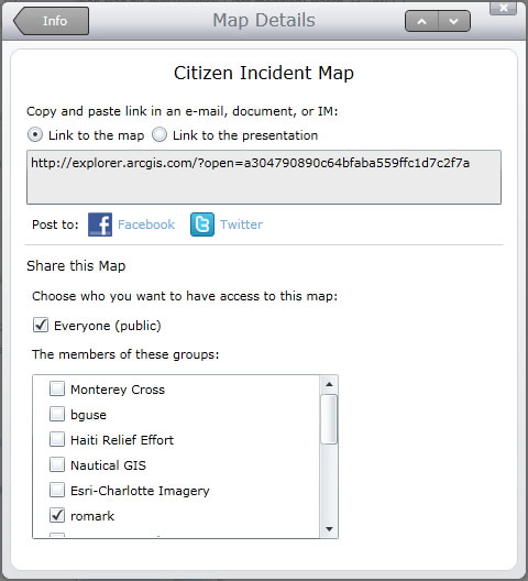
Every saved map has a direct link that can be shared in many ways.
There is much more you can do in the new ArcGIS Explorer Online. To learn more about other tools and functionality, visit the following: