ArcWatch: GIS News, Views, and Insights
April 2012
Interactive Map Provides Fast, Easy Access to Election Information

A pop up on the map displays the date of the next election.
When voters in Harrison County, West Virginia, go to the polls this year, they will be able to quickly and easily determine their polling place and voting precinct locations via a new Election Polling Places interactive map developed using Esri's free web templates.
Harrison County, with a population of about 70,000, also plans to use Esri templates to create a real-time election results viewer that citizens can access to keep up-to-date on the latest returns.
"Harrison County is proving that it's possible for small governments to bring their authoritative data online and engage citizens using a technology that they have learned simply works," says Christopher Thomas, Esri director of government markets. "Applications like these are easily replicated and can help governments communicate with the public on everything from elections to service requests."
Harrison County clerk Susan Thomas requested an upgrade of the county's outdated paper maps in preparation for the 2012 elections so her office could quickly and accurately confirm the eligibility of candidates for seats on the county commission and school board. "With the new 2010 census data available, there's no better time to update our precinct map," says Thomas.
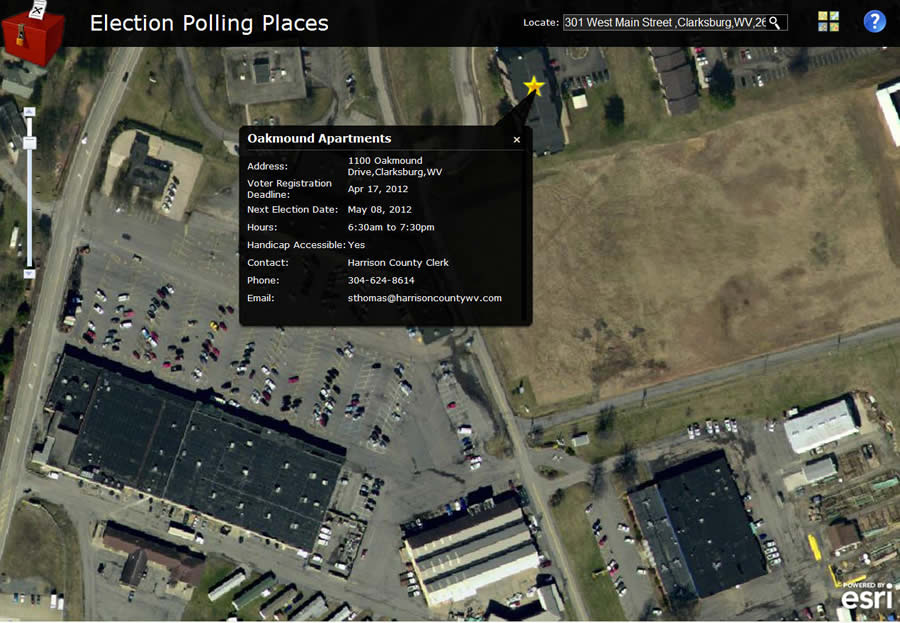
Voters can also view their polling place on an aerial map.
In response, the county developed an online mapping application that leverages existing geospatial resources in Esri's ArcGIS platform. This public application clearly defines the county's district boundaries while bringing more transparency to the elections process. Besides providing citizens and staff with accurate district and poll information, the application is expected to boost efficiency by decreasing the number of poll location inquiries the county receives during elections and help ensure that voters are registered in the correct precinct throughout the year.
"It's a win for everyone," says Harrison County geographic information system (GIS) coordinator Mike Pizzino Jr. "This makes our work more accurate, which definitely helps the taxpayers."
Harrison County's elections application was built using ArcGIS and free web mapping APIs available on Esri's ArcGIS for Local Government website. Click modules, then click Election Polling Places and Election Results Viewer.