Get Just What You Want
Clip and Convert Study Area Data Quickly in ArcGIS 9.2
 Use the Extract tool with a SQL expression to clip just the data needed. | |
 The resulting shapefile is smaller and more manageable. |
Esri Data & Maps supplies a wealth of vector imagery and attribute data that can be used immediately. Many datasets for large areas, such as countries, regions, and states, are supplied on DVD or CD in read-only Smart Data Compression (SDC) format. However, if your area of interest is small, these files can be unnecessarily cumbersome to load, navigate, and redraw. Exporting a selected portion of a larger SDC format file to a shapefile is much easier. You can simply clip your area of interest from the sample data using the Select tool in ArcToolbox without loading the file in ArcMap or previewing it in ArcCatalog.
- Insert the Esri Data & Maps DVD or CD in the drive.
- Start ArcCatalog and click the Connect To Folder button.
- Browse My Computer to locate the drive containing the DVD or CD and click OK.
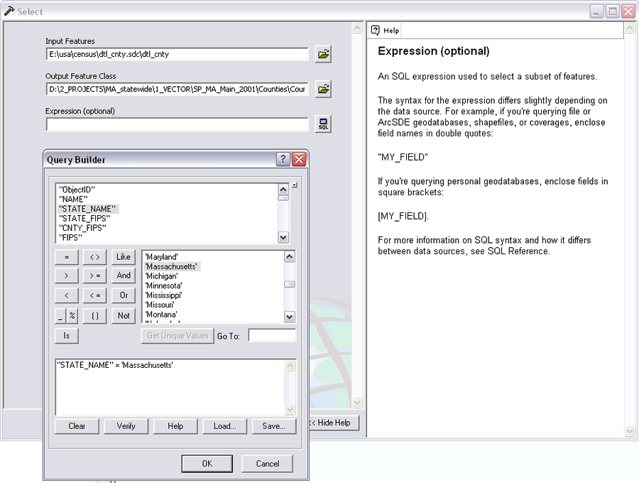
- If it is not already available, open ArcToolbox. Choose Analysis Tools > Extract > Select.
- On the Extract dialog box, click the folder icon next to Input features and browse to the desired dataset on the DVD or CD. In this example, the file is dtl_cnty.
- Click the folder icon next to Output feature class and be sure to change the output location to something other than the default DVD or CD drive.
- Still on the dialog box, click the SQL button. Use the Query Builder to create an expression that will extract the desired data subset. In this case, the expression "STATE_NAME" = 'Massachusetts' was used to select all the counties in Massachusetts. Click OK to run the Extract tool.
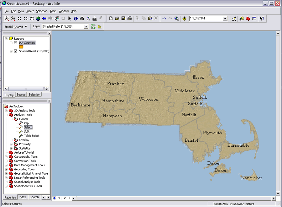
- The output is a shapefile that can be used immediately or imported into a geodatabase.