2010 Esri Developer Summit Thrives on Energy of Shared Innovation
By Matthew DeMeritt, Esri Writer
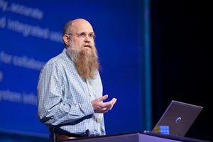 Scott Morehouse, director of software development at Esri, told the audience that the Web and Web-based computing represents a significant opportunity for ArcGIS to evolve. |
If success is measured by the din of collaborative exchange, then the 2010 Esri Developer Summit was a triumph. One could barely walk 10 feet without overhearing attendees exchanging ideas about how they improved their work with GIS tools. The chatter was strong evidence that GIS is an inherently interpersonal discipline that thrives on the energy of shared innovation.
That collaborative spirit was in the air at the summit, which drew more than 1,200 people to the Palm Springs Convention Center in California from March 22-25. It was enhanced last year with the addition of user presentations. With twice as many this year compared to last, developers had a wide range of topics to learn about and apply to their work.
Many of the presentations packed the Convention Center's largest rooms and were followed by enthusiastic and informative questions and answers. More often than not, the question and answer sessions spilled into the lobby of the venue and took on a life of their own.
Esri selected user presentations based on their usefulness in tackling everyday problems. A standout among user presenters, Timmons Group's Vish Uma gave two presentations on common obstacles that developers face. His first presentation on continuous integration (CI) highlighted the commonality in workflows across a dauntingly wide spectrum of software and organizations. Uma shared best practices for overcoming the challenges posed by the GIS software development process and explained how he optimized his workflow through automation.
 Esri Developer Summit attendees relaxed and worked in the GeoLounge, where they could e-mail, tweet, and blog. In the background, others watched a simulcast of events such as a technical session. |
"One of my big revelations with the last release of ArcGIS was how many tasks I could eliminate from my schedule by simply automating them," said Uma. "All of a sudden, building and deploying solutions became more fun and opened new avenues of inspiration. That's why CI is so important."
In his second presentation, Uma demonstrated how he overcame the problem of limited Web client printing solutions. He explained the architecture behind a printing service he built for Timmons. The service was invaluable in overcoming well-known limitations, such as the inability to print multiple map services over a basemap.
"Talking to Esri technicians over the years has helped me find workable solutions to real problems," said Uma. "It's rewarding to be able to pay Esri back for their assistance by helping my peers. It's what Jack Dangermond means by 'GIS community.'"
User presentations on APIs were a top draw. More than half of all user presentations mentioned their applicability in a multitude of scenarios. Brenden Collins and Steven Andari from Blue Raster, LLC, demonstrated their ArcGIS Server/Flex "supermashup" for the Southern Forests for the Future project. Run by the World Resources Institute, the project is a Web portal where visitors can go to understand suburban encroachment into forests in the southern United States in a spatial and temporal context. Collins and Andari integrated YouTube and Flickr, as well as Web Map Service (WMS) and KML, into the application, which uses dynamic map caching to create a time series of urban sprawl. "The service raises awareness about the invaluable resources that forests provide, like fresh water, timber, and recreation," said Collins.
 Keynote speaker David Chappell talked about cloud platforms. |
This was Collins' first time attending the Esri Developer Summit. He said he was overwhelmed by the availability of Esri staff on the showcase floor. "I found myself gravitating to the Flex and geoprocessing teams with all my nagging questions and getting immediate answers," he added. "That was enormously helpful and a pleasant surprise."
The 2010 Mashup Challenge Winners
Developers responded to the 2010 Mashup Challenge with many novel entries, making it difficult for the selection committee to choose a winner. The guidelines were simple: Build a mashup using Esri's ArcGIS Online content and Web APIs, publish the related URL, and post a video describing the application on YouTube. Dave Bouwman, CTO and lead software architect at DTSAgile of Fort Collins, Colorado, took the top prize of $10,000. His Executive Compensation Mashup compared top U.S. executive salaries with the total income for selected counties in the United States.
Second place went to Daniel Bradshaw, owner of DB MediaStudio in Springville, Utah. He won $5,000 with Fluttr: The Human Story in Realtime, a mashup that automatically populates an international map with live feeds from Twitter, Flickr, and YouTube.
Mark Laudon of LaudonTech in Surrey, Ontario, Canada, took third prize and $2,500 for Floor Plan Mapping, an interactive building floor plan with employee search capabilities that allows retrieval of information such as a brief employee biography.
Ernesto Giron, GIS senior analyst for the International Center for Tropical Agriculture in Cali, Colombia, won fourth prize and $2,500 for Drought Timing for Agronomic Screening. This interactive international soil map indicates soil type and quality in a specified area and its agricultural potential with respect to changes in climate.
View the applications and watch videos that demonstrate the winning mashups.
Bouwman and his DTSAgile colleague Brian Noyle also received some of the best attendance of all the user presentations. One of Bouwman's presentations, Ruby-fu: Using ArcGIS Server with Rails, explained how Ruby on Rails, a popular Web development platform that powers Twitter, Hulu, and Basecamp, can be configured to work with ArcGIS Server. One of Noyle's presentations covered the hot issue of iPhone and Android app writing. Noyle demonstrated the design and implementation of a geocoding enabled site for location-based feedback within a user's local community.
Technical and Plenary Sessions Popular
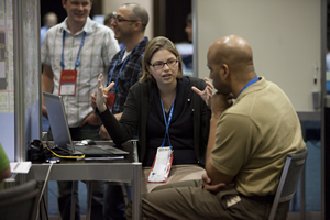 Attendees could meet one-on-one with representatives from Esri. |
Many developers made a beeline for the technical sessions, especially the ones that previewed the capabilities of ArcGIS 10, the new version of Esri's software that will be released this summer. Esri's Jeremy Bartley and Keyur Shah demonstrated the REST API's ability to create maps, execute queries, geoprocess, and generate KML. Attendees learned how to use the REST API in a variety of mashup environments including JavaScript, HTML, Google Earth, Python, and other Web technologies. "I noticed that the really popular sessions focused on extending servers through .NET and Java," said Bartley. "One of the exciting developments at ArcGIS 10 is that it supports writing custom server object extensions that can be consumed in both SOAP and REST services, which is hugely significant to developers."
Both Esri president Jack Dangermond and Scott Morehouse, Esri's director of software development, spoke to the developers at the Plenary Session. Morehouse gave them an overview of ArcGIS 10. "It's a single, unified system that is about managing and working with maps; accessible to the Web, mobile devices, and desktops; and powered by servers running on enterprises and in the cloud," he said.
Morehouse also introduced an important aspect of the ArcGIS 10 system: ArcGIS.com, a "Web gateway into the ArcGIS system." When ArcGIS.com goes online soon, it will serve as an online GIS resource where visitors can
- Find basemaps made by Esri and the ArcGIS community.
- Make maps and create mashups by adding content that's been published by others.
- Search the Web or GIS servers for additional content for the maps.
- Share maps with others.
- View sample applications, download source codes, and more.
"ArcGIS.com is a comprehensive, Web-based interface into your geographic information system," Morehouse said. "The ArcGIS.com Web site extends and complements other aspects of ArcGIS."
Keynote speaker David Chappell, principal of Chappell and Associates in San Francisco, delivered an engaging address on cloud platform development. He defined cloud computing, discussed new and future trends, and explained what it means to GIS developers building with ArcGIS and deploying it in the cloud.
Chappell said that in the last 50 years, only five platforms have emerged for business computing: mainframes, minicomputers, personal computers (PCs), PC-based servers, and mobile phones.
"We are right now, I believe, witnessing the birth of the sixth platform type. It is cloud platforms," he said. "As a software developer—as anyone who cares about code—you ought to think in a big way about cloud platforms."
Watch the technical session videos.