ArcWatch: GIS News, Views, and Insights
May 2012
Mapping a Trail to Mitigate Beaver Overpopulation
This year's Patagonian Expedition Race took the competitors through Karukinka Natural Park, a large conservation area in Tierra del Fuego in Chile. A huge variety of unusual wildlife, from the smallest carnivorous plant to the largest woodpecker in the Americas, flourishes in that region.
Before planning the race route, cartographers Jason Blair and Katie Panek collaborated with race organizers N�madas International Group, on a trail-building project in Karukinka Natural Park. Growing numbers of non-endemic beaver have become a cause of concern to park officials in recent years, necessitating the creation of a new pathway for visitors to hunt the busiest of all rodents.
In the 1940s, the Chilean government introduced beaver to the park in hopes of stimulating the international fur trade. When the fur trade slowed, the beaver population skyrocketed and threw off Tierra del Fuego's delicate ecology.
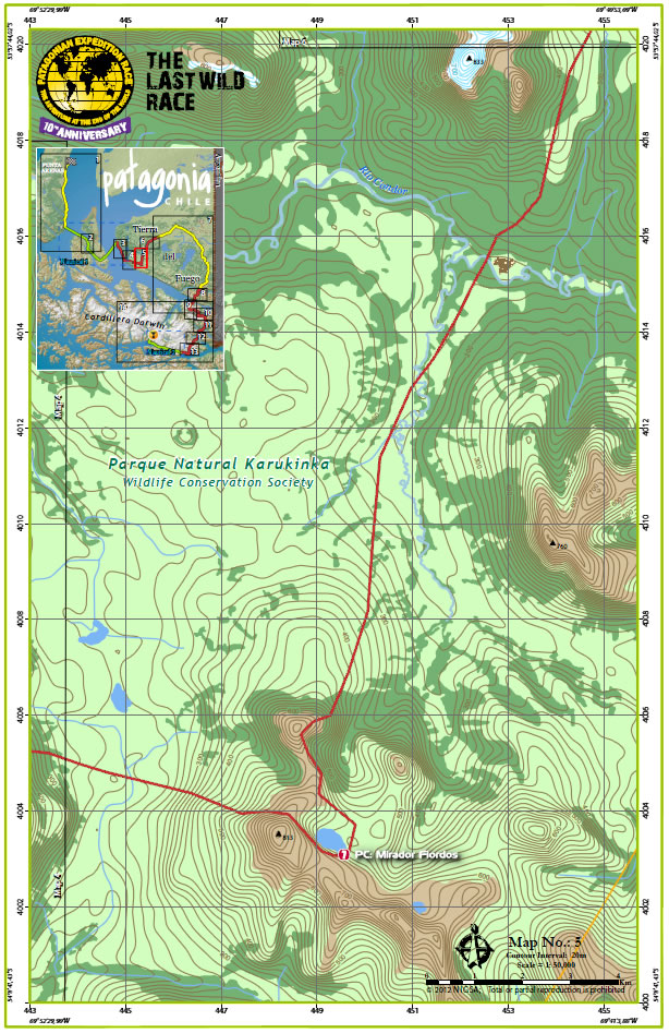
This map shows Karukinka Natural Park in Chile, which features a new trail built for hunters to curb beaver overpopulation.
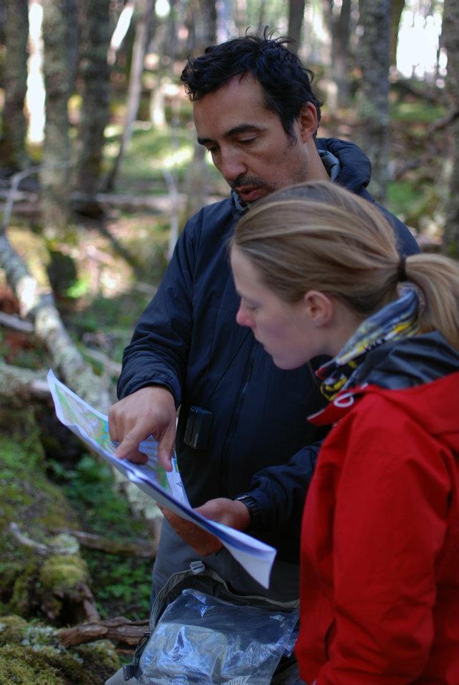
Patagonian Expedition Race director Stjepan Pavcic and cartographer Katie Panek examine the map of the proposed Karukinka trail.
"The beavers began to drastically change the vegetation and landscape of the valleys," Blair said. "Building these trails will significantly increase access for hunters and trappers to start reducing the number of beavers in the area."
GIS allowed Nomadas International Group to design a trail that fits into the surrounding environment as unobtrusively as possible while also ensuring the longest possible life of the trail. Created in ArcGIS, Blair's and Panek's maps helped trail designers evaluate potential paths based on a number of factors, including proximity to streams, tree shade, and susceptibility to rain erosion.
Although the trail is specifically for tourists and hunters, race officials incorporated a four-kilometer section of it into the race route to draw attention to its conservational purpose.