2008 Esri International User Conference to Host a Special Climate Change GIS Program
By Carla Wheeler, ArcWatch editor
 Imja Lake is a fast-growing glacial lake in Nepal. Some scientists say that global warming is causing the lake to increase in size and that it's in danger of bursting. Photo courtesy of Mahesh Pathak, Society for Wetland and Biodiversity Conservation Nepal (WBC Nepal). |
Melting glaciers and shrinking snow cover. Earlier bird migrations and egg laying. More intense droughts. These signs and others, say the scientists serving on the Intergovernmental Panel on Climate Change (IPCC), point to what they call "unequivocal" global warming.
Today, a growing number of people are heeding the findings of IPCC, which shared the 2007 Nobel Peace Prize with former U.S. vice president Al Gore for raising awareness about man-made climate change and laying a foundation for combating it. Scientists, environmentalists, and others are increasingly focused on studying climate change and its repercussions. (For example, studies that forecast continuing shrinkage of sea ice led the U.S. federal government last month to list polar bears as threatened under the Endangered Species Act.
But the technologies that were unavailable to an earlier generation of researchers studying air and water pollution in the 1960s and 1970s—at the birth of the modern environmental movement—are widely available today, making access to data and analysis much easier.
Conservationists then lacked easy access to earth data sources like satellite imagery and computer tools like the Web, and GIS hadn't even been invented yet. But now, thanks to worldwide advances in computers and earth sciences, "technology has become ubiquitous, and scientific methods and GIS tools have evolved to permit the ecological and atmospheric sciences to benefit from improved quantitative and predictive tools," said Esri president Jack Dangermond. "GIS gives us the ability to better understand climate-related changes that are occurring in our world and, in addition, can help guide us in the choices we make as we plan strategies for conservation and sustainable development."
The Climate Change GIS program at the upcoming 2008 Esri International User Conference (Esri UC) will demonstrate how GIS, remote sensing, and other technologies are being used in climate change research. The program is the brainchild of the newly formed Esri Climate Change GIS Working Group, which invites everyone from scientists to city managers to learn how the technologies can assist them as they research global warming and its potential effects and devise mitigation plans and programs around the world. (View the agenda.)
The Climate Change GIS presentations will be sponsored by Esri and satellite imagery company SPOT Image Corporation, partners in the Planet Action initiative. Planet Action encourages the earth observation industry and geographic information professional communities to support projects that study and tackle climate change-related issues.
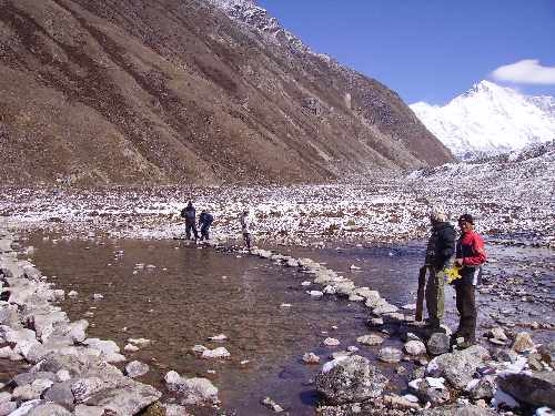 The Nepal Society for Wetland and Biodiversity Conservation uses GIS to inventory water bodies in their Planet Action supported project. Photo courtesy of Mahesh Pathak, Society for Wetland and Biodiversity Conservation Nepal (WBC Nepal). |
Esri UC attendees will be able to choose from more than 20 Climate Change GIS program workshops, panel discussions, paper sessions, and Special Interest Group meetings, which will be held August 5-7, 2008, at the San Diego Convention Center. The presenters will include Esri staff and representatives from several organizations such as the Nature Conservancy; the National Oceanic and Atmospheric Administration (NOAA); the U.S. Geological Survey (USGS); and the University of California, Davis.
Sessions will involve all sectors of the GIS user community including government agencies, private businesses, military organizations, nonprofit groups, forestry departments, and power utilities.
The presentations will cover a wide variety of technologies and methodologies that can be used in studying climate change including GIS, satellite imaging, remote sensing, multispectral analysis, and predictive modeling. Some of the topics on the Climate Change GIS Program agenda will be carbon sequestration in old oil wells, carbon accounting, the Bering Glacier retreat and sea level rise, climate change patterns and characteristics, alternative energies such as wind and solar power, and climate change and the impact on the spread of nonnative invasive species.
Using ArcGIS to Analyze Climate Patterns and Climate Change, The Nature Conservancy's Carbon Accounting Model, Understanding Current Ecosystem Disturbance Patterns with Remote Sensing, and Synthesizing Historical Ecology Data with a GIS are a few examples of presentations, workshops, or papers. A session will also focus on how GIS is being used by the Woods Hole Research Center in Woods Hole, Massachusetts, for projects related to climate change such as studying current and historic releases of carbon and exploring how forests might be used to withdraw carbon from the atmosphere.
For more information about the Esri Climate Change GIS program, contact Geoff Wade, Esri natural resources industry manager, at gwade@esri.com; Charles Convis, Esri Conservation Program coordinator, at cconvis@esri.com; or Terry Martin, Esri national accounts manager for the United States Air Force Installations and Environment, at tmartin@esri.com.