A New User Interface, Integration with ArcGIS Server, and Better Customization
 ArcPad 8 comes equipped with an improved GPS toolbar and a new user interface with modern icons, toolbars, and menus.
This major release also includes new usability and performance enhancements to increase field productivity and help users manage their GIS projects more efficiently.
Integration with ArcGIS Server
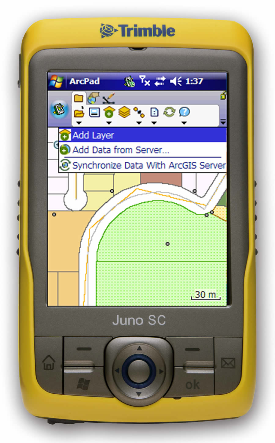
With the new ArcGIS Server ArcPad extension, users can publish their ArcPad projects directly to ArcGIS Server. Mobile devices that connect to the Internet (by cradle, USB, Wi-Fi, or phone connection) can now synchronize ArcPad field edits with the enterprise geodatabase via ArcGIS Server.
New Look and Feel
ArcPad 8 software's new look and feel, with modern icons, menus, and toolbars, uses less screen real estate than previous versions. Toolbars can now be docked, minimized, and maximized, and a new desktop tool called the ArcPad Toolbar Manager can be used to either modify the out-of-the-box toolbars or create your own. ArcPad 8 software's new Open Map dialog box replaces the previous ArcPad Startup dialog box. You can use the Open Map dialog box to browse maps by list or thumbnail.
ArcPad Studio Now Included
ArcPad Studio, the development framework to customize ArcPad, is now included with every ArcPad 8 license. ArcPad 8 is now a maintenance-based product, and the first year of ArcPad maintenance is included. Customers may subscribe to annual maintenance to get software updates and technical support. Technical support will be provided to customers who are current on maintenance.
Updated GPS Toolbars
The GPS user interface has been refreshed in ArcPad 8. The GPS status bar replaces the position dialog box found in previous versions of ArcPad. The GPS status bar included with version 8 has a new, translucent look and appears at the bottom of the map screen. It shows much of the same detail as the position dialog box but now has visual color cues to indicate the quality of the GPS fix. More detailed GPS position information is also displayed on the full-screen multi-tab GPS dialog box.
Improved StreetMap Capabilities
ArcPad 8 software's StreetMap extension provides an easier method to find addresses and locations using a new lookup index. The extension is based on Esri StreetMap Premium data derived from the Tele Atlas/TomTom dataset and now includes data for Europe in addition to North America. The extension is included at no extra cost and supports the Smart Data Compression (SDC) format, enabling display, address geocoding, reverse geocoding, and routing capabilities.
Enhanced ArcPad Data Manager Extension
The updated ArcPad Data Manager extension gives users new options when preparing GIS data for use with ArcPad 8. Users can quickly configure an ArcPad project for repeated use with geoprocessing tools or author an ArcPad project for publication to ArcGIS Server. Additional geoprocessing tools have been added in ArcPad 8, via ArcGIS Desktop, making it easier to deploy data directly to a variety of mobile devices.
"From very basic to more advanced, sophisticated applications, ArcPad 8 helps users get up and running quickly," says Jian Lange, Esri product manager for ArcPad. "The customization framework now included with this release provides additional capabilities to complete mobile GIS tasks and projects effectively."
Learn more about ArcPad or evaluate the software for free.