ArcWatch: GIS News, Views, and Insights
June 2012
Celebrating the Power of Where—Esri Style
New Geospatial Technologies and People Passionate about GIS Bring Geography to Life at the Esri International User Conference

Even while dining in the Gaslamp Quarter, the talk will turn to GIS.
Where's the best place in the world to celebrate the power of where? San Diego, California, home to the Esri International User Conference (Esri UC). More than 15,000 people from all corners of the GIS world will converge here for one week in July to celebrate geographic understanding and hear about the latest geospatial tools and solutions.
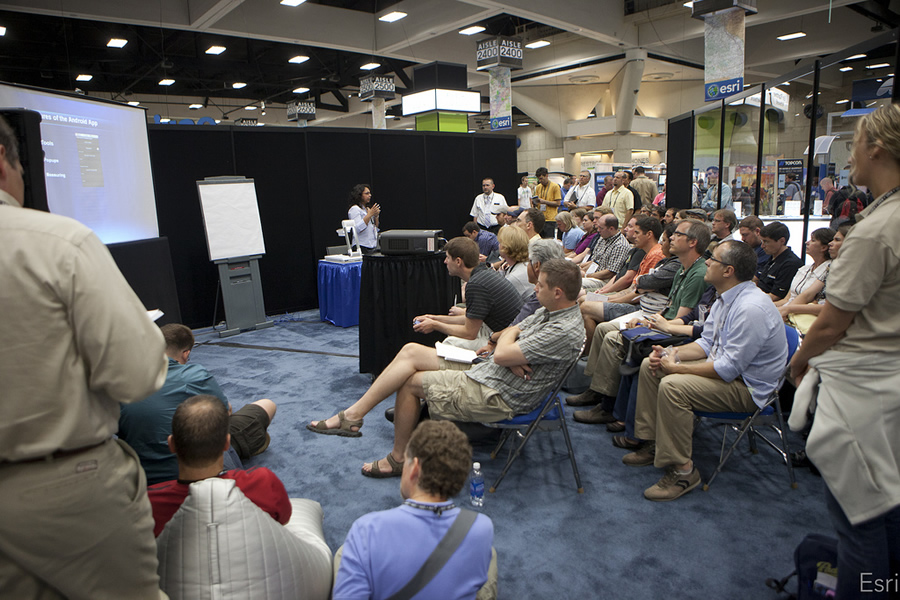
Geospatial technology will be the number one topic of conversation, guaranteed. Whether you attend a highly technical presentation at the San Diego Convention Center, stroll along the Pacific Ocean in the evening, or eat at an eclectic bistro in the Gaslamp Quarter, you will hear people around you talking about data collection and analysis, geoprocessing, web maps and applications, GIS in the cloud, mobile GIS, and more. Like you, they will be there to learn about geospatial solutions, collaborate and network with fellow "geogeeks," and celebrate their work. Not ordinary work, but the type that, thanks to data, geospatial analysis, modeling, and visualization, safeguards and improves the quality of life for people across the globe.

Esri UC attendees meet to celebrate their work and learn what's next on the geospatial technology horizon.
"You simply can't be the most effective GIS user you can be without attending the Esri UC regularly," says Stacey Maples, a GIS analyst and instruction coordinator at Yale University. "The technical workshops alone are worth 10 times the cost of travel. There is no better way to keep up with trends and changes in GIS technology."
If you've never gone to the Esri UC or you've skipped it for the last year or two, this is the perfect year to book a trip there. Why 2012?
ArcGIS 10.1 Will Soon Be Ready to Use
Esri is about to release ArcGIS 10.1, which will improve collaboration and make it simpler to put mapping and geospatial analytics into the hands of more people in your organization, even those with no GIS expertise.
This summer, Esri also will roll out ArcGIS Online for organizations, a customizable, cloud-based, collaborative content management system for maps, applications, data, and other geospatial information. It's available on a subscription basis. No additional hardware or software needs to be purchased or installed.
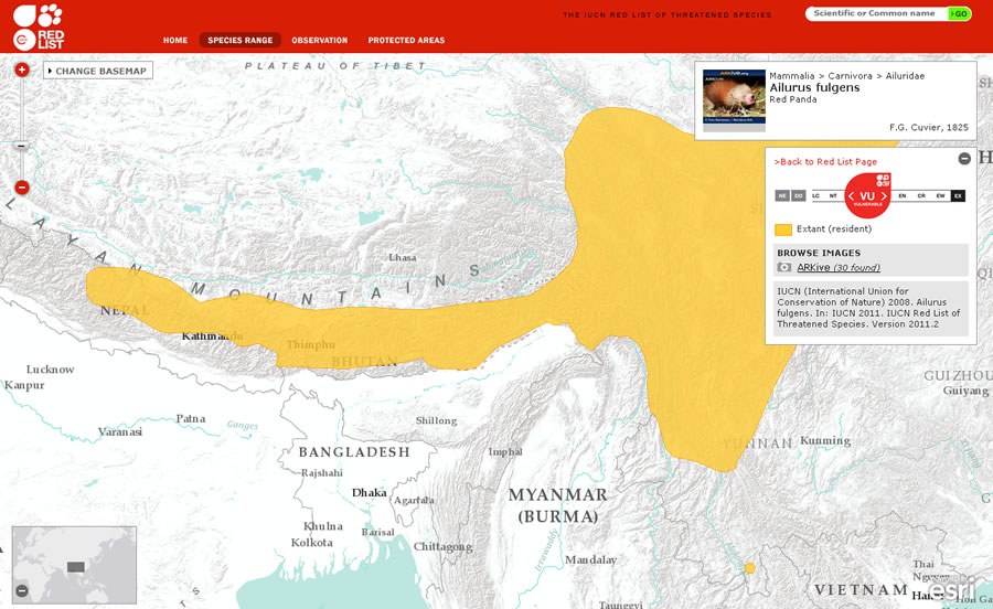
The International Union for Conservation of Nature uses Esri technology to map threatened species.
You will see demonstrations of ArcGIS 10.1 and ArcGIS Online during the Plenary Session on July 23.
Listen to Interesting Keynote Speakers
Esri always invites fascinating keynote speakers to give presentations about how they use geospatial technology. This year's slate of speakers will be no exception.
For example, Julia Marton-Lef�vre, director general of the International Union for Conservation of Nature (IUCN), will talk about mapping's power to drive sustainability. Esri technology is used to map the habitat of plants and animals on the IUCN Red List of Threatened Species. The IUCN calls this list the most comprehensive and objective global approach for evaluating the conservation status of plant and animal species. View the maps through the Red List Maps application by typing in the common or scientific name of a plant or animal or a general term like "birds" or "mammals."

Esri business partners always are happy to demonstrate their geospatial solutions.
Stop by the Esri Labs Island
The Esri Labs Island in the Exhibit Hall at the San Diego Convention Center will give you the opportunity to experience, evaluate, and discuss new and emerging innovations, technologies, and experiments from Esri. This island is designed to foster collaborative show-and-tell and technical discussions and allow you to meet the staff that drives the innovation engine.
At the Esri Labs Island, you will have access to
- Demonstrations and presentations on various topics such as HTML5, social networking, 3D GIS, imagery, and mobile GIS
- Information about how GIS and science can be used to solve problems and answer questions
- Best practices and technical deep dives
- Like-minded researchers, developers, and geogeeks
Watch demonstrations about a wide variety of topics such as HTML5, 3D and mobile GIS, and social networking.
If you enjoy challenging problems and want to test-drive the latest technology and products, visit the Esri Labs Island and follow Esri Labs on Twitter (@esrilabs) for updates.
You will not be disappointed!
Drop In on the New ArcGIS for You Island
The ArcGIS for You Island in the Exhibit Hall will showcase maps and applications focused on the specific business needs of local and state government agencies. Maps and applications for ArcGIS for Local Government includes those for public works, water utilities, elections, planning and development, land records, and public safety; the maps and applications for ArcGIS for State Government includes those for the environment, natural resources, and emergency management.
Ask ArcGIS and industry experts from Esri about the free maps and applications designed to help you implement workflows and applications for your organization. Please stop by with your questions, feedback, success stories, and concerns and what you would like to see in future releases of our maps and applications for local and state governments.

Whether your maps created using ArcGIS are printed or on the web, they serve an important role.
Choose from 600 Presentations
When planning your Power of Where week, use the conference's easy-to-navigate Agenda Search and Planner. You can choose from among 600 sessions, including pre conference seminars (e.g., Designing Great Web Maps), user group meetings, demonstration theaters, and 20-Minute Tech Workshops (e.g., Using GIS Technology on Smartphones and Types of Databases: Which One Is Right for Me?).
There's been a lot of interest in the use of Esri CityEngine for 3D GIS. On July 24, Michael Frederickson from Pixar and Dominik Tarolli from Esri will give a presentation called CityEngine—Example Use Cases in Film and 3D GIS.
Esri CityEngine is used by many different industries, including some—like the entertainment worlds of films and games—that lie outside the world of traditional GIS. Frederickson will talk about using CityEngine for the film Cars 2; the technology permitted vast virtual worlds to be created and allowed the director to plan and then implement shots within the movie. The remainder of the session will show how the same techniques can be leveraged in the more traditional 3D GIS space for urban planning, emergency response, and military action.
Visit the Esri UC website at esri.com/uc for the latest details, or stop by the Esri Facebook page to say hello.