ArcWatch: GIS News, Views, and Insights
June 2012
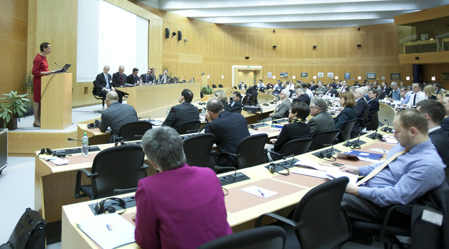
Remarks Delivered by Ambassador Betty King at the GIS for the United Nations and the International Community Conference
Organized by UNITAR's UNOSAT and Esri, at the WMO
Geneva, Switzerland
April 3-5, 2012
Ambassador Betty King lauded the use of GIS technology in projects geared to help solve global challenges.
Good morning, Assistant Secretary General Lopes, Director Pisano, distinguished guests, colleagues, and friends. Let me begin by thanking both UNITAR and the American company Esri for organizing this event. I am delighted with the opportunity to address such a diverse and accomplished group of executives, researchers, and practitioners. It is also very fitting that we have gathered for this forum at WMO, which has long used technology in cooperation with many actors to further its mission.
More and more, we understand that technology has the potential to increase the effectiveness and transparency of development assistance and humanitarian aid, including the work of the United Nations. This forum is a chance to review the future of geographic, or geospatial, information systems and their role in creating more effective and tailor-made models for development and humanitarian aid efforts around the world.
With that in mind, I wish to congratulate those of you here today on your efforts to bring about positive change to communities across the globe. On behalf of the US government and President Obama, I applaud your use of technology in your work. The world's current resources are insufficient to address all the major global development and humanitarian crises that we face. Through the use of science and technology, including innovative uses of GIS applications, we can become more effective and efficient in this endeavor and stretch the power of limited resources.
The deployment of technology and bold new ideas in the face of global challenges has yielded many benefits. But there is still much more that can be done. And we rely on the expertise of men and women such as you, who understand the lifesaving potential of GIS technology and how to put it to use, to create safer, healthier, and more prosperous communities around the world.
This is clearly relevant for the UN as well as for others involved in development and humanitarian assistance. Technology is a valuable tool that has the potential to transform the way we work, and it also can deliver cost efficiencies, increase transparency, and make an organization more relevant to what is happening around the world in real time. In the United States, technology is a critical piece of our global development policy. As a part of our policy, President Obama set the tone by calling for investments in "game-changing science and technology to help spark historic leaps in development." Secretary Clinton and Administrator Raj Shah of the Agency for International Development have embraced the president's call and put innovation in science and technology at the core of our development strategy.
When used effectively, technology can accelerate progress toward development goals in health, food security, climate change, energy and environmental sustainability, and broad-based economic growth. A focus on innovation makes our efforts in development more effective and efficient.
In February of this year, US government and private-sector leaders gathered at the White House to highlight our progress in answering President Obama's call to use science, technology, and innovation to promote global development. At that event we saw how technology has been harnessed in innovative ways to reach diverse development goals, saving lives at birth, promoting transparent elections, and combating trafficking in persons. Technology empowers the work of social entrepreneurs such as Somaly Mam. Somaly Mam uses smartphones to document trafficking of girls into the sex trade in Cambodia. Putting her own life at risk every day, she has used digital technology to convince local police to mount raids of brothels and rescue young girls from forced prostitution.
From the Green Revolution to the historic scientific achievements that have brought on the "beginning of the end of AIDS," technology, including a range of GIS applications, has had a decisive and lasting impact on the lives of millions in the developing world. Development work that is based on facts and solid evidence is more successful because it is more credible. As Esri's slogan "Understanding Our World" highlights, to make true progress occur, we must first gain a solid understanding of the facts. Similarly, evidence-based decision making is a foundation for sound and effective development and humanitarian efforts around the globe.
Today, the world faces many challenges: climate change, famine and drought, global epidemics, violent conflict, and persistent poverty. Technology such as GIS offers the possibility of visual analysis and allows us to see political boundaries, population trends, and socioeconomic differences. It also offers us the ability to acquire and verify facts.
Just a few weeks ago, our Refugee and Migration Affairs Office gave a presentation to US mission employees on the humanitarian crisis in the Horn of Africa. Through the use of GIS technology, they gave us an incredible insight into the situation, illustrating the location of refugee camps and the efficacy of aid. In this way, GIS is a powerful tool for education as well as a route to more meaningful analysis and the development of more effective and efficient solutions.
In addition to helping us to better understand and more effectively respond to humanitarian crises, the US is also using GIS technology to improve development efforts in other sectors. Last year, the US Agency for International Development [USAID] launched GeoCenter, which serves as a clearinghouse on matters concerning GIS at the agency. GeoCenter employs geospatial methods and technologies to help USAID think spatially about all of its programs and to improve overall planning, monitoring, evaluation, information sharing, and communications.
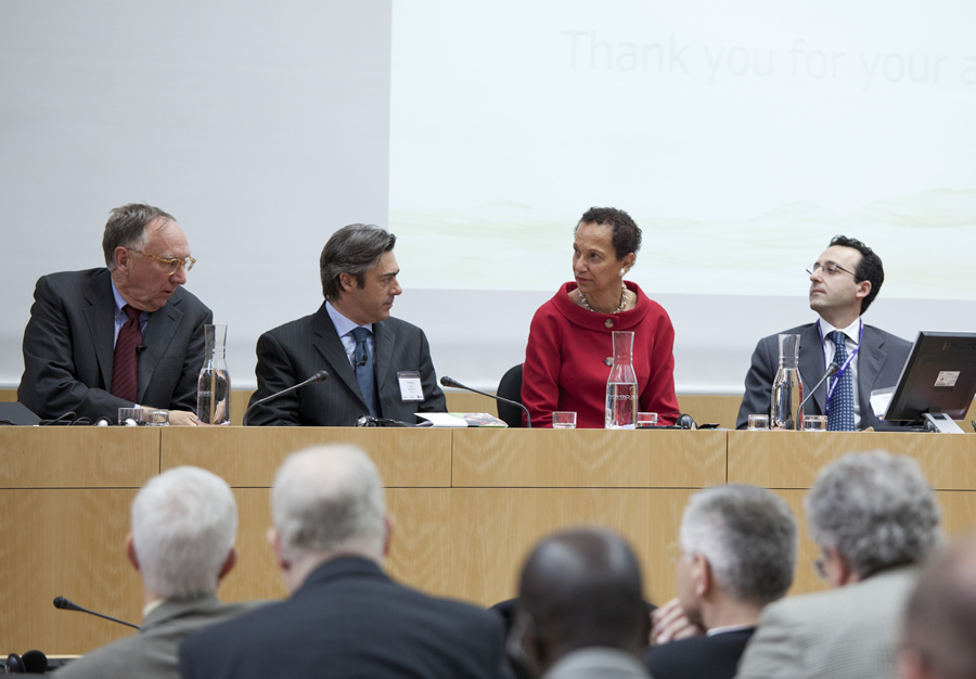
Esri president Jack Dangermond (far left) joined Ambassador King at the conference.
Using GIS technology, we can analyze and see where natural disasters have previously occurred and how they have impacted the landscape. We can also try to predict where a natural disaster is most likely to occur. From there, aid workers can create and implement programs that use the best path for supplying emergency relief and develop new, more efficient evacuation and shelter methods. Collaboration between partners is critical for the success of such efforts.
And we have seen heartening results from cooperation between the US and international organizations such as UNOSAT, which serves as a focal point for UN satellite imagery requests to the US government. UNOSAT has worked with the State Department and the US Agency for International Development in support of humanitarian relief. By working collaboratively, these organizations ensure that satellite requests are coordinated and more efficiently handled without duplication.
It is clear that technology such as GIS can help us to work smarter and do better. Secretary of State Clinton has credited much of the progress the US has been able to make in the Horn of Africa to the Famine Early Warning System Network, which uses GIS to monitor drought and crop conditions. The network also alerts governments and aid groups when crises are coming.
Technology is also helping us to gain ground in other areas, such as the battle against malaria. For instance, the World Health Organization utilizes GIS technology in its Roll Back Malaria partnership. Using information from GIS maps, national malaria control programs have been able to identify populations at risk and target and monitor implementation of control interventions including the use of bed nets and larvicide spraying.
Domestically, we are using GIS technology to help us make targeted decisions on addressing poverty and promoting urban renewal. For instance, researchers in Baltimore, Maryland, have used GIS to map and uncover pockets of poverty and implement homelessness prevention strategies. The City of Baltimore has used this information for revitalizing the city's shelter system and to better serve those in need.
But technology is really just a tool that needs to be used, and used effectively. Importantly, it is both an enabler and an equalizer, which, when used well, can help us address development challenges. But when used ineffectively, it can waste precious time and resources.
Technology also offers the ability to scale up projects. Some solutions start with the goal of reaching thousands, then millions, and then expand from there. Technology can help us do that. We have seen this in the area of education in countries, such as India, where the US partnered with local organizations to improve education for millions of children with technologies such as interactive radio, video, and computer applications.
This evening, almost one billion people in the world will go to bed hungry. That should keep us all up at night. Speaking at the International Food Policy Research Institute, Secretary Clinton described the hunger crisis as a "complex problem of infrastructure, governance, markets, and education. These are things we can shape and strengthen. We have the tools. We have the resources." And we have the technologies.
Through Feed the Future, the US is working with countries to develop more resilient agricultural sectors so they can feed themselves over the long term. As part of this effort, we recognize the importance of providing critical humanitarian assistance to save lives and protect livelihoods. Technology and innovation, including GIS, are critical tools in this work. Technology not only aids in decision making and analysis, it also promotes greater transparency and accountability.
Under the leadership of Secretary Clinton, the State Department and the US Agency for International Development use technology not only to become more nimble and effective but also to become more transparent and accountable. We recently launched a Foreign Assistance Dashboard, which lets anyone with an Internet connection see where we're investing and how much. Technology is a critical part of this endeavor. Technology can also promote change, build coalitions, inform and empower citizens.
Last year, we saw how young citizens in the Arab world used social media and the Internet to build coalitions and support for change in their societies. Earlier this month, we saw how the group Invisible Children used technology to spread its message about the Lord's Resistance Army and the imperative to bring Joseph Kony to justice. And just last week in Geneva, the Human Rights Council passed a resolution to begin mapping the atrocities in Syria. These are all concrete examples of how technology, including GIS, is being used to make change happen today, in real time.
Visual information is increasingly important in today's digital and interconnected world. Whether it is video or GIS data, it is clearly powerful. It gives us three-dimensional information that allows us to better understand and to create multifaceted solutions to complex problems.
GIS brings this type of outreach to a higher level. By presenting complex data and analysis in an easy-to-understand, visual format, geospatial information improves the delivery of such information in a way that was never before thought possible.
The donor community can now connect in a very real way and in real time to the areas they most wish to reach. One can access, and even see, information about drought levels in Djibouti and many other problems from an iPhone. Geographic information systems are bringing this technology into the palms of our hands.
In 2011, with 13 million people on the brink of famine in the Horn of Africa, the US Agency for International Development launched the Famine, War, and Drought campaign to educate the public about the ongoing crises in the Horn. GIS was critical to this public awareness campaign. Geospatial information was transformed into images and made available to the public. Rather than poring over pages of data, you simply had to look to a map to see that the price of food in Galkayo, Somalia, had risen by over 130 percent, or that food security in Mogadishu had reached emergency levels.
Placing information in the hands of the public allows for greater freedom of choice. Incredibly, GIS is transforming society and empowering individuals by making complex information readily available in usable formats. This ultimately makes for a more knowledgeable and democratic society.
To me, one of the most exciting and vital uses of technology is how we can harness it to help the world achieve the Millennium Development Goals [MDG]. Having worked on the MDGs from their very inception, I personally know the importance of why making these objectives a reality is critical if we are to make our world a better place.
The sixth MDG calls for us to combat HIV/AIDS. As long as HIV/AIDS posed an existential threat to entire nations, little progress could be made on the other MDGs. The mapping of the problem of HIV/AIDS was instrumental in helping us better understand patterns of the disease and to design more effective solutions, bringing us that much closer to the beginning of the end of the disease. This, in turn, will help us move on and devote more resources to other MDGs.
The ability to see real-time data gives aid and development workers a huge advantage in the world of AIDS treatment and prevention. Researchers can determine where their work should begin with solid evidence-based decision making. The steady decline in the number of new HIV infections and deaths from AIDS is a testament to the ability of targeted efforts to achieve the MDGs.
However, the area of maternal health still plagues global society, and only marginal improvement has been made since the adoption of the MDGs. This is clearly one area in which multilateral and bilateral partners can work more effectively and efficiently together, and clearly there is a major role for utilizing technology to address this challenge.
Recently, I had the privilege to address a group of young people from Alaska at a Model United Nations Conference, and I did it via digital video technology. These students wanted to know how to become more involved in diplomacy and what their role would be in an increasingly globalized society. I told them that the way forward is through interconnectivity. Let us remember that technology such as GIS can be a means to achieve that end.
As you discuss the future of GIS over the next two days, I hope you will consider not only the power of technology in helping us to achieve greater interconnectivity and true partnership but also remember that it is up to us to use it better. Technology does not have a mind of its own. It has to be directed and put to its most effective use, or it can be a waste of resources, or worse yet, applied to nefarious purposes.
We have seen how technology can be brought to bear in development and humanitarian efforts. It can improve effectiveness and efficiency. It can enhance transparency and accountability. It can scale up projects. It can raise awareness and build coalitions. It can enable organizations to respond in real time. And perhaps most importantly, by empowering those in need with knowledge, it can help create more prosperous and democratic societies and help the world to become a better place.