New Release of ArcGIS Explorer Provides Powerful Capabilities
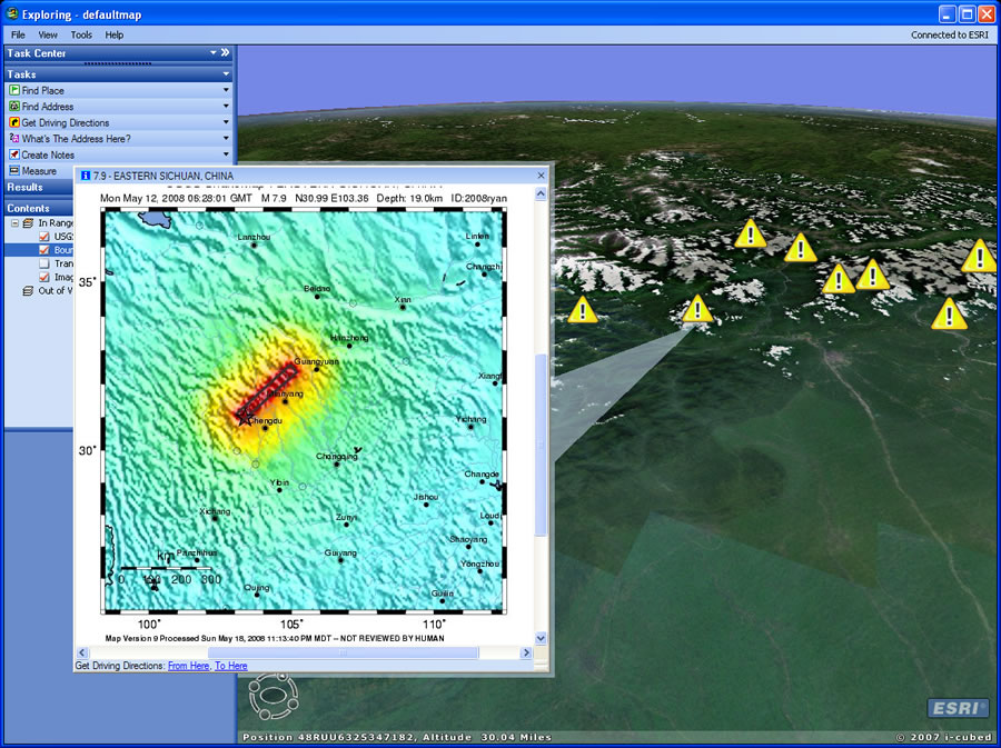 ArcGIS Explorer connected to a USGS Shake Map feed after the 7.9-magnitude earthquake that struck China last May as well as some of the pop-up content that was created. | |
 |
Upgrading to the new version of ArcGIS Explorer will give you more of the data and capabilities you need to better analyze and explore the world.
Esri's free, lightweight, and downloadable application lets people query and analyze data from online sources, then map the data on virtual globes. ArcGIS Explorer 480 increases the power of ArcGIS Explorer.
You will now be able to access new content by connecting to enterprise geodatabases and GeoRSS feeds. For example, ArcGIS Explorer can connect to the United States Geological Survey (USGS) online Shake Map feeds [pictured above right].
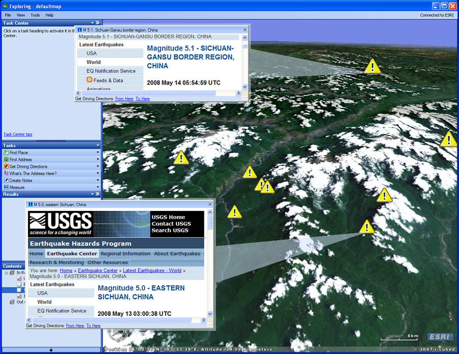
In this next example, ArcGIS Explorer was connected to another USGS GeoRSS feed publishing all the magnitude 5 and above earthquakes worldwide. The map display at the right pinpoints the locations of some strong aftershocks from the large earthquake centered in Sichuan Province and the USGS data that relates to the temblors.
In the ArcGIS Explorer 480 release, GeoRSS feeds join the other supported connections: ArcGIS Server, ArcIMS, and Web Map Server (WMS).
The new version of ArcGIS Explorer also offers the following:
- GPS Exchange Format (GPX) Import—ArcGIS Explorer supports GPX format files via its file import capability and supports importing waypoints, tracks, and routes.
- Updated default maps and layers, including enhanced topographic map services and updated streets, boundaries, and places in addition to improved KML/KMZ support.
- More sharing opportunities—ArcGIS Explorer now provides direct e-mail capabilities, allowing users to easily share their maps, layers, and results with others.
- Faster globe navigation.
- Improved KML support, including support for time series animation.
- Improved presentation—ArcGIS Explorer offers more ways to control user interface elements such as auto-zoom to results and automatic display of saved or e-mailed pop-up windows.
- Better dashboarding—Additions to dashboarding capabilities include a new HTML-driven Quick Content task and a streamlined home server setup. ArcGIS Explorer can now also be embedded in a Web page.
- Increased display performance—This includes a significant improvement in drawing speed because of tile-fetching improvements.
- More options for map display—ArcGIS Explorer 480 adds support for graticules and reference grids (U.S. National Grid [USNG] and Military Grid Reference System [MGRS]). It also offers the ability to set raster background transparency, new options for point symbols and symbol size, improved pop-up window capabilities, and easier access to feature attributes.
- Resource center—New tasks, layers, and results are also available from the updated ArcGIS Explorer Resource Center. Some added tasks include Find Computer Location, Find Telephone, and Add Photo. You can download the Add Photo task directly from the resource center to add geotagged photos to ArcGIS Explorer.
- Platform support—ArcGIS Explorer now runs on Windows Vista, Service Pack 1, on specific graphics card/driver configurations.
- Developer support—ArcGIS Explorer Software Developer Kit (SDK) now supports Microsoft Visual Studio 2008 and includes an updated object model to support new features and enhancements.
To download ArcGIS Explorer, visit www.esri.com/arcgisexplorer.