GIS Puts Culver City Sewer Maps in Their Proper Place
By Jessica Wyland, Esri Writer
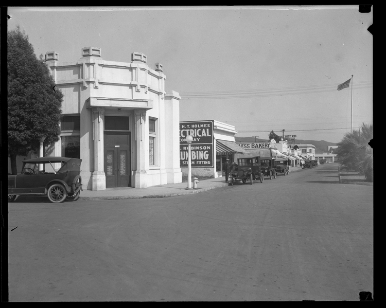 Culver City, California, circa 1920. |
Harry H. Culver started making plans in 1913 for the city that carries his name. Culver City, California, incorporated in 1917, lies halfway between the cities of Los Angeles and Venice. Buoyed by a strong economic base of movie studios, small businesses, and industrial endeavors, the city grew to include more people, more land, and schools. By 2000, the city had quadrupled in size and is now a community of nearly 40,000 residents.
The effects of time and growth compromised Culver City's public works data, especially the city sewer system. When Marcos Mendez started work in 2007 at the Culver City Information Technology Department, he began to collaborate with the Public Works Department to update citywide sewer maps. The city needed a current record of its assets for maintenance and inspection. Mendez used geographic information system (GIS) technology from Esri for the project to create an asset database and to provide online maps of the city's sewer system to contractors, city engineers, and the general public.
Compiling Sewer Plans
Mendez began the process by looking at all the city's sewer as-built plans and profiles. This was a real challenge, since the city does not have a staff member who works on maintaining sewer plans full time. Mendez cobbled together sewer plans from various files including street plans, tract plans, and parks and recreation records. One thing Mendez had working for him was the city's mature GIS program, replete with many datasets developed over a span of more than 10 years. This information ensured greater accuracy and provided aerial photography for cross-referencing.
A project goal was to hyperlink sewer plans to the GIS-based sewer line data so that the information would be accessible via the Online Sewer Access System Web application. The database was created using ArcGIS Desktop from Esri. To improve the Web application's functionality, the city recently launched Esri's ArcGIS Server. The site provides information to engineers and contractors who must determine where to connect private sewer pipes to the public sewer main. Public works field crews use the site to research and obtain plans. When a user visits the city Web site, the Web application displays the sewer map. With a click on a sewer line, the user can retrieve a scanned PDF of the as-built plan.
"GIS made everything come together," Mendez said. "Culver City staff can go into the Web application and access everything they need from one system. GIS is saving us a lot of time because we don't have to dig through cabinets for information or rely on memory."
Since Culver City was founded almost a century ago, some of the original sewer plans went missing. Other plans, dating back to 1922, were very difficult to scan internally, so the city completed that portion of the project using contracted experts. However, there were still blanks to be filled.
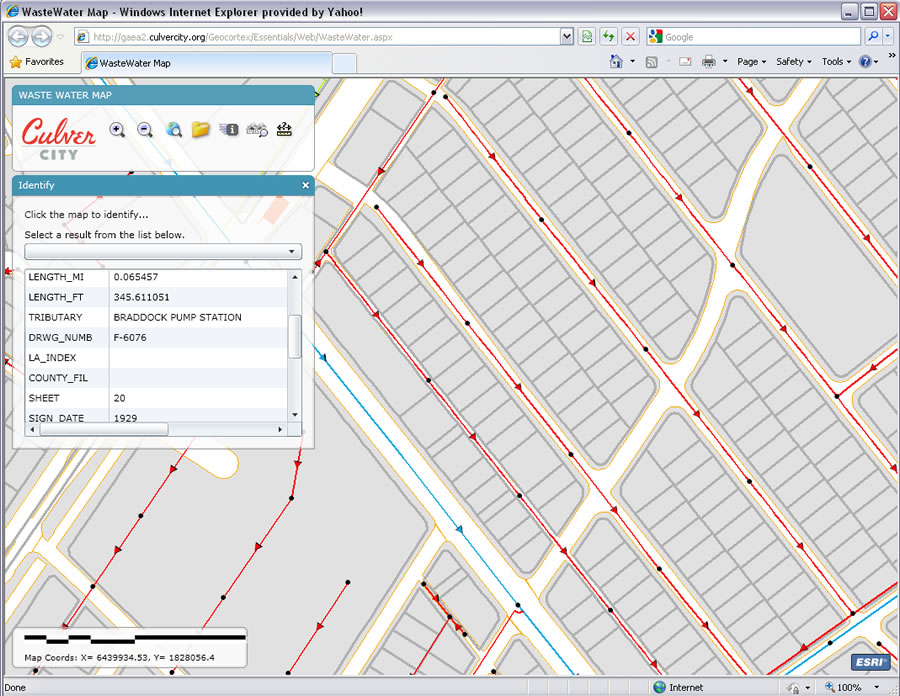 The new Sewer Web Application offers more map space, has a cleaner look, and is more user friendly then the previous Web Application. |
"We used numbers in each field of the attribute table within the GIS data to designate the status of sewer plans," Mendez said. "For example, I would place a 0 in the attribute information if the sewer line was not in need of attention. A 1 means it is missing a sewer plan. A 2 means the plans could not be scanned and needed to be contracted out. A 3 indicated there was a question for the sewer maintenance manager."
Mendez coordinated as-built plans with sewer lines where possible. If he could not find a match, he used aerial images or GPS data to georeference the location. Culver City engineers checked every single line and point to ensure accuracy before approving the data.
A Job Well Done
Culver City now has an up-to-date printed Citywide Sewer GIS Map Book and the Online Sewer Access System to share the data with the public. When repairs are needed, the public can now access sewer information online and determine the location of a private sewer connection to the public sewer. This eliminates the need for people to travel to city hall and research the information, thereby saving time for the city staff and members of the public.
"Our sewer GIS database has also increased productivity for engineering and operations and propagated better information flow a thousand-fold," said Johnnie Griffing, GIS project manager. "Thematic maps are now generated that depict entire portions of the system as connected to each pump station. This was a big revelation for engineers and field crews who had not previously had a means for visualizing the extent of the sewer system's relationship to pump stations. The map book offers a fine level of detail previously only available by retrieving and viewing hundreds of paper drawings—reflecting the most current and staff-verified picture of sewer distribution as it is in the field. Management can now review these details of the system to make better decisions."
The Online Sewer Access System map shows sewer pipes, flow direction, manholes, aerial imagery, parcels, pump stations, pumps, and wet wells. Sewer data is served on top of city infrastructure layers such as streets and city boundaries, all within the GIS. Users can navigate based on address or intersection, click on a line or point, see the attribute information, and view associated scanned drawings that have been hyperlinked.
The city's sewer data now includes construction material, footage, year installed, tributary, and ownership data. Material, size, and diameter of all pipes have been documented as well as digitized outfalls—large-diameter sewer pipes that take Culver City sewer flows to the sewer treatment plant. There is also manhole data including small access points, called cleanouts, that reside on private property and larger sewer maintenance access points, called lamp holes, that are located in alleys. Such geographic points were not included in previous versions of sewer maps. Mendez is currently adding manhole identification numbers that correlate with mapbook pages to further assist field crews.
"We use the map book now rather than the large roll-up map," said Mate Gaspar, engineering services manager for Culver City. "The map book is easy to read, and I know it is complete, updated, and accurate. We have also increased efficiency by using the Online Sewer Access System to view sewer plans rather than pull maps from the plan room."