ArcWatch: GIS News, Views, and Insights
July 2012
Foresters Share Ideas, Solutions at Esri Forestry GIS Conference

Along with business cards, many ideas were exchanged at the conference.
Befitting a gathering of foresters, a group attending the Esri Forestry GIS Conference last May in Redlands, California, took a day off from a series of indoor presentations and lightning talks to put geospatial technology to use in the great outdoors.
The mobile data collection and mapping lab took the foresters into the San Bernardino National Forest near Big Bear Lake to work with ArcGIS and the products from a range of Esri partners, such as Laser Technology, Trimble Navigation, and F4 Tech.
Paul Barker, a product engineer with Esri's mobile team, gave attendees an opportunity to try out tablet computers running ArcGIS for Android and ArcGIS for iOS. Conference attendees used an example application to add or update features and collect data for the features in a forested park near Big Bear Lake.
Because ArcGIS for Android and ArcGIS for iOS run on smartphones, millions of people around the world are beginning to have access to maps and data via these ubiquitous devices.
"Let's look at it numerically: 158 million smartphones were activated last year, bringing the total worldwide to 500 million. And that was a 58 percent increase over the previous year. Those are staggering numbers. This has led some people to say that 'mobile is the new black,'" said Dave Bouwman, chief technology officer and senior software architect at DTS Agile, which builds custom enterprise GIS systems and mobile applications. "The shift in how people interact and work with data is a huge thing, and very powerful."
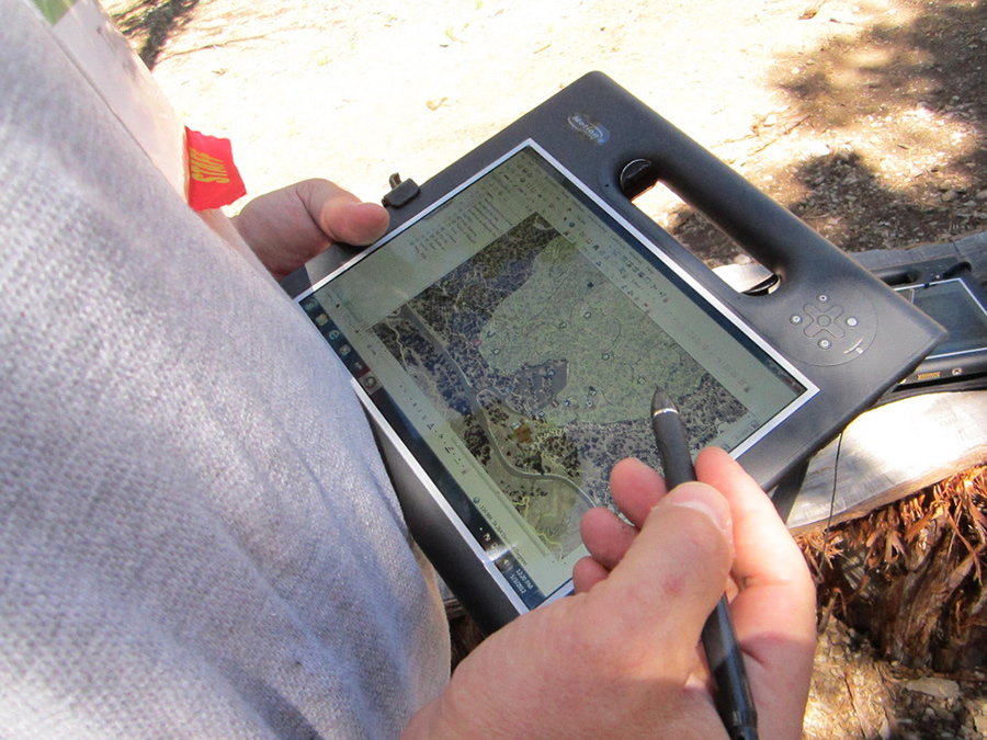
ArcGIS can be used on a ruggedized tablet to conduct forest inventories.
Bringing Together People to Exchange Ideas
The conference, held May 1-3, 2012 at Esri headquarters in Redlands, California, drew about 150 forestry GIS professionals from around the world. Highlights of the event included presentations from Marvin "Ray" Risco, president of Weyerhaeuser Solutions Inc., and Joseph K. Berry, principal of Berry & Associates and a leading educator in the application of GIS technology; case studies that showcased GIS solutions; demonstrations of mobile technology; and the day-long field lab in the San Bernardino National Forest on data collection and mapping.
Mark Books, president of the Esri Forestry Group and a GIS forester at the US Army's Fort A. P. Hill in Virginia, said the aim of the conference was to get forestry GIS professionals in the same room to connect with one another and share ideas. "The idea of the user group is to develop a one-stop shop for all things forestry and GIS. So this conference is different from Esri user conferences in that it is organized by this community for this community," he said. "It provides us with an opportunity to get together with peers to exchange stories and hash out solutions."
The case study presentations from GIS forestry professionals were particularly useful, illustrating both what the technology is capable of and how people are using it to solve their management problems, Books said.
"You could be the president of a company, or you could be the boots-on-the ground forester in a one-man GIS shop. Those two people are going to look at GIS differently," he said. "Someone who doesn't push the buttons needs to know its capabilities on a broader scale, but someone who is pushing the buttons needs to hear, 'Yes, there is a solution to this problem, and here is how you go about solving it.'"

A forester learns to capture measurements using laser technology.
Some of the presentations focused on the use of GIS to analyze wildfire risks in Texas, assess the risk of disease transmission between native bighorn and domestic sheep on forest service lands, and assist in planning where logs will be hauled via cables in New Zealand. (Cable operating engineers use GIS to calculate the best location for cables and anchors that ferry the logs from the dense forest to the log haulers.) View the presentations and videos from the Esri Forestry GIS Conference.
ArcGIS 10.1 and Lidar
In a video message to conference attendees, Esri president and founder Jack Dangermond said that ArcGIS 10.1 will be a "big jump forward" for ArcGIS in many ways. One of the most significant changes will be in support for lidar (light detection and ranging) data. ArcGIS 10.1 will be able to directly read lidar LAS datasets, allowing users to more easily view, manage, and analyze lidar data.
"Lidar has a 'bad rap' as [being] expensive," said Ron Behrendt, president of Behron, a consulting firm based in Whitefish, Montana, in an introduction to lidar. "But I like to think of it as good value."
That value is found in the useful information about forests and natural landscapes that can be obtained from lidar, as indicated by the title of his presentation: Creative Lidar Point Cloud Filtering Exposes Overlooked Trails and Roads. Lidar allows for the direct measurement of three-dimensional structures and underlying terrain. It is particuarly valuable for forestry applications because it can penetrate tree canopies, clouds, and water.
Tembec, a Canadian forest-products company that manages nearly 25 million acres (10 million hectares) of forest, is getting a wealth of key data via lidar, including stand height, stand density, tree diameters, timber volume, basal area, and biomass volume, said Chad St. Amand, the company's GIS manager.
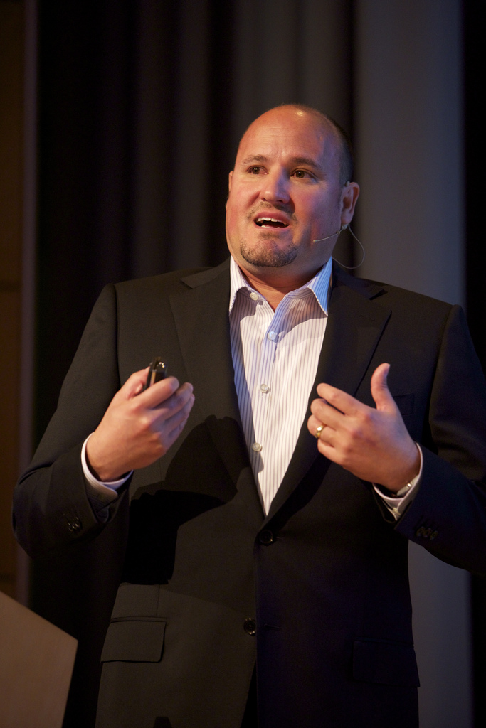
Marvin "Ray" Risco, president of Weyerhaeuser Solutions Inc., says that technology will play a role in helping Weyerhaeuser better manage natural resources.
"If you can think about it in forestry," said St. Amand, "lidar can probably do it for you."
Weyerhaeuser Looks Ahead
The conference focused on more than GIS technology. In his keynote, Weyerhaeuser's Risco described his company's focus on using its resource management and technology skills to serve a growing world population. He noted that 30 percent of the planet's land area is covered by forests.
"We believe that countries will continue to strive to educate their populations (and) to increase their standard of living, which will put more stress on the planet," Risco said. "We have choices to make: Do we curtail consumption? Do we curtail population? Who do we tell that they can't improve their standard of living? That's not realistic. In fact, what we need to do is to figure out how to shift the capacity of production up, and the way to do that is to become much more efficient in how we manage our basic natural resources."
Weyerhaeuser manages more than 20 million acres of timberland in North America and produces a variety of products such as lumber and paper. "Sustainability [of resources] without economic sustainability is not realistic; it's only a point in time," he added. "The forests that are under rotation management or high-yield management will become much more important in the future if we're going to meet the world's needs going forward."
Joe Smith is society affairs editor and Steve Wilent is editor of The Forestry Source, the monthly newspaper of the Society of American Foresters (www.eforester.org).