Seen and Heard at the 2009 Esri International User Conference
By Carla Wheeler, ArcWatch Editor
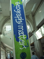 Geography matters to GIS software users. Photo by Robby Deming/Esri |
During the Esri International User Conference (Esri UC), people like to talk technology. Geospatial technology, mostly. But when Esri president Jack Dangermond opened this year's conference in San Diego, California, in July, he talked first about people. "You are an extraordinary group," he told more than 12,000 attendees from 104 countries, emphasizing that the reason for gathering was to celebrate their work as part of a large global network of GIS professionals who come from diverse backgrounds and a multitude of disciplines.
"The purpose is to focus on you and your work and build relationships where we can teach each other real experience and real knowledge—not book knowledge," said Dangermond, who founded Esri 40 years ago.
He said that collectively, the people in the room possessed the greatest store of knowledge about geography and how to interpret it and apply it. He encouraged everyone to take the time to meet new people and exchange ideas. "Look around this week and find somebody important to do something important with," he said.
According to Dangermond, it's the relationships that matter most after all these years. "I don't know about you, but in my life, relationships give me the power and inspiration to do what I do," he told the crowd.
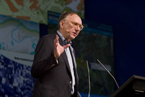 Jack Dangermond stressed that like geography, relationships matter. Photo by Eric Laycock/Esri |
Thousands of those important conversations—in person or on social media such as Twitter—took place during the Esri UC and at the related GIS conferences, summits, and seminars at the San Diego Convention Center. People also saw technology demonstrations, went to book signings at the Spatial Outlet, and toured the Map Gallery.
The week's highlights, available on video, included Dangermond's talk about the conference theme, GIS—Designing Our Future. He explained how GIS and design can be wedded in a concept he calls GeoDesign to create a better future for the world. Climate change and other environmental problems result, in part, from happenstance, according to Dangermond. "We need a future that doesn't just simply happen to us, and that is what it is looking like today," he said. "We need to change from that kind of future to one that is purposely designed."
 The Esri UC promotes and produces people-to-people connections. Photo by Eric Laycock/Esri |
The Plenary Session also featured a series of talks about the major upcoming ArcGIS 9.4 release. Esri's director of software development, Scott Morehouse, said that some changes to expect with ArcGIS Desktop include tighter integration of ArcCatalog with ArcMap and improvement of the organization of the default menus. He also said his team is working to improve users' experiences in the areas of editing, geoprocessing, spatial analysis, and publishing and sharing maps to the server. "I think the word we use is streamline—reduce the number of clicks that you need to do; reduce the number of concepts you need to carry in your head to get your work done." Watch the other plenary technology demonstrations, including ArcGIS 9.4: 3D GIS, presented by Nathan Shephard from Esri.
At the plenary, Governor Martin O'Malley received the President's Award on behalf of the state of Maryland, space scientist Dr. Krishnaswamy Kasturirangan of India accepted the Making a Difference Award, Cindi Salas received the Enterprise Application Award on behalf of CenterPoint Energy, and Henk Scholten accepted the Lifetime Achievement Award.
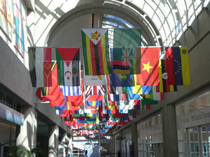 People from 104 nations were represented at the 2009 Esri UC. Photo by Robin Rowe/Esri. |
O'Malley talked about using GIS to help create government performance measurement tools. "GIS holds a tremendous amount of promise," he said. "GIS is more than a revolutionary technology. It is more than an analytic tool for making our government work. It's more than a new tool for implementing public policy. It just might be the linchpin of a powerful new movement."
Counting Citizens, Creating Land Records, and Protecting Rainforests
The keynote speakers at the plenary talked about the importance of mapping in their work. Tim Trainor, chief of the Geography Division for the U.S. Census Bureau, spoke about how his organization is using GIS to prepare for the upcoming 2010 Census. For example, he said 140,000 temporary census enumerators used GIS software tools on handheld computers to collect and edit data during the recent address canvassing of the nation. "Those enumerators walked every street in the United States. Their work ensured an accurate address list that we will use as part of the mail-out of the census questionnaires that we will send next spring, on April 1," he said. "This was by far the largest deployment of mobile GIS in the world."
Peruvian economist Hernando de Soto, president of the Institute for Liberty and Democracy (ILD), spoke about the prevalence of shadow economies in poor countries. He explained how formalizing land records and standardizing property systems can help alleviate poverty and bring in democracy. (A pilot project in Ghana used geospatial technologies to create a land-titling process and GIS-based land records system.) De Soto said the United States' property system can serve as an example to the rest of the world.
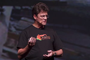 Biologist Willie Smits talks about how GIS technology was used to better understand the environmental damage caused by oil palm plantations in Indonesia. Photo by Eric Laycock/Esri |
"In your country, you have got not only the imagery technique to do a world revolution but you have a legal technique," he said. "What you've got is a great property system, and it's important that you . . . teach the rest of the world how you built [that] up."
Biologist Willie Smits, founder of Borneo Orangutan Survival (BOS), told the audience about how clearing land for oil palm plantations is destroying the rainforest and the orangutans' habitat in Indonesia. He demonstrated how satellite imagery and GIS technology was used to map how, over time, illegal logging, slash and burn agriculture, and the oil palm plantations on Sumatra have destroyed much of the rainforest there. "You can use the technology to see exactly what is going wrong," he said. "You can see how the forest is melting away." Smits also talked about how geospatial technologies can be used to monitor illegal logging and make smarter business decisions.
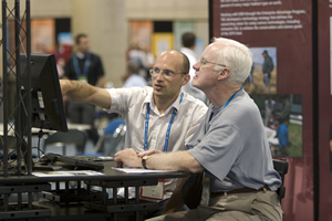
 The GIS software demonstrations draw many people to the Esri UC. Photo by Eric Laycock/Esri |
He showed maps that revealed where on Borneo the oil palm plantations were destroying natural habitat, as well as the most suitable sites for planting oil palms. He also showed the audience a GIS map that was created to show the best places to plant the environmentally friendly sugar palms on Borneo—at the higher elevations, where the oil palms are being planted instead.
The GeoMentor Program
During the plenary, the National Geographic Society and Esri's education team announced the GeoMentor program launch. Charlie Fitzpatrick, Esri's K–12 program manager, rallied the GIS users in the audience to volunteer to assist educators and students with GIS projects. "Sometimes, they just need help installing software, or finding data, or convincing a techie that they really, really, really do need to be able to write files to the C drive," Fitzpatrick said. "They need a mentor who understands the power of geography—they need a GeoMentor." He then introduced teacher Jacqueline Smith and students Joey Hightower and Matt Kelly from Joppatowne High School in Maryland, along with GeoMentor Eric Cromwell.
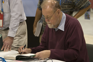 Dr. Roger Tomlinson signs a copy of his Esri Press book, Thinking About GIS. Photo by Eric Laycock/Esri |
Dr. Roger Tomlinson, known as the "father of GIS," moderated the Esri Senior Executive Seminar. Among the speakers was California's geographic information officer Michael Byrne, who called GIS the "new white board" for decision makers. A lively discussion ensued about the limits of data sharing in the United States, but Tomlinson said it's less expensive to obtain data in this country than in some other countries. "The policies in the United States are very wise and very liberal," he said. "In Canada, [they] charge high prices for data, and this suppresses the use of data." Read more about the seminar.
Tomlinson was also later spotted at the Spatial Outlet, where he signed copies of his book, Thinking About GIS, Third Edition.
The power of geospatial technology was discussed countless times at the Esri UC. Read more about the FedExGIS Tracking Operations; the future of GIS in cloud computing and the ArcGIS Online services; and the announcement by Chris Cappelli, Esri's director of sales, about the upcoming release of a GIS application for the Apple iPhone.
 The Map Gallery shows how GIS software users put their skills to use. Photo by Susan Harp/Esri |
Conference-goers couldn't help but poke their heads into Exhibit Hall A on July 15 after they heard the hum of excitement (and saw the cheesecake bar). With flashbulbs going off and winners receiving big pats on the back, the Special Achievement in GIS (SAG) Awards ceremony generated energy, pride, and connections. The awards honor organizations for their exceptional use of GIS, demonstrating vision, leadership, and innovative applications of Esri technology to better serve society. From creating intuitive, information-rich Web sites for the public to responding more quickly to 911 calls, companies, institutions, and communities worldwide are finding many new ways to leverage GIS. See which organizations won SAG Awards.
At the close of the conference, Dangermond and Esri's senior directors answered videotaped questions from attendees. One of the questions to Dangermond was, "What's your passion these days? What still drives [you]?" Dangermond's answer: "Esri is a team of contentious friends that drive and motivate each other. We all love technology and applications and what they bring. I heard someone say something earlier in the week that was inspiring—'Realizing a good idea that really matters.' Now that gets me excited!"