Surprise, Arizona, Bridges the Gap between CAD and GIS
By Matt Freeman, Esri Writer
In Arizona's dry Sonora desert, the city of Surprise is a booming Phoenix suburb with a small-town feel and big-city amenities.
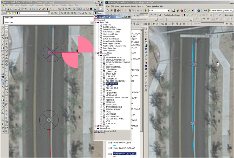 Crossfire is a stand-alone software solution that provides access to ArcGIS from inside the AutoCAD environment. |
One of those amenities is the city's enterprise GIS. The enterprise GIS helps city employees who work in Surprise meet the geospatial information technology (IT) demands of one of the fastest-growing cities in the United States. At the peak of the housing boom, from 2006 to 2008, Surprise issued more than 800 new house construction permits per month. The 2000 Census reported a population of 30,848 in 2000. The city now estimates that number has soared past 109,000.
"GIS is the foundation on which both the city's land information and asset management systems are based," says City of Surprise GIS division manager Lloyd Abrams.
From planning to emergency routing, nearly every department in the city relies on its enterprise GIS for accurate and current geographic information. However, Surprise's spatial data has not always been available to its employees in an enterprise GIS. In recent years, data was provided by individual departments and various developers, surveyors, and engineers in a CAD format. The GIS division then had to manually integrate data from AutoCAD into an Esri shapefile before it was accessible to employees working in an ArcGIS Desktop environment. In desktop GIS, select employees performed advanced spatial analysis, modeled operational processes, and visualized results on maps. The interval between receiving CAD data and being able to view it in the city's GIS was sometimes lengthy. Surprise had invested in an accurate survey control network that city departments and developers alike were required to utilize while acquiring and submitting data. "The network ensured that incoming data fit well into the city's GIS basemap, but it wasn't a seamless transition," says Abrams.
Moving to an Enterprise GIS
Anticipating a housing boom, Surprise began to migrate its CAD data into an enterprise GIS. Centrally stored in a Microsoft SQL Server-supported relational database management system (RDBMS), AutoCAD map data became accessible via an intranet portal supported by Esri's ArcGIS Server.
The upgrade to server GIS gave Surprise the power to streamline business practices and workflows within the city.
Migrating from CAD to GIS
Surprise's permitting system, engineering activities, and utility maintenance tasks all benefited greatly from the GIS investments. However, Abrams' department of four employees was still tasked with manually translating incoming CAD data from housing developers before it could be stored in the new GIS geodatabase.
Surprise began to shop for a software solution that could automate the existing CAD-to-GIS migration process, which was well established but time consuming.
"All data from developers was still coming in to us in a CAD format," stresses Abrams. "To keep it flexible for developers, we wanted to keep that business practice alive but still be able to quickly update the data into our GIS."
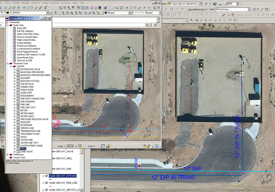 Crossfire preserves the integrity and symbology of CAD blocks when extracting data from ArcGIS Server. |
The solution to Abrams' dilemma was found just 20 miles away. Phoenix-based Esri business partner Engineering Mapping Solutions, Inc. (EMS), introduced Abrams to Crossfire, a stand-alone software solution that provides access to ArcGIS from inside the AutoCAD environment.
Developed and brought to market by EMS, Crossfire was created using features from the software development kits (SDK) of both ArcGIS and AutoCAD. By relying on the core development tools of the software solutions concurrently, Crossfire can achieve complete data compatibility. The solution allows a seamless path between CAD and GIS data without the need to manually change file formats, raster datasets, or geodatabase formats. Crossfire's automated editing features, user-friendly interface, overall flexibility, and easy implementation process were exactly what the city needed.
Since implementing Crossfire, many of the GIS division's lengthy editing chores have been retooled in the ArcGIS environment, thanks to the newfound CAD-GIS interoperability. Documenting and mapping a single utility pipe split, for example, is best handled using the out-of-the-box commands provided in ArcGIS. For larger, more datacentric tasks-such as adding an entire subdivision of utilities like water and sewer as well as land base layers including centerlines, address annotation, and parcels-the toolset inside Crossfire is the preferred approach.
"With minimal adjustments to our long-established CAD-based workflow, the staff is able to maintain all GIS data housed in ArcGIS directly, using Crossfire," says Abrams. "It allows us to continue to use the custom tools that have worked well for us over the years. Crossfire enables us to leverage our investment in CAD software and staff expertise and still meet the city's GIS needs."
The recent ease in the CAD-GIS integration process has allowed Surprise to augment and better utilize its enterprise GIS from both within and outside the city. Now that its crucial CAD data is easily and quickly available in a GIS environment, Surprise is moving forward with a public-facing Web site that will give its citizens access to utility, zoning, building, and other types of information via a GIS-based portal.
Being able to visualize its data from a geospatial perspective has promoted a shift in thinking within the city. "Our GIS has increased our efficiency in communicating, collaborating, making decisions, and thinking spatially," says Surprise information technologies department manager Randy Jackson. "Not only do maps adorn the walls of many departments, but the geospatial elements of our assets are embedded in almost all our data. Being able to visualize data in a geospatial context makes us more confident when it comes to making major decisions and dealing with the day-to-day issues."
For more information, contact Phil Ponce from Engineering Mapping Solutions, Inc., at phil@emsol.com.