New Version of Color Selection Tool Available
 ColorBrewer 2.0, released in 2009, adds new export and preview functionality. |
Choosing an appropriate and effective color ramp is one of many important decisions you make when creating a map. Color ramps apply a continuous range of colors to a group of symbols. While ArcMap includes predefined color ramps for use with elevation or precipitation data in the Color Ramp styles folder, you can also create custom color ramps.
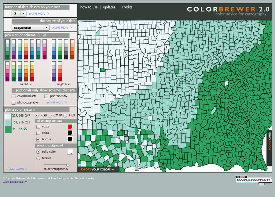
The number of color choices available can make this task daunting. With ColorBrewer, a free online tool, making more intelligent color selections is easier.
In 2002, Cynthia A. Brewer and Mark Harrower developed ColorBrewer based on work supported by a National Science Foundation grant as part of a research initiative at the Pennsylvania State University. It is a teaching as well as a diagnostic tool for developing and testing color schemes and creating better maps.
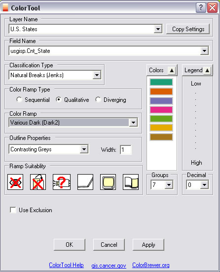 ColorTool, available from the National Cancer Institute GIS, runs ColorBrewer inside ArcMap for ArcGIS 9.x releases. It allows previewing color ramps or the map of interest. |
A new version of this handy tool, ColorBrewer 2.0, joined the original one this year. Released by Axis Maps LLC, ColorBrewer 2.0 includes enhancements that were based on feedback received by Brewer and Harrower.
The new version lets users select more colors for map features to test how they will appear with a given color scheme. Transparency is supported, so a background hillshade can be viewed with color ramps.
With the original version, color schemes could be checked for suitability for a color-blind audience or output via printer or photocopier. Any number of these tests can now be combined in one operation.
Export options have also been expanded. You can export colors directly into Adobe Illustrator or Adobe Photoshop in addition to copying and pasting color specifications or downloading them as a Microsoft Excel spreadsheet.
If this isn't convenient enough, thanks to the National Cancer Institute GIS, ColorBrewer is now available inside ArcMap as a tool. ColorTool runs inside ArcGIS 9.x releases and previews color choices in the actual map of interest. Visit the National Cancer Institute GIS Web site to download it.
You can find out more about intelligent color choices and learn other aspects of cartographic design at the Esri Mapping Center.