Manage Data Faster and Easier with ArcPad 10
By Jennifer Jacob, Esri Product Marketing
This year marks the tenth anniversary of ArcPad, a mobile geographic information system (GIS) software application that was developed to help field-workers collect and map data.
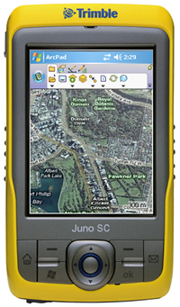 Maps from ArcGIS Online can be accessed and used in your ArcPad 10 projects. | |
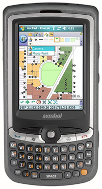 Use QuickCapture to automatically build tools and forms you need to edit your data. |
ArcPad was originally called MapPad and had approximately 200 users in both Australia and the United States. Today it is the most widely adopted mobile GIS handheld software product used around the globe with over 300,000 users. This summer's release of ArcPad 10 is packed with more capabilities than ever before.
ArcPad 10 greatly improves field productivity, helps you manage your GIS projects more efficiently, and provides a better user experience. Here's what to expect with the new release:
- Support for ArcGIS Online Map Services—For the first time, you will be able to access a variety of basemaps from ArcGIS Online and incorporate any of them into your ArcPad projects. You can now access basemaps such as World Street Map, World Topographic Map, and World Imagery as well as Microsoft Bing Maps.
- Dynamic QuickCapture Toolbar—ArcPad 10 includes a dynamic toolbar that automatically builds the tools and forms you need to edit your data. With a simple tap on the screen, you can add data to the data layer of your choice. The QuickCapture toolbar requires no customization and can be used in all your ArcPad projects.
- Enhanced ArcPad Data Manager for ArcGIS 10—ArcPad Data Manager now lets you customize an ArcPad project with no coding or scripting. You can save time, because data forms are automatically generated and populated for related tables. You also have greater control over using photos in ArcPad projects. Hyperlinked photos are now integrated into the checkout and check-in processes.
- Better Camera and Photo Experience—A new camera module, DirectShow, works with a greater number and range of hardware devices. The user experience for the camera is the same on all mobile devices. Along with improved photo management within ArcPad Data Manager, you will be able to more quickly and easily incorporate photos into your ArcPad projects.
- Improved Performance—ArcPad performs better than ever, with better memory allocation and a new quick-draw tool. The ArcPad StreetMap extension has also been improved to ensure that the maximum amount of memory is available to both ArcPad and StreetMap.
ArcPad includes advanced tools for finding, creating, and updating GIS information. ArcGIS Desktop provides checkout and check-in management of ArcPad data and maps, while the ArcGIS Server ArcPad extension can be used to synchronize edits with the enterprise geodatabase directly from the field.
ArcPad Studio, which was included in core ArcPad software at version 8, is the development framework to create projects tailored to an organization's specific workflow. You can take advantage of industry-specific templates, applets, and add-ins in ArcPad Studio to build custom applications.
More Information
To learn more about what's new in ArcPad 10 or evaluate ArcPad, visit www.esri.com/arcpad.