Opening the World to Everyone
By Carla Wheeler, Esri Writer
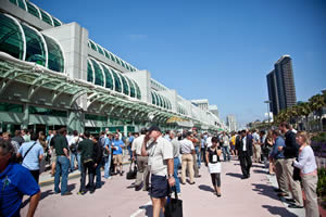 More than 13,000 people attended the 2010 Esri International User Conference, held at the San Diego Convention Center in California. |
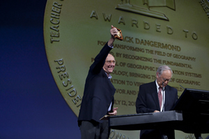
"Mapping is our language," Esri president Jack Dangermond told a throng of thousands versed in the lexicon of geospatial technology at last month's Esri International User Conference (Esri UC).
But it's a language he wants more than geographic information system (GIS) professionals to learn and use. Dangermond sees a day coming soon when everyone can tap into the capabilities of GIS, from people reporting potholes to government agencies via cell phones to African farmers accessing maps on the Web to obtain soil, weather, and other data for managing crops. It's a vision that echoed the conference's theme, Geography—Opening the World to Everyone.
"GIS already organizes our geographic information," Dangermond said during the plenary, which kicked off the Esri UC, held July 12–16 in San Diego, California. "It is time to share this with the world. Can this be done on a global scale?" he asked. "Advances in computers, the Web, mobile devices, real-time measurement, and GIS software are making this possible. A Web-based geospatial platform is emerging that is a distributed network of data and services."
Dangermond brought Kyle Brinkman, Kurt Daradics, and Jason Kiesel from CitySourced onstage to demonstrate the company's application for enabling people with smart phones to document and report the information and location of problems such as graffiti, traffic, street light outages, garbage, or blight. These applications were created using Esri's GIS technology, giving people the means to become more involved in their communities and cities the opportunity to better interact with citizens.
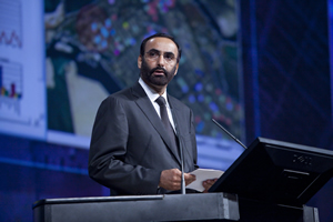 His Excellency Mohammed Ahmed Al Bowardi accepts the Making a Difference Award. |
"Everyone is getting more involved in crowd sourcing and social media," Dangermond noted. "For example, Tweets can now be georeferenced. There are huge opportunities to bring in new types of real-time information from citizens. Responding to these opportunities takes collaboration for sharing data and technology. The geospatial platform is emerging to handle this. In terms of technology, we are about there. Now comes the fun."
GIS Mapping and Citizen Involvement
At both the plenary and the Esri Senior Executive Seminar, Dangermond stressed the emerging importance of volunteered geographic information (VGI) to communicate and engage in what he called "citizen-driven government." People are using the Web to report everything from potholes in cities to tar balls in the Gulf of Mexico. (See the Gulf of Mexico oil spill interactive social media map that Esri hosts that includes oil, tar ball, and oil sheen sightings posted on Ushahidi and YouTube videos and geolocated Tweets, or "geotweets," offering commentary and information related to the spill).
"VGI," said Dangermond, "is big."
There's also a greater emphasis to make federal data more widely available via the Internet. This is what Jerry Johnston, geospatial information officer (GIO) for the Environmental Protection Agency (EPA), discussed during his talk on July 11 in San Diego at the Esri Senior Executive Seminar, a meeting of upper level executives from government, business, and non-governmental organizations around the world interested in GIS.
Johnston said that data.gov, inaugurated one year ago, will soon launch a map viewer that will let people visualize data from the vast store of public data available on the federal government site. He said that the Web site currently contains 1,632 datasets, 565 tools and widgets, and 270,194 geospatial datasets. What has been lacking, he said, is a map viewer. Information is in ZIP files, which works well for the developers who are creating applications using the data, but "the average citizen can't see it," he said. "We need to have user-friendly tools."
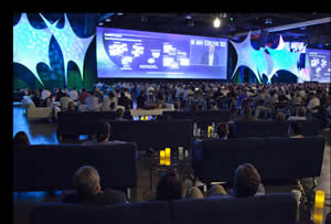 Attendees listen to Esri President Jack Dangermond talk about what's new in the ArcGIS 10 release. |
Working with Esri, data.gov will later this summer offer a Flex map viewer for visualizing data. Several types of data that will be viewable, he said, include the EPA's toxins release inventory, showing where hazardous chemicals are stored, along with census and air pollution data. Johnston said he expects the map viewer to be available before the end of August.
Meanwhile, he said that developers are creating interesting applications using the data available in data.gov. Examples include FlyOnTime, which lets people check and see airlines' past on-time flight performances; the National Obesity Comparison Tool, which allows visitors to check the obesity percentages by county across the United States; and the Plant Hardiness Zone Map, which helps people find out what types of plants will grow well and survive in their areas.
Highlights from the Plenary
More than 13,000 people from 134 countries attended the 30th Esri UC, which Dangermond said was the largest gathering ever of the GIS community. They represented 6,000 organizations. As in years past, he asked the attendees to take a moment to introduce themselves to someone new. Hands stretched across aisles.
"The purpose of this meeting is to get to know each other, share our information and experiences, and learn from each other and develop relationships," Dangermond said. "That's a very powerful thing, if you think about it. How we learn is basically through friendship."
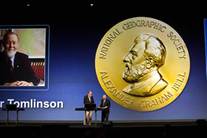 Gil Grosvenor from the National Geographic Society presents the Alexander Graham Bell Medal to Dr. Roger F. Tomlinson. |
Dangermond then presented the Making a Difference Award to the government of Abu Dhabi, United Arab Emirates. The emirate uses GIS for managing cities, utilities, health, the environment, emergency response, and science. The Abu Dhabi Systems and Information Centre has built a spatial data infrastructure that facilitates geospatial data sharing among 40 government agencies and other stakeholders. His Excellency Mohammed Ahmed Al Bowardi, secretary-general of the Abu Dhabi Executive Council, accepted the award.
Dangermond also acknowledged the work of the United Nations, especially its cartographic and statistical unit that has diligently worked to support standards and templates to build a foundation for GIS users worldwide. He also lauded the 200 winners of the Special Achievement in GIS (SAG) Award for outstanding work in their organizations and industries.
Introducing ArcGIS 10
Dangermond also devoted time to explain why ArcGIS 10 is a new milestone. "ArcGIS 10 is a complete system for geographic information. It makes it easier [to use], much more powerful—a pervasive GIS that is in the cloud, the office, and the field. Intelligent maps simplify the complexity of GIS [such as tables, metadata, and workflow] and hide it behind a map. Geographic information is more than the data—it's all the pieces behind the maps that enable us to share our stories and get our ideas across to others."
Dangermond said that ArcGIS 10 includes hundreds of improvements such as fast display, templates, template-based editing, integrated parcel management, map books, and online resources. "This makes for a stronger scientific platform for time awareness, advanced spatial analysis, integrated scientific programming, and 3D GIS," he said.
Esri technology experts demonstrated how ArcGIS can be used in a wide collaborative effort wherein the enterprise is connected to everyone else. Look for information about these among the Esri UC plenary blog posts or watch the videos at www.esri.com/uc. These include demonstrations on community maps, ArcGIS Online, ArcGIS.com, ArcGIS for iOS, productivity in ArcGIS 10, the integration of Python scripting, imagery, GIS processing integration, ArcGIS Network Analyst, and analysis using 3D and new space and time enhancements. Also, Barney Krucoff, geospatial technologist for Washington, D.C., talked about the value of contributing data to ArcGIS online.
Recognizing Special Organizations and GIS Pioneers
The City of Frisco, Texas, received the President's Award. The city has embedded GIS into the community's infrastructure, including the school district, health care, and emergency response. Paul Siebert, the city's assistant fire chief, came onstage to the sound of flashing lights and alarms. Dressed in firefighter gear, he showed all the ways that GIS is used in responding to an early-morning smoke alarm at the high school: routing, the water system, the real-time camera feed, and the facilities plan. Susan Olson, information services and GIS manager, City of Frisco, accepted the award.
 Jack Dangermond accepts his Alexander Graham Bell Medal. |
The Lifetime Achievement Award was presented to Carlos Salman Gonzalez, the president and chief executive officer of Sistemas de Informaci�n Geogr�fica, S.A. (SIGSA). He brought modern mapping tools to Mexico. He also purchased a nursery and led a movement that has planted millions of trees in that country. After working for the Mexican government, he opened his own mapping company, which today is the largest mapping company in South America.
National Geographic Society's board chairman Gil Grosvenor awarded the society's highest honor, the Alexander Graham Bell Medal, to Roger Tomlinson, known as the "father of GIS." "The award honors Tomlinson's qualities of great innovation," said Grosvenor. "His efforts have made geographers out of people who didn't even know they were geographers." He gave a second Alexander Graham Bell Award to Dangermond for his innovations that are transforming the world of geography, bringing the use of geographic information to every part of the globe.
Bigfork High School students Tia Bakker and Ernie Cottle from Montana took the stage wearing caver helmets. They explained how they used GIS to analyze caves' natural resources inside Glacier National Park. Their teacher and GIS mentor, Hans Bodenhamer, encouraged the many GIS professionals in the audience to volunteer as GIS mentors to the youth in their communities.
Understanding Supercities
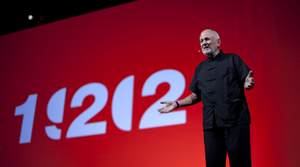 Richard Saul Wurman spoke about the 19.20.21 project. |
Richard Saul Wurman, author of more than 80 books and founder of the renowned Technology/ Entertainment/Design (TED) conferences, gave the keynote presentation. Wurman discussed the project 19.20.21.
The project, which will have Web, television, and other components, is an attempt to understand comparative data on 19 cities that will have 20 million or more inhabitants in the 21st century. The initiative is meant to provide "a road map for understanding the world ahead," according to the 19.20.21 Web site.
With the majority of the earth's population now living in cities, Wurman saw a need to address an information gap about the urban supercenters driving modern culture.
GIS will be used to answer the questions, Where is a city's center? Where does it end? How do we determine its edge? The way we ask the questions is extremely important. He talked about five factors for geospatial analysis: concrete density, geopolitical area, transportation basin, metropolitan statistical area, and city lights. Wurman hopes to eventually develop a standard for measuring cities so that they can be analyzed and compared.
Health, education, demographics, growth patterns, crime, the cost of living, transportation, and many other topics will be explored and compared using common templates. "People publish [data about] their city, side by side, and the world could compare them," said Dangermond at the close of the 19.20.21 presentation. "How is New York relative to Abu Dhabi? How could you compare Shanghai to West Berlin?"
Dangermond called on the attendees to collaborate on 19.20.21. "I think it is a really neat idea that we can bring our knowledge together to build an understanding platform to create a better world."