Latest Version of ArcGIS Explorer Ready for Download
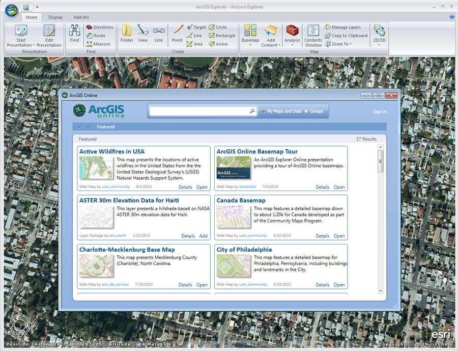 Search for and add geographic content directly from ArcGIS Online. |
The new release of ArcGIS Explorer lets you tap into more ArcGIS Online data and services, making working with geographic information and sharing it with colleagues simpler than ever.
The new version of the free geographic information system (GIS) viewer offers many compelling features and enhancements, including tools to increase productivity and more ways to share geographic information. Many new updates help integrate it with ArcGIS 10, including direct support for ArcGIS image services, improved support for ArcGIS 10 layer packages and geodatabases, and more ways to leverage ArcGIS Online.
Using ArcGIS Explorer, you can directly access ArcGIS Online. That makes it easy to find and share geographic information and form online communities. You can search for and add geographic content directly from ArcGIS Online as well as immediately share map content using your online account. ArcGIS Explorer offers direct access to all maps, data, and groups.
The new release supports greater interoperability with both Esri's ArcGIS system and Keyhole Markup Language (KML). ArcGIS Explorer now lets you share or export layer packages, providing better interoperability between the free client and ArcGIS Desktop.
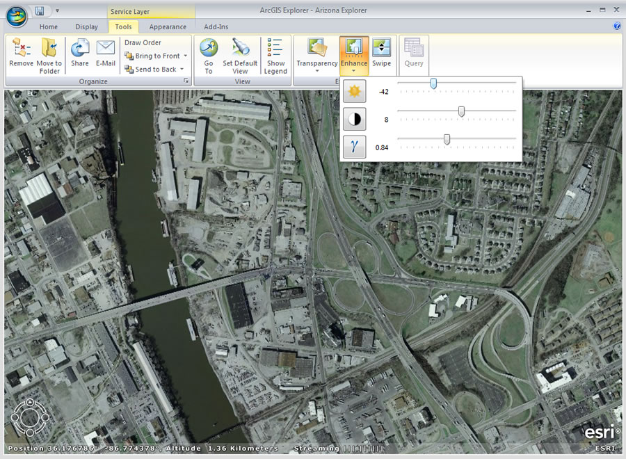 New tools and properties for image services include gamma, brightness, and contrast. |
You can also share notes as KML and convert KML to notes. Notes are generally popup windows that contain additional content. Shared layer packages, notes, and KML can be saved locally, added to ArcGIS Online, or e-mailed directly from ArcGIS Explorer. KML handling has been improved in both the 2D and 3D modes, and regionated KML is now supported in 2D mode. Regionated KML is a format that breaks an image file into tiles or regions that are easier to deliver than one large file.
The new version of ArcGIS Explorer also will give you the ability to
- Add data from Excel spreadsheets.
- Directly use and optimize image services. New tools and properties for image services include gamma, brightness, and contrast; compression and resample method; and mosaic method and operator. Image services can also be added as elevation layers.
- Access OpenStreetMap, which is now included in the ArcGIS Explorer basemap gallery.
Notes can now be labeled, and the note, presentation, pop-up, and Analysis Gallery features have all been improved with new tools to help you be more productive and more easily share information. A new Query capability provides the ability to create expressions to filter data displayed on maps. Improvements have also been made to symbology in 2D and 3D modes.
In addition to the free download of ArcGIS Explorer, Esri offers a free ArcGIS Explorer Software Developer Kit (SDK). This SDK has been updated to support Visual Studio 2010, including templates for the new add-in types and an updated add-in wizard. The reference and conceptual help have also been updated, and new/updated SDK samples are included.
ArcGIS Explorer is supported in English, German, French, Spanish, Japanese, and simplified Chinese. Download today. Learn more.