A Better Way of Organizing Imagery
By Mark Romero, Esri Technical Marketing
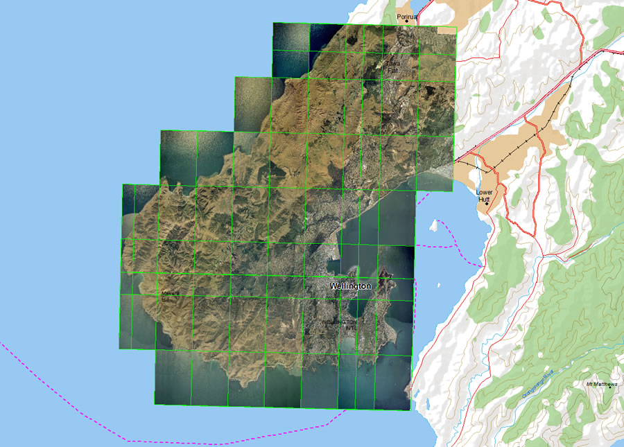 The mosaic dataset is viewed as a single mosaic. | |
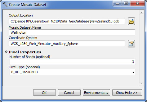 Create Mosaic Dataset Tool | |
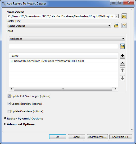 Add Rasters To Mosaic Dataset Tool |
Whether you visualize imagery or use it for analysis, you need to manage it and make it quickly accessible in a GIS. A great way to manage and catalog your collections of imagery is with a mosaic dataset. When viewed in your map, it appears as a mosaicked image, but it is actually stored as a catalog referencing all the images stored on disk in their original form without any conversion of the data. Optional processing can be applied for more advanced visualization and accessed on the fly.
If you have large imagery collections, need to build mosaics, want faster display speeds, need to serve imagery to other users, and don't want to convert the data, you may want to try the mosaic dataset now available in ArcGIS 10.
Mosaic datasets are easy to make.
Step 1. From the Catalog window in ArcMap, create a new geodatabase (or use an existing one), right-click it, and point to New Mosaic Dataset. Give it a name and select a coordinate system. If you know the number of bands, enter those as well as the pixel depth. If these parameters are left blank, the mosaic dataset will adopt the pixel properties of the first image that's added.
Step 2. Right-click the mosaic dataset and select Add Rasters. Select the raster type. This is specific to the image sensor you'll be adding. The raster types correspond to different sensors, such as QuickBird, GeoEye-1, or Spot, or can be those normally supported in ArcMap, such as .tiff or .jpg. Next, select the input as individual image files, an existing image dataset, or a workspace where all the images exist. Click OK.
Step 3. Once the rasters are added to the mosaic dataset, you can view it in ArcMap. It will load into the table of contents as a special group layer with three key sublayers. Each of these layers has its own layer properties that are specific to how you might interact with the mosaic dataset.
Step 4. The mosaic dataset can be served as an image service using ArcGIS Server or used locally in ArcMap.
For more detailed steps, see mosaic dataset in the ArcGIS 10 help. For more information on mosaic datasets, see On-the-Fly Processing and Dynamic Raster Mosaicking: Mosaic datasets resolve many traditional raster management issues in the summer 2010 issue of ArcUser magazine.
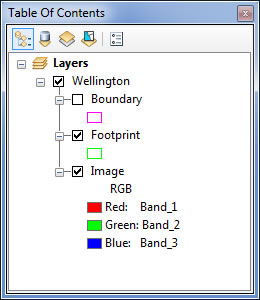 The Mosaic Dataset in the Table of Contents |
Preprocessing Best Practices
Whether you're adding imagery to a mosaic dataset or a raster catalog or simply adding it to ArcMap, consider using these preprocessing steps first:
- Build pyramids to improve the display performance. Building pyramids isn't always necessary with preprocessed images. If you're unsure, you can still build them. The software is smart enough to know if you need them or not.
- Calculate statistics so the software can properly stretch the raster data for improved display. This step is not necessary when the data is already radiometrically preprocessed (e.g., DOQQ or NAIP).
- Consider converting certain formats, such as ASCII DEM, to a format that's faster to read, like TIFF.
- If converting data, use a lossless (e.g., LZW) or lossy (e.g., JPEG) compression.