ArcGIS 9.2 Tool Makes Features Visible
Zoom to Make Visible
 Setting scale dependent display for layers avoids this ugly scenario: labels and features displayed at an inappropriate scale. |
Get to out-of-scale features easily.
A new ArcMap tool available with ArcGIS 9.2 lets you immediately zoom to the visibility threshold for a map layer if a scale visibility range has been set for that layer. The Zoom To Make Visible tool is accessed by right-clicking on the layer in ArcMap and choosing it from the context menu. The tool is enabled if the layer has scale visibility range and is not being drawn because of the map's current scale. ArcMap maintains the map's centerpoint.
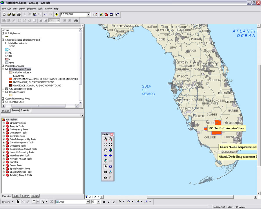
Setting visibility ranges for layers is a good practice. Suppressing features and labels when the map is viewed at scales that would be inappropriate for that level of detail makes maps less cluttered and more readable. However, when a feature is out of scale, the Zoom To Selected Feature tool won't help because the feature can't be found and interactively selected.
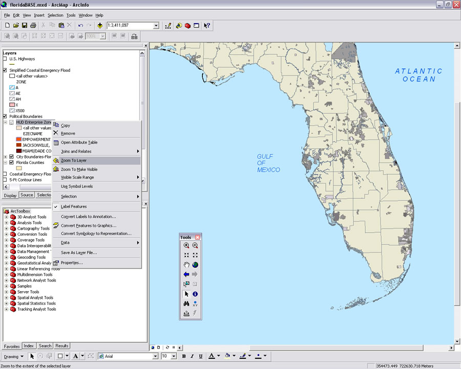 The Zoom To Make Visible tool is available from the context menu when scale visibility is set and the layer is not visible because it is out of scale. | 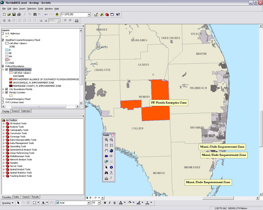 Using the tool, ArcMap zooms to the nearest scale that will display the desired layer. |
Using the Zoom To Make Visible tool is much quicker than determining the visibility level of the layer properties and zooming to that level.
Remember that the Zoom To Make Visible tool doesn't guarantee features in that layer will be immediately visible because you may be looking at part of the map that does not contain any features from that layer.