Get Started with the Latest Version of ArcGIS Explorer
By Bern Szukalski, ArcGIS Explorer Product Manager, Esri
ArcGIS Explorer takes you around the world . . . and does much more.
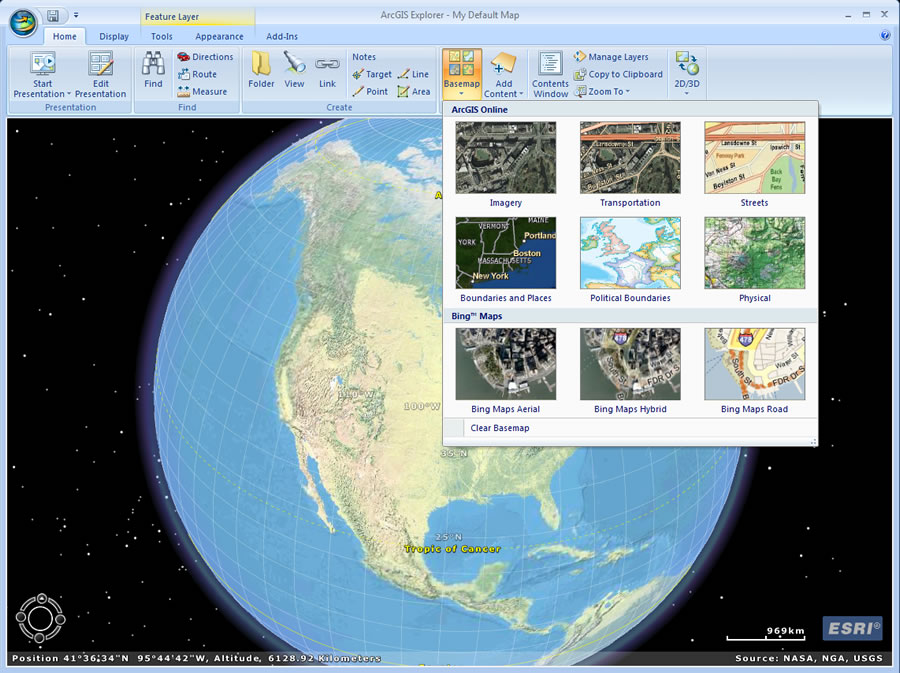 You can swap the startup basemap with several choices, including topographic maps and streets. |
Easier to use than ever before, the new version lets you explore, visualize, and share your GIS data. You also can place other types of information, such as photos, videos, and reports, on your map in a geographic context. New features, like an easy-to-use ribbon and presentations, let you share geographic information with an audience that may not be familiar with GIS.
So what's the best way to get started? First, download ArcGIS Explorer for free from the Esri Web site. It's available in your choice of languages including English, French, German, Japanese, and Spanish—something new for this release. Once you've checked your system requirements, performed the installation, and started ArcGIS Explorer, you'll see a default map of imagery that you can begin exploring.
The first thing you're likely to do is navigate around the globe—perhaps find your house—and start adding information to the map. We've posted a Getting Started video that guides you through all the basics. This video provides a good introduction if you're not already familiar with using the ribbon and navigating around the globe.
If you've used previous versions of the release, you will no doubt notice the new ribbon, which offers a visually appealing, easy, and intuitive way to use ArcGIS Explorer. The ribbon gives you access to many useful features such as the 2D/3D map mode, which lets you switch from a 3D display to a 2D display with one click. As you continue to experiment, you'll also find the ArcGIS Explorer basemap gallery interesting and useful. You can swap the startup basemap with several choices, including topographic maps and streets. You can add more layers to your basemap from the Mapping for Everyone site or the ArcGIS Explorer group on ArcGIS Online. You can also search ArcGIS Online for additional content and add your own data and services by clicking Add Content, then choosing what you want to add from the drop-down list.
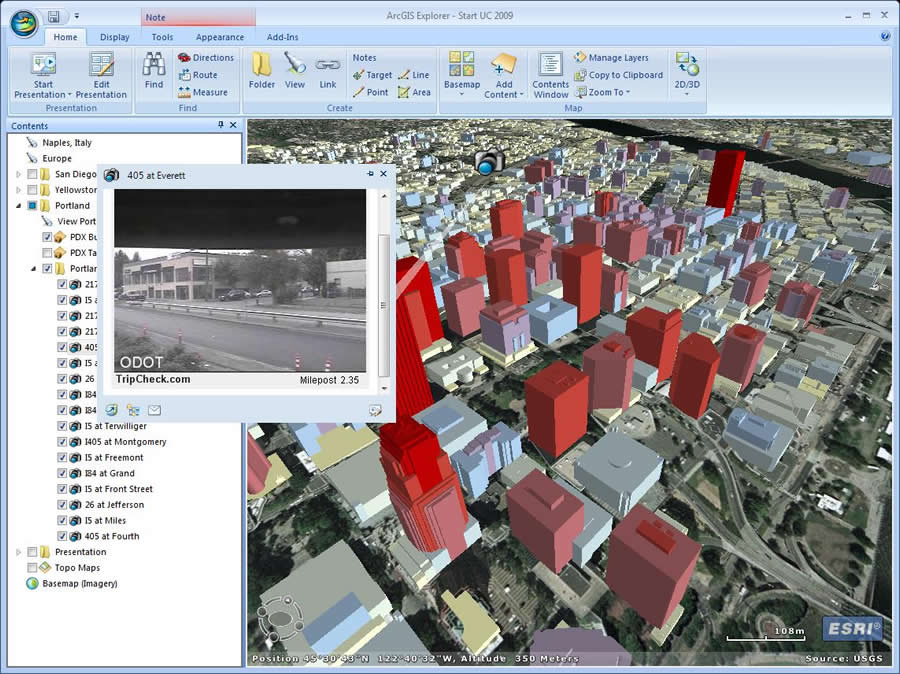 Use notes to add photos, video, and documents on your map. |
Notes are another easy way to place a wide variety of information, such as photos, videos, and documents, on your map. You can learn more about how to create them in the ArcGIS Explorer Notes Help topic.
Eventually, you may want to use some of the sample tools called add-ins, which are free downloads that extend the capabilities of ArcGIS Explorer. These include Weather Forecast, Bing Yellow Pages and Bird's Eye View, and Panoramio. When you get an add-in, it is added to your ribbon so you can easily find it during your next ArcGIS Explorer session. Add-ins are being created all the time, so keep checking back.
More Useful Resources
The built-in ArcGIS Explorer Help is a great resource and includes a Getting Started section covering all the basics such as how the ribbon works, how you navigate, and various options you can set. Help contains a lot of information for beginners and experts alike. Other chapters cover adding and working with data sources, working with layers and notes, organizing your contents, and creating presentations. The ArcGIS Explorer blog features timely and interesting posts that cover tips, tricks, and tutorials for all levels of users. Subscribe to the blog's RSS feed to make sure you get the latest news and information.
Get Started
So why wait? Download ArcGIS Explorer and see for yourself why it's a great way to explore, visualize, share, and present geographic information.