Nine Innovations in ArcGIS 10
 John Calkins |
Each year at the Esri International User Conference John Calkins, Esri technical evangelist, gives a brief overview of his favorite upcoming innovations. Here are Calkins' top nine favorite innovations in ArcGIS 10.
- User Interface: ArcGIS 10 features a new user experience. The upgraded look includes dockable windows that can automatically hide. Also, ArcMap has a new embedded catalog window. These and other underlying framework changes will greatly improve your productivity.
- Attribute Tables: At 10, attribute tables are displayed in a dockable window. You'll see a new toolbar across the top that gives you easier access to the tools you need. Also, you will be able to open multiple tables using the tabbed interface at the bottom.
- Search: A new search capability complements the Add Data dialog box. The new search tool enables you to type in search criteria and, with subsecond response time, locate the data you specify. You will be able to use special keywords like points, lines, polygons, or layer to further refine your search.
- Reporting: ArcGIS 10 includes a new reporting capability. A series of predefined templates makes it easier to make appealing, formatted reports. Once you've created a report, you will be able to save the report and later reexecute it with a different selected set.
- Geoprocessing Tools: The customization capability in ArcGIS 10 is enhanced to give you access to all analysis tools. You'll be able to drag and drop the Buffer tool or a geoprocessing model onto a toolbar. There's also a new geoprocessing option that will enable background processing.
- Table of Contents Views: The table of contents supports multiple views. In addition to listing the layers by drawing order you can now list by source, list by visibility and list by selection.
- Symbol Search: You no longer have to browse through 20,000 different symbols to change symbols. You will simply do a search, which is far more efficient than browsing through the multitude of symbols included with ArcGIS.
- Temporal Mapping: ArcGIS 10 is becoming time aware, making it easier to make temporal maps with ArcGIS. There's a new Time tab on the Layer Properties dialog box as well as a new clock tool that will allow you to set the display's date and time.
- Fast Basemaps: In versions prior to 10, when ArcMap updates the display, it redraws each layer sequentially. A new basemap layer in 10 enables continuous, fast redraw.
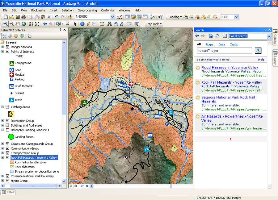 Locate the data needed using the new search tool. | |
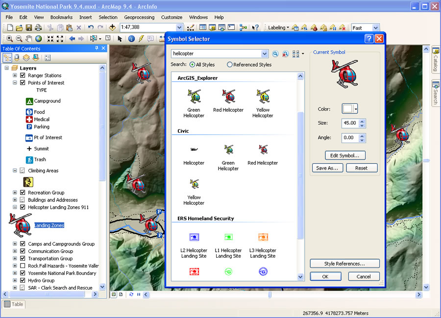 Use the symbol selector in ArcGIS 10 to find the symbol you need. | |
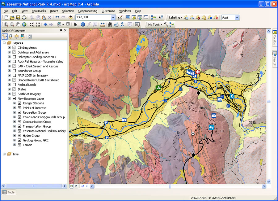 Redraw basemap layers quickly in ArcGIS 10. |
ArcGIS 10 is expected to be available in the second quarter of 2010.