ArcWatch: Your e-Magazine for GIS News, Views, and Insights
October 2011
Esri Offers New ArcGIS Online Resources for Facilities
Two templates called Campus Basemap and Campus Editing were just released on ArcGIS Online. These templates will help facility managers integrate their facilities data into one standard format, apply cartographic rules to the data so it is easy to view and understand, and make the data easily accessible to others in their organizations.
You can also visit ArcGIS for Facilities, a new, online group where you can find maps, applications, and best practices created by Esri to help with your facilities projects.
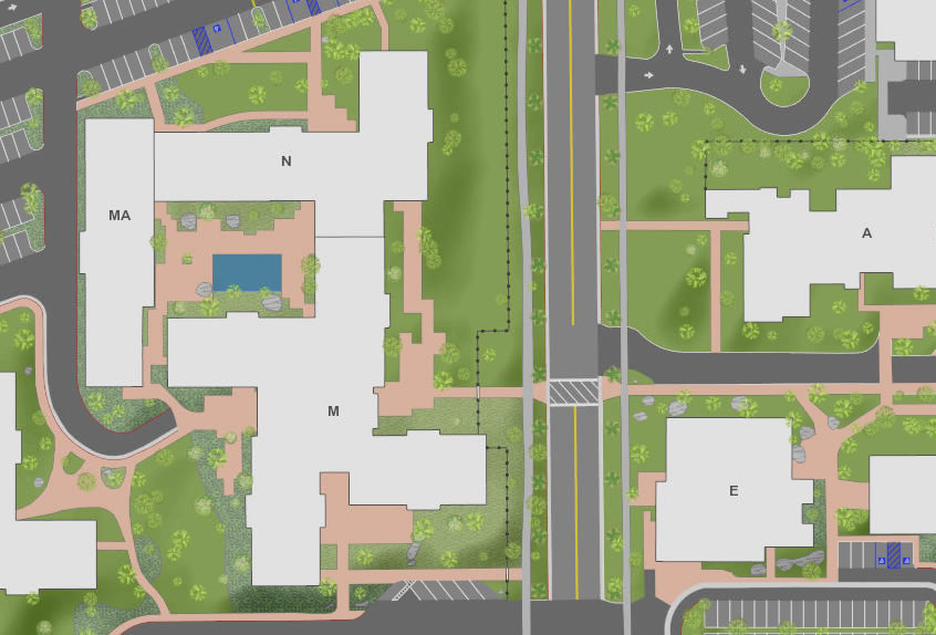
Esri's Campus Basemap template is an ArcGIS Map document that can be used to create a basemap for any type of campus.
ArcGIS Online is a cloud-based system for creating and sharing maps and geographic information. Anyone can use it to create, view, and use intelligent maps as well as upload and style geographic data, create web maps, interact with maps on any device, and embed maps into websites and web-based applications. ArcGIS Online also provides a wealth of information and resources for users who can benefit from additional assistance with their GIS projects.
Campus Basemap Template for ArcGIS 10
The Campus Basemap template is an ArcMap document that can be used to create a detailed, multiscale basemap for a university or business campus. Government agencies can also use the template to produce a detailed basemap for a downtown area, government complex, or military base.
The Campus Basemap template is designed to help organizations publish high-quality basemaps using their own authoritative content. The template provides a consistent geographic context so organizations and agencies can share data and provide applications and services to their users. The template supplies important reference information such as buildings, parking areas, sidewalks, and fences.
Campus Editing Template for ArcGIS 10
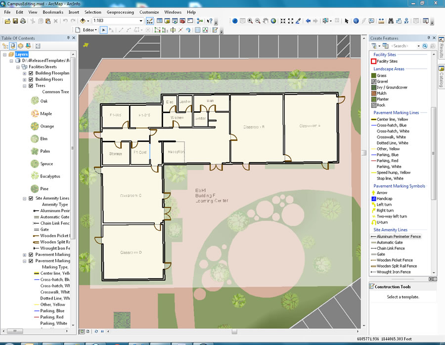
Using the Campus Editing template, a scanned paper floor plan can be used to easily get data into the ArcGIS format.
The Campus Editing template includes an ArcMap document, an add-in for the Editing Toolbar, and a set of editing workflows for managing building, interior space, and related exterior campus data. Mapping technicians at a school campus, government agency, military installation, or private business can use this data editor to streamline the collection, maintenance, and use of asset information.
The editing template includes workflows you can customize to support the format of your own facilities source data. You can also use it to create and import both interior and exterior features. Adding interior and exterior facilities and assets to your campus map can be completed expediently by using imagery as a guide. High-resolution imagery can assist you with inputting exterior facilities and other data, such as roads and parking lots, to the map. Buildings, floors, and interior spaces can be added by using a georeferenced scan of a building floor plan. Also included is an add-in called the Attribute Assistant, which uses a series of predefined methods that automatically populate attributes when you update or add new features to the campus map.
For more information on how GIS is used for facilities management, visit esri.com/fm.