ArcWatch: Your e-Magazine for GIS News, Views, and Insights
October 2011
Mapping Invasive Trees in Hilo, Hawaii, Using GIS

The Invasive Tree Map conveys the distribution and hazards associated with Molucca Albizia trees in Hilo, Hawaii.
In some parts of the world, Molucca Albizia trees provide nurturing shade for coffee plants. But on the Island of Hawaii, this invasive species that originated in Southeast Asia can cause serious damage to property and even threaten people's lives.
To help discover the scope of the problem, geographic information system (GIS) technology was used to map the spread of the Molucca Albizia trees in South Hilo, Hawaii. The mapping project gave residents and a task force working on the issue a better understanding of where the trees grow and just how deeply rooted the problem has become.
Molucca Albizia (or Falcataria moluccana in scientific circles) can grow up to 15 feet per year and are prolific seeders, allowing them to spread rapidly and shade out native trees in the island's wet lowland forests. The tree also has very soft wood that is prone to breaking during heavy winds, causing trees and large branches to come crashing down. Islanders are concerned about the spread of this tree in urban areas on the eastern side of the island, where falling trees have struck homes, blocked roads, and downed power lines.
Danger Posed
The night of August 9, 2011, Dr. Beth Polidoro awoke to sparks shooting from a power strip plugged into an outlet beside the bed in which she and her husband, Dr. Jan Schipper, and newborn son were sleeping. The room lights began to flicker, and the power strip burst into flames, spewing little pieces of smoldering plastic through the room and emitting a thick black smoke. A frantic minute ensued as Schipper fought to control the flames, narrowly quelling the fire before it could spread. The family awoke the next morning to find the utility company working down the street, clearing Molucca Albizia that had fallen onto power lines and sent a surge of electricity into their home the night before.
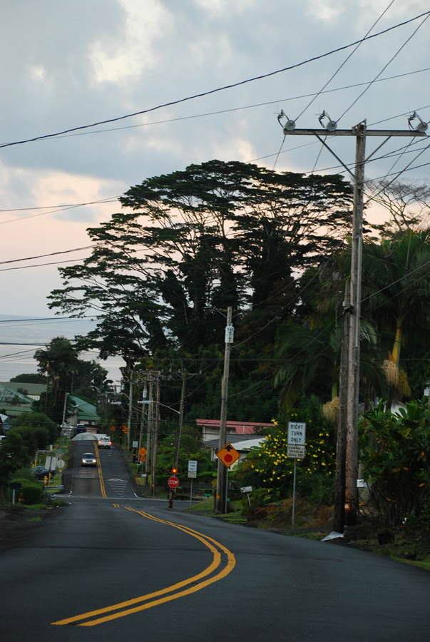
Molucca Albizia trees growing near power lines pose a danger.
The fire occurred a few months after the Piihonua Meadows Community Association (PMCA) worried about the spread of Molucca Albizia within its Hilo neighborhood, contacted Senator Dwight Takamine from the Hawaii state legislature about the spread of the trees. Senator Takamine helped convene a community task force with representatives from the PMCA, the University of Hawaii (UH), county planning departments, state resource management agencies, and the United States Forest Service (USFS). As part of the task force, the Big Island Invasive Species Committee (BIISC)—a project of the UH Pacific Cooperative Studies Unit that Schipper manages—was asked to create a map showing the distribution of Molucca Albizia within the neighborhood.
Mapping Molucca Albizia
Neighborhood resident and BIISC volunteer Logan Berner offered to conduct the mapping project using GIS to determine the extent of the problem in both the neighborhood and a portion of the surrounding South Hilo District. In doing so, Berner hoped it would be possible to convey to the community and task force that the spread of the invasive Molucca Albizia, in addition to being a neighborhood-level problem, is a regional problem affecting urban areas and lowland forests.
By mapping the trees and analyzing their locations, Berner wanted to
- Identify for the task force which trees within the Piihonua community posed the greatest threat to the hospital, residential homes, power lines, storm runoff channels, and emergency evacuation corridors.
- Determine the distribution of Molucca Albizia in the region surrounding the Piihonua community so as to better understand where the trees tend to become established.
- Raise public and official awareness about the growing threat posed by the spread of Molucca Albizia on the east side of the island.

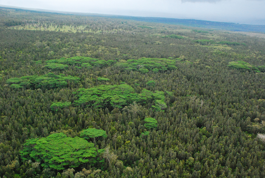
The invasive trees have become prolific in the Puna district on the island of Hawaii.
The BIISC helped Berner plan the mapping project and provided access to computer software, satellite imagery, and field equipment. Berner began the project by using high-resolution QuickBird satellite imagery and Esri's ArcGIS software to map a survey route through the neighborhood and surrounding area of interest. During the roadside survey, he geolocated each patch of Molucca Albizia using a handheld GPS and then roughly delineated the patch extent on custom satellite maps. For each patch, he estimated the maturity and number of trees, as well as the threat—low, medium, or high—that they posed to neighboring power lines, roads, and buildings.
After completing the roadside survey, Berner used ArcGIS to overlay the geolocated patches of Molucca Albizia on top of the satellite imagery and digitize polygons around each patch. The patches were color coded—yellow, orange, or red—based on the threat they posed to the community.
In addition to identifying trees along the road corridor in the Piihonua community, Berner used the QuickBird imagery to map Molucca Albizia across a broader portion of the South Hilo District. He used the Georeferenced Information Processing System (SPRING), a free remote-sensing software package developed by Brazil's National Institute for Space Research, to implement an object-oriented, unsupervised classification algorithm. In essence, the algorithm partitioned the satellite image into clusters of pixels that represented different types of land use or land cover. Using ArcGIS, he then compared each cluster of pixels to the original satellite image and to the field survey maps to determine whether or not that cluster represented Molucca Albizia.
After developing a map showing the regional distribution of Molucca Albizia, he used the software to identify areas where the trees grew within 100 feet (~30 m) of a road or stream. Trees within the 100-foot buffer zone were of particular concern, as they could fall during a windstorm and block roads or clog streams and cause flooding. Berner overlaid the results from the roadside survey, the distribution model, and the hazard analysis on the QuickBird satellite imagery. To place the neighborhood and regional distribution of this invasive tree into the broader context of invasive species on Hawaii, he added a small inset map showing the islandwide distribution of native and alien forest and shrub ecosystems, previously mapped by the Hawaii Gap Analysis Program.
Molucca Albizia trees also grow in Wao Kele o Puna, also known as the Puna Forest Reserve, south of Hilo.
Berner presented the map to the PMCA, and the task force recommended which of the 43 Molucca Albizia patches along the road corridor required attention. The map showed that 8.9 percent of the study area was occupied by the trees, which came as a surprise to some in the community and on the task force.
The map served as an important tool in subsequent discussions about potential control efforts and assisted in building consensus among community stakeholders that the spread of molucca albizia posed a significant threat that required action and further study. This helped empower the PMCA by further legitimizing the concerns it had expressed to Senator Takamine, and, more broadly, helped bring the issue of invasive species management to the attention of those on the task force.
The utility company has offered to cut down some of the trees close to power lines, and the USFS, UH, and Department of Hawaiian Homelands have partnered to remove a large patch of Molucca Albizia that was of particular concern to the community. In addition to removing trees, the USFS and UH will experiment with restoring native forest to the area. Developing the tools and techniques to control this invasive species is an important step in the right direction, though considerable work remains to be done. The species is widely established, and eradication would be nearly impossible. However, it is clear that Molucca Albizia must be managed so as to control the threat and long-term expense that these trees pose to communities and native ecosystems.
Data sources for the project: GeoEye QuickBird satellite images; County of Hawaii Planning Department roads; United States Geological Survey streams, coastline, and digital elevation model; Hawaii Gap Analysis Program shrubs and trees.