ArcWatch: GIS News, Views, and Insights
October 2012
Discover the Ocean Floor Using ArcGIS Online's Ocean Basemap
The Ocean Basemap is a global GIS map that shows the oceans' seafloor along with surface and subsurface feature names. Think of it as a map of the ocean's basement!
Esri developed this map service and hosts it in ArcGIS Online. If you are interested in bathymetry, marine science and resource conservation, and oceanic mapping, you can use it as a cartographic reference map of the ocean or as a basemap for building your own maps.
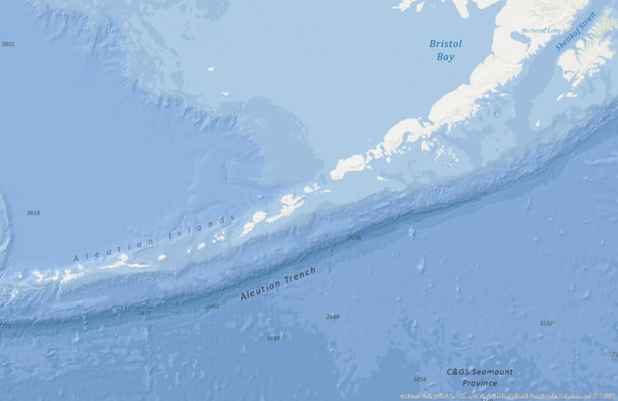
This map, showing the Aleutian Trench in the Bering Sea, was built using data provided by Esri; GEBCO; NOAA; Canadian Hydrographic Service (CHS) California State University, Monterey Bay (CSUMB); National Geographic; DeLorme; and NAVTEQ.
The Ocean Basemap contains more information about the ocean than any existing terrestrial basemap service. It includes bathymetric portrayal, marine water body names, undersea feature names, and derived depth values in meters. While you can't query the information in the Ocean Basemap, it is a superior cached cartographic representation of the seabed.
You will find higher-resolution bathymetric and altitude data from coastal areas that are the most surveyed parts of the ocean. Data tends to be plentiful along the shore and becomes sparser as one moves away from the coastline toward deeper seas.
The Ocean Basemap currently provides coverage for the world with a resolution down to a scale of around 1:577,000. Additional data coverage for United States waters improves the resolution to 1:72,000. High-resolution coverage in limited areas of US waters is available at 1:9,000. Through Esri's Community Maps Program, the Ocean Basemap can and will be extended with higher-resolution bathymetric data for more areas.
The Map's Information Sources
The Ocean Basemap blends publicly available, authoritative ocean data sources into one cartographically uniform basemap. Global coverage for the Ocean Basemap was created with data from the General Bathymetric Chart of the Oceans (GEBCO), the National Oceanic and Atmospheric Administration (NOAA), National Geographic, DeLorme, and NAVTEQ.
Agencies, commercial businesses, academic institutions, and nongovernmental organizations can contribute authoritative data to the Ocean Basemap through Esri's Community Maps Program. Esri ensures data contributions are of high quality, and the datasets have permissions in place for public use. Esri's cartographers integrate newly contributed data with the map and publish it to ArcGIS Online as a map service. Read the full list of contributors.
How to Use the Ocean Basemap
The Ocean Basemap, created with uniform cartography, has a muted color palette that makes it ideal for overlaying custom content or content from ArcGIS Online. Maritime professionals, such as ocean scientists, port managers, and ocean use planners, now have a consolidated, uniform cartographic source to bring their research into the map. You can access the basemap through ArcGIS for Desktop or any of the ArcGIS applications for smartphones and tablets (iOS, Android, and Windows Mobile). That means that you have access to the same basemap anywhere, at your desk or on the go.
To make maps using the Ocean Basemap, visit ArcGIS Online and click Map at the top of the page. A map will appear that says My Map. Choose Oceans from the basemap gallery. Click Add to search for layers online such as coral reefs. To add a map service data into an ArcGIS 10.1 for Desktop map, in ArcMap choose File > Add Data > Add Basemap (in version 9.3, choose File > Add Data From ArcGIS Online) and select Ocean Basemap. You can participate in Esri's Ocean GIS community and find helpful hints on the ArcGIS Resouces page for Oceans.