Use New Batch Mode with Geoprocessing Tools
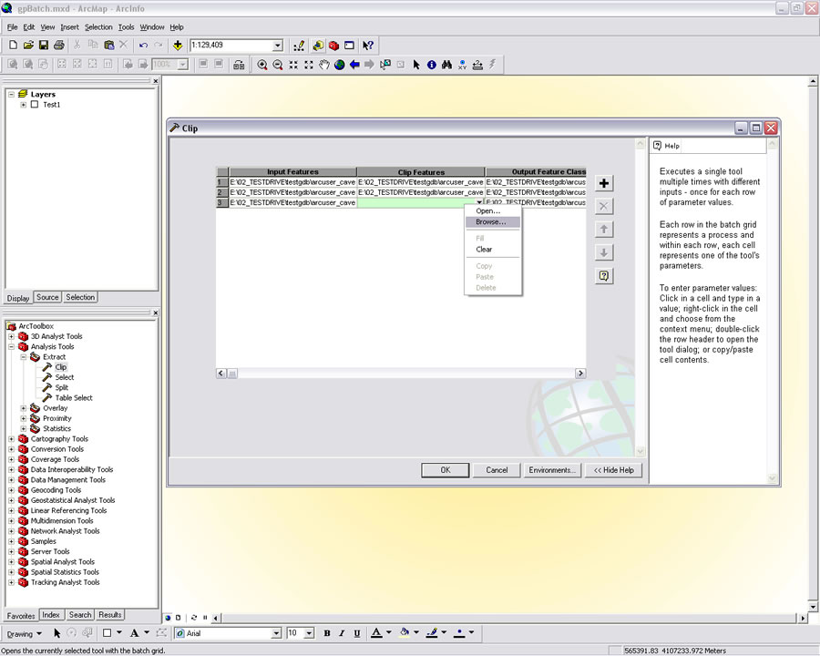 Fill all the fields in the grid to add the parameters for the geoprocessing tool. In this case, the Clip tool will be used to clip, crop, stream, and slope layers to the extent of the watershed. | |
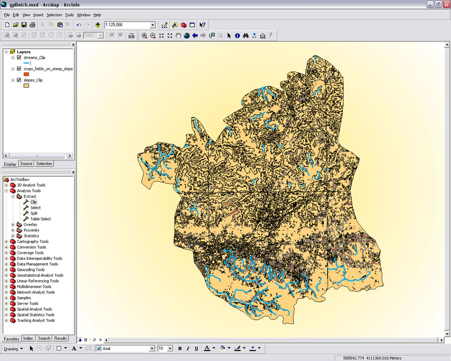 If the batch mode is used while running ArcMap, the new layers generated by the geoprocessing operation will be added to the map document. |
When performing geoprocessing operations, the same tool must often be applied to several datasets. ArcGIS supplies several methods for accomplishing repetitive geoprocessing tasks without tediously invoking and configuring the same tool over and over.
In "More Ways to Increase Productivity—Take advantage of iteration in ModelBuilder," in the July–September issue of ArcUser magazine, readers learned how to accomplish this by using the new iteration functionality in ModelBuilder.
Using the new batch mode is another method for increasing productivity when performing geoprocessing tasks. With ArcGIS 9.2, any geoprocessing tool in ArcToolbox can be run in batch mode simply by right-clicking the tool and choosing Batch from the context menu. This can be done from ArcToolbox in either ArcMap or ArcCatalog.
The parameters for that tool are exposed as lines on a grid. Each line represents a process (the application of a tool on a dataset to generate new data). The default size for the grid may not display all grid cells, so be sure to scroll to the right and fill all the required parameters. When using this feature in ArcMap, the input layers do not have to be in the map document. Fill the cells of each line of the grid for each input layer.
Several methods are available for quickly filling these grid lines. Input can be added to the grid by dragging datasets (in ArcCatalog) or layers (in ArcMap). Right-clicking a cell in the grid invokes a context menu. Choose Open to use the regular dialog box for the tool or Browse to go directly to the desired dataset. Click the drop-down for a cell to display datasets that have already been used. Click the Plus (+) button to add another line (and input) to the grid.
Before running the tool, click the Environments button and choose General Settings to set the Current and Scratch Workspace. Click OK to run the tool. The new layers generated by the geoprocessing operation will be saved in the Current Workspace and, if using ArcMap, will be added to the map.