Utilities Shine with GIS
 Crisis after crisis strikes the fictional utility: A fire starts in a manhole outside a power substation, the employees work with a data management system that's in disarray, and the company falls behind in fulfilling requests for new service.
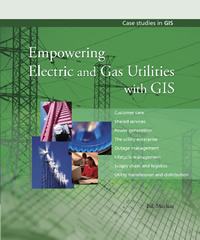
In Empowering Electric and Gas Utilities with GIS, just published by Esri Press, author Bill Meehan shows how an enterprise geographic information system (GIS) could help solve those problems.
He walks readers through scenario after scenario at a fictional utility he calls AnyTown Energy, explaining how a GIS can
- Provide better customer service.
- Enhance decision making and lower operating costs.
- Locate/Prevent outages.
- Restore power and gas.
- Manage assets such as wires, poles, and transformers, and minimize risks such as power outages and gas leaks.
- Conduct planning, design work, and engineering for the utility.
- Find the best sites for new plants including solar power systems and wind farms.
- Improve logistics such as keeping track of work orders and crews.
Meehan says utilities typically turn to GIS to map a network such as the company's electric lines or gas pipelines. But the technology's applications go far beyond that to include processing work orders in a timely fashion and quickly spotting trouble such as the location of downed power lines or gas leaks. "GIS is about discovery. It's about visualizing trends for better decision making. It's about finding weaknesses in your infrastructure before disaster hits," he says in the book's preface.
Utah governor Jon M. Huntsman, Jr., writes in the book's foreword that technologies such as GIS will be critical to how his state and the nation will assess how best to meet citizens' energy needs. "GIS reveals trends. It shows us patterns, like our energy use or our ability to capture energy in creative and efficient ways. GIS helps us formulate answers to tough questions, like where to site a wind farm or sequester emissions."
"Utilities are awakening to the dramatic impact a GIS can have on their overall operations," Meehan said in an interview with ArcWatch. Besides using the AnyTown Energy scenarios, he provides three dozen examples of multifarious ways that utilities ranging from locations in Burbank, California, to Beirut, Lebanon, use geospatial technology.
"GIS is more than simply producing the standard operating maps utilities have been so used to dealing with," says Meehan, director of worldwide utility industry solutions for Esri. "GIS is a critical element, either directly or indirectly, in nearly every electric and gas utility workflow."
Meehan said he wrote the book to help utilities improve their operations in both routine and dramatic ways. He drew upon his experience as vice president of electric operations at NSTAR, Massachusetts' largest investor-owned electric and gas utility, where he says he was the "champion, visionary, and manager" of the company's comprehensive GIS.
Empowering Electric and Gas Utilities with GIS (ISBN 9781589480254, 280 pages, $34.95) is available at online retailers worldwide, at www.esri.com/esripress, or by calling 1-800-447-9778. Outside the United States, contact your local Esri distributor. Visit www.esri.com/distributors for a current distributor list.