New ArcGIS API for Flex Makes Creating Web Mapping Applications Faster and Easier
By Keith Mann and Matthew DeMeritt, Esri Writers
Web geographic information system (GIS) technology takes a leap forward with the ArcGIS API for Flex, new from Esri.
Using the Flex API, available free from the ArcGIS API for Flex Resource Center, developers can combine GIS-based Web services from ArcGIS Server with other Web content, which can be displayed in simple, dynamic mapping applications over the Web or on the desktop. The API exploits the powerful geospatial capabilities of ArcGIS services. Users can transform their local data into a visually rich interactive map, query and display GIS data features and attributes, locate addresses, identify features, and perform complex spatial analytics.
Integrated with Adobe Flex Builder 3, Flex is a client-side technology that is rendered by Flash Player 9 or Adobe AIR. Developers can even program with ArcGIS API for Flex remotely, as long as they have access to ArcGIS Server via a URL. Since the API is built on the Adobe Flex framework, developers can put all Flex components, such as list boxes, data grids, landscapes, and text controls, into custom applications.
"The ArcGIS API for Flex is a powerful framework for building rich Internet applications on top of ArcGIS Server that look good, run fast, and are fun to use," said Antony Jayaprakash, a product engineer at Esri. "ArcGIS API for Flex enables combining the best of desktop and the best of Web technologies."
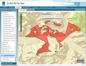
Developers can download the API library at the ArcGIS API for Flex Resource Center, which makes available source code samples that display tiled maps, turn layers off and on, and switch between different kinds of maps and imagery. The samples demonstrate how to incorporate symbology, create a map layer, geocode, analyze data, add drawing tools, and much more.
The resource center contains specific documentation about using the API and also includes a code gallery with sample applications, so developers can share their work.
The City of Boston, Massachusetts, was an early adopter of ArcGIS API for Flex and ArcGIS Server. The city recently deployed the Solar Boston application, a public-facing Web mapping application designed to showcase active renewable energy installations. The application, with a fast and visually dynamic user interface, allows users to calculate the solar power that can potentially be obtained via rooftops.
"We chose ArcGIS API for Flex because it allowed us to leverage the power of ArcGIS Server while delivering a rich, interactive experience to our users," explains Greg Knight, senior GIS applications developer, Boston Redevelopment Authority. "Development was both fast and enjoyable, and we are pleased with the functionality and performance of the application."
To learn more about the ArcGIS API for Flex and ArcGIS Server, visit www.esri.com/flex or call 1-800-447-9778.
