ArcWatch: GIS News, Views, and Insights
November 2010
Where will My Children Attend School This Year?
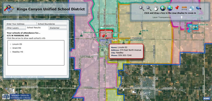
Type an address into the SchoolSite Locator and the proper school matches will appear.
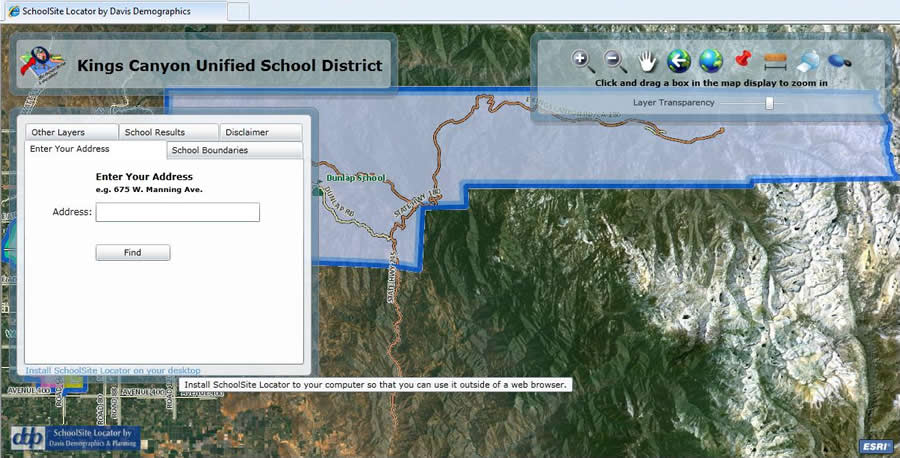
Every summer for years, hundreds of parents new to the area had to call the Kings Canyon Unified School District in Reedley, California, to find out which school their children should attend. In a district as large as Kings Canyon, that was no easy job. Nearly 10,000 students attend 19 schools in both Fresno and Tulare Counties, which together encompass 599 square miles in California's Central Valley. It's a vast area of rich farmland, national forests, and many small towns. So when parents called, the district's transportation staff members spent a lot of time flipping through school boundary maps trying to find accurate street data to match up the children's addresses to their assigned schools. It was time consuming for both parents and staff.
But today, parents can find their children's assigned schools within seconds using geographic information system (GIS) technology. All they do is type their address into the King's Canyon Unified School District's online school locator. The names, street addresses, and telephone numbers of the elementary, middle, and high schools where they should send their children will pop up. Approximately 67 percent of the population in the district is Hispanic, so a Spanish-language version of the application is available.
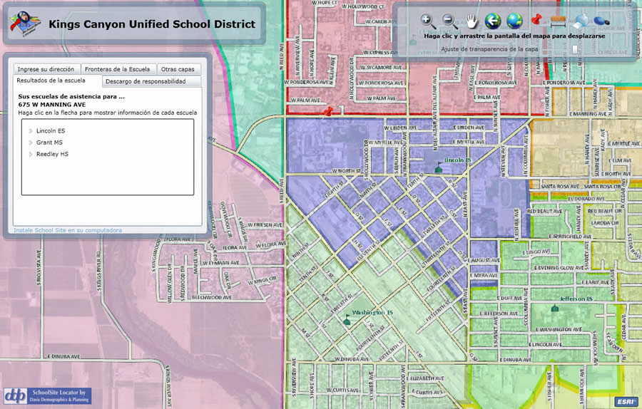
A Spanish-language version of SchoolSite Locator was created for the Kings Canyon Unified School District.
Developed by Davis Demographics & Planning, SchoolSite Locator is an Internet mapping application built on Esri's ArcGIS Server.
The district decided to address the issue of providing school assignment information in a more efficient manner as part of a redesign of kcusd.com in the summer of 2009. Officials wanted to add interactive elements to the site as a way to better communicate with parents and the community. In-house, it was already using ArcGIS for some basic mapmaking, but for the school assignment application, the district was interested in using a Web-based GIS solution.
After careful research, the school district contacted Davis Demographics & Planning (DDP), an Esri business partner for more than 20 years. Using up-to-date street data from Tulare County and only address points from Fresno County, DDP was able to seamlessly merge the two datasets into a composite address locator and provide the district with a simple yet powerful address lookup tool. DDP acquired the street and address datasets from the counties, cleaned up the district's attendance boundaries, and moved the data to its own servers, thereby providing a Web service to the district. The application was up and running in less than two weeks.
SchoolSite Locator offers access to a variety of map layers.
The data was also sent to the district for internal use. With only ArcGIS Desktop in place at the district for simple mapmaking tasks, officials there had no easy way to disseminate useful information to staff and community members prior to DDP's involvement.
DDP hosts the district's map data, including the addresses, attendance boundaries, and school locations, and provides a unique Web address, or URL, directing users from the district's home page to the SchoolSite Locator Web application.
The SchoolSite Locator application has greatly reduced the number of phone calls from parents, and those still received are now handled quickly and easily, since the application can be installed directly on the user's computer desktop. Transportation employees, who are assigned to handle the school assignment calls, can just double-click on a desktop icon, connecting to the service outside the browser interface.
Some of the additional features of the SchoolSite Locator that have proven popular include the ability to
- Print attendance boundary maps.
- Link directly to each school's Web page.
- Measure walking distances (from a home to a school, for example).
- Find information such as a school's address and phone number by clicking on the mapped school.
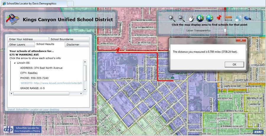
Distances can be measured, too.
The SchoolSite Locator also can display customized map layers such as school board trustee areas and bus stops. SchoolSite Locator also offers access to a variety of map layers such as aerial basemaps, available through Esri's ArcGIS Online.
"SchoolSite Locator is a welcome solution," said John Clements, the district's director of transportation. "Our district street data has finally been cleaned up and organized. The data is finally useful, which is all we ever wanted. SchoolSite Locator has proven to be a great asset to our transportation staff and a wonderful addition to our district Web site."
For more information about Davis Demographics & Planning's SchoolSite Locator, visit schoolsitelocator.com or contact Ken Ward at 888-337-4471, extension 215.