Water Utility's Network GIS Greatly Improves Repair Times
By Susan Harp, Esri Writer
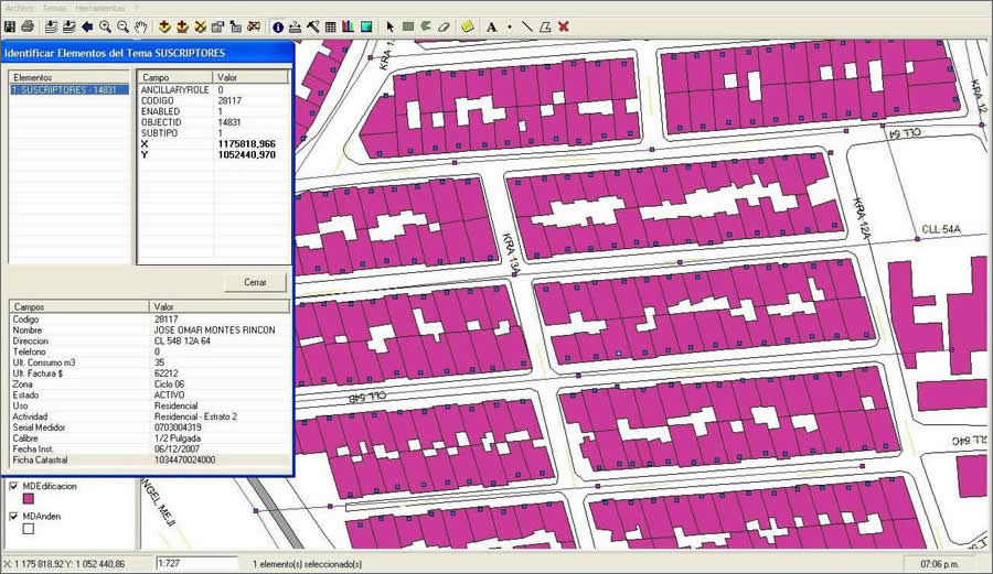 A neighborhood map combines water utility infrastructure and customer information in a single display. |
Just a few years ago, repairing a water pipe in the city of Manizales, Colombia, was a time-consuming process that could take up to 12 hours.
Why? Utility crews, working with outdated paper maps of the network often needed extra time to track down an engineer familiar with the system in that area to obtain the unique historical knowledge that would assist in the repair.
Those days are gone. Aguas de Manizales, S.A., a water utility in Colombia, adopted a geographic information system (GIS) solution that provides an overall map of the utility network and assets; network analysis tools; and flexibility to add more capabilities, such as online Web access. The solution consists of a geodatabase—geographically referenced information that can be combined in layers such as physical networks, topography, and street maps—and software that allow multiple employees to use and analyze the information. Results have been positive; improved knowledge and better efficiency helped reduce the number of breaks and repair times by more than half.
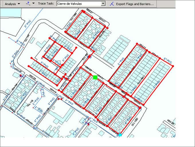 The network trace feature produces a view of water service that would be affected by valve closures during repair work. |
Aguas de Manizales manages the collection, treatment, and distribution of potable water and wastewater for the city of 366,000 people in central Colombia as well as several other rural areas.
The utility recognized that using out-of-date network plans and relying on personal memory for storing infrastructure information was slowing down response time to outages as well as hindering the company's planning and decision-making processes. Aguas de Manizales decided to modernize its asset inventory and management system in a way that would improve work efficiencies and reduce the impact of outages. Before changing to the GIS solution, paper plans of the network did not include new improvements or changes to the plans. That information was stored in the memories of several engineers and supervisors, which created isolated islands of knowledge. So when system problems occurred, the person with the appropriate knowledge had to be found and brought to the site to assess the damage, which could take up to half a day. And because plans lacked detailed valve schematics, major values controlling a large area would have to be closed, leaving a greater number of customers than necessary without service during system repairs. In addition, the process of emptying and refilling pipes created the risk of further pipe damage from pressure changes.
Planned Approach to Enterprise GIS
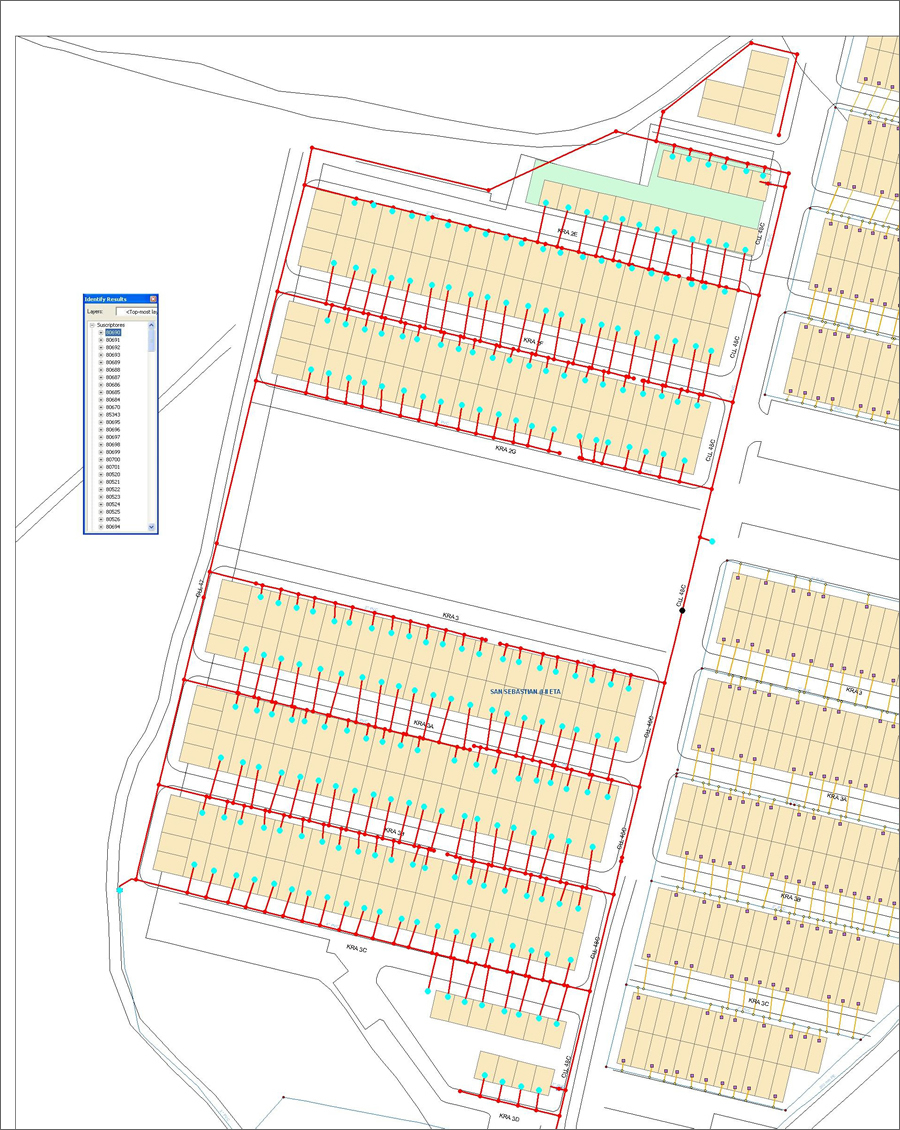
Creation of the GIS database required making a new digital map of the entire system. To save on this expense, the as-built plans were used as a foundation and updated with information obtained by interviewing knowledgeable personnel. Locations of above-ground infrastructure, such as treatment plants, tanks, valves, and hydrants, were recorded using Global Positioning System (GPS) equipment at each site. A new policy, designed to reconfirm network information and ensure all changes are added to the GIS, requires that any fieldwork involving network changes must be reported to the utility's GIS group. The enterprise GIS was created using Esri software, including ArcGIS Server, ArcGIS Desktop, and the 3D Analyst and Spatial Analyst extensions, and Microsoft SQL Server. With the help of Proc�lculo Prosis S.A., the authorized Esri distributor in Colombia, custom applications were developed to integrate with the company's customer resource management system.
 A detailed map of the Aguas de Manizales water utility infrastructure gives multiple departments access to up-to-date information, including meter connections. |
Now, when a system break occurs, network personnel still make an on-site inspection, but they report back to a GIS analyst at the company's call center. Because all valves now have a unique GIS identifier, the analyst can use a valve isolation trace tool to specify how many and identify which valves to close in order to minimize interruption of service to customers. The analyst also uses GIS to look up part specifications for needed repair materials.
By using GIS, the utility has reduced outage response time from 12 hours (for a three-inch pipe break at 1.8 breaks per network kilometer) to 4.5 hours (at 0.7 breaks per kilometer). Improvement in service has also been reflected in customer satisfaction surveys.
"An unexpected benefit has been the creation of a GIS culture in which diverse users, from the technical deputy director to field personnel, can access the information and seek new and creative geographic solutions for their work challenges," said Ricardo Sanabria Mart�nez, GIS leader, Aguas de Manizales.
Innovative ideas include using GIS to provide watershed information needed for environmental program planning. Another application links inspection video recordings to the GIS, which makes the recordings easier to find and use.
To learn more about this project, contact Ricardo Sanabria Mart�nez at rsanabria@aguasmanizales.com.co or Carlos Cardona at ccardona@prosis.com.