ArcWatch: GIS News, Views, and Insights
December 2010
Are There Toxic Chemicals in Your Community?
Download Esri's New My Place History App and Find Out

Bill Davenhall helped spearhead the creation of the My Place History application.
My Place History is a free iOS application that links public health information to places you have lived so you can view any risks you may have been exposed to during your life. We developed the application at Esri based on the positive reception to a presentation I made at TEDMED 2009. There I spoke about the heart attack I suffered in 2001 and how a person's environment can sometimes play a role in personal health, whether through living near toxins from chemical plants or in a region often shrouded in smog.
My Place History was designed for Apple's iPhone and iPad. It's a unique application that lets you enter the street addresses of all the places you have lived or worked within the United States. After entering your addresses, you can create a report listing exactly what toxic chemicals are in close proximity to your past places. Learn more. A Web version of the My Place History application is also available.
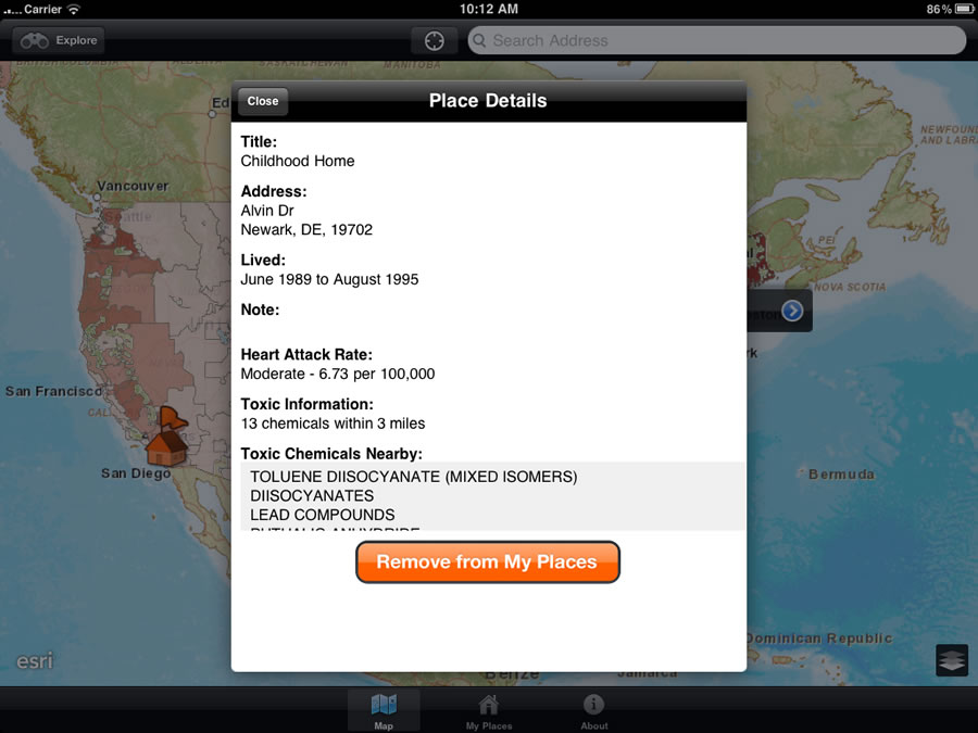
You also can learn details about the toxic chemicals found near your childhood home.
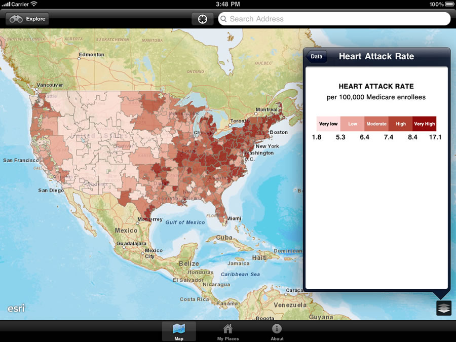
Using the My Place History application, you can see where heart attack rates among Medicare enrollees is high.
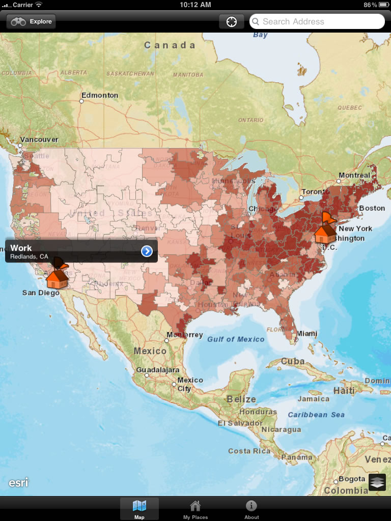
You can check the heart attack rates near your workplace.
Toxic chemicals are determined by the United States Environmental Protection Agency (EPA). Currently, more than 581 unique chemicals are monitored annually (another 16 carcinogenic chemicals are soon to be added to the list if current regulations succeed). While the EPA and the National Library of Medicine (NLM) have sites that provide citizens with access to this data, along with explanations, neither allow building, exploring, saving, or sharing (exporting as a .pdf) a lifetime place history.
I believe that having a geographically accurate place history, maintained and controlled by consumers, can help inform us and our health care providers about the potential environmental health burdens we all accumulate over a lifetime. As new local health data is published at increasingly smaller levels of geography, consumers can come to expect their My Place History to reveal a wide range of useful information suitable for sharing with their families and doctors. In the initial My Place History release, we provide users with the locations of the EPA's Toxic Release Inventory against a background showing the death rates for heart attacks in people enrolled in Medicare. Please take the time to read the About section of the My Place History application to learn more about the data's limitations.
If you create your own My Place History, I would be interested to find out what you discover. I would also like to hear your suggestions for data that would be helpful to add to the application. Examples include cancer cases, locations of primary care providers, household lifestyles, or children who have not been immunized. E-mail me at bdavenhall@esri.com.
The U.S. Department of Health and Human Services (DHHS) Community Health Data Initiative has promised greater data sharing in hopes that citizens will use the data to make better decisions about their health and get more involved in their communities' health issues. DHHS has also encouraged software developers to build applications that leverage this data, so in the spirit of innovation, I introduce My Place History to you.
Follow Bill Davenhall on Twitter.