ArcWatch: Your e-Magazine for GIS News, Views, and Insights
December 2011
Afghans Work to Preserve Habitat
Esri Technology Plays a Role in the Conservation Quest
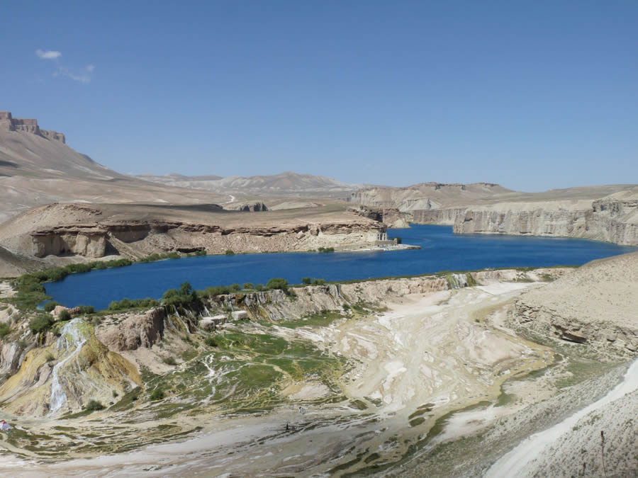
Tourists swim and use paddleboats in the lakes at Band-e-Amir, which became Afghanistan's first protected national park on Earth Day in 2009.
Maps created using GIS technology are being used to identify wildlife habitats to protect and other sensitive areas to conserve in Afghanistan, including places such as Band-e-Amir, the country's first national park.
Band-e-Amir is a chain of six deep lakes, situated in a desert area high in the Hindu Kush mountains. They are separated by mineral deposits of white travertine limestone and lie like a jeweled necklace on a woven rug.
With the changing light and moving mountain shadows, these lakes range in color from faint turquoise to intense shades of blue, and their placid glass surfaces mirror the surrounding peaks. Ibex (wild goats) and urial (wild sheep) can be seen roaming along the red cliffs. Afghan snow finches also make the area their home.
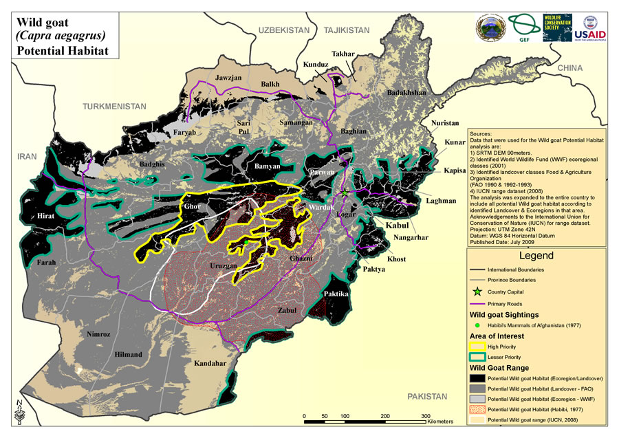
Habitat maps, such as this one that shows wild goat sightings and habitat areas, are used by the Wildlife Conservation Society to prioritize the entire surface of Afghanistan and designate areas that should be protected.
Afghanistan's government declared Band-e-Amir, one of the most spectacular travertine systems in the world, a national park on Earth Day in 2009. The Wildlife Conservation Society (WCS), funded by the United States Agency for International Development (USAID), played a strategic role in working with Afghanistan's citizens and agencies to open the park, which draws Afghan tourists who swim in the lakes and rent paddleboats. WCS uses Esri's ArcGIS to develop sustainable resource management plans for the park and other areas throughout the country.
For example, ArcGIS was used to create maps of habitats for ibex, wild cats, and snow leopards. The technology also was used to create a map of biologically significant wetlands and important bird habitats, including proposed protected areas. One of the important bird areas that was identified and mapped was Band-e-Amir.
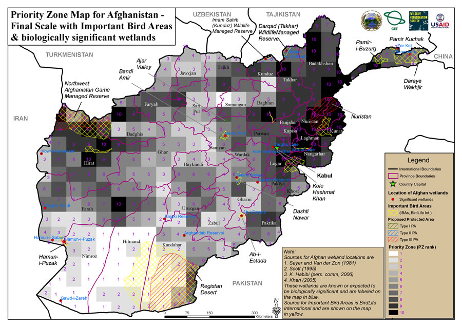
This map shows the location of important bird areas and biologically significant wetlands in Afghanistan.
A Hard Sell
In 2011, the country continued expanding its environmental protection policies, which is extraordinary because conservation has not been part of Afghan cultural thinking. This foreign concept has been a hard sell, especially when 80 percent of the population's livelihood is tied to natural resources, such as rangeland, which is used for pasture, and shrubs and timber, which are used for fuel. War has made matters worse by displacing millions of people who have been forced to find shelter, fuel, and food while on the move. Forests have been cut down to obtain wood for fuel, grasslands have been degraded, and soils have blown away. In a country fraught with so many problems, the establishment of a national park is phenomenal.
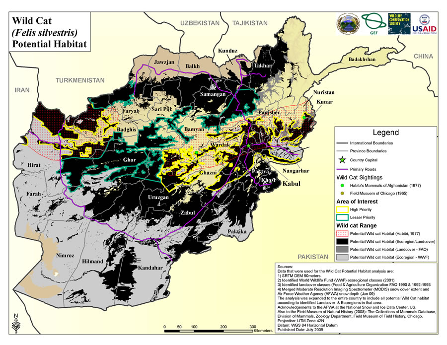
This map shows the potential habitats for wild cats.
Building a GIS
WCS consults with Afghanistan's National Environmental Protection Agency (NEPA), central and local governments, and communities to brainstorm about issues, develop concepts, and build the country's capacity to protect and restore the environment.
In 2006, WCS worked with a team of local citizens to gather terrain, habitat, and species data for a database; process that data in GIS; and create maps to help them better understand and address the country's environmental needs.
Muhammad Ayub Alavi, a geologist born in Bamyan Province who works as a WCS conservation specialist in Band-e-Amir, explained how GIS supports conservation plans for his country. "We are using ArcGIS for Desktop to analyze habitat, ecoregions, and wildlife populations. The government sanctioned us to create the first protected area system plan for the country. GIS shows information that lays the general foundation for our work for the next 25 years, which is outlined in our system plan. We have used it to prioritize the entire country's surface and designate areas that should be protected."
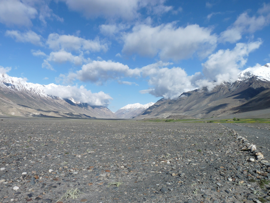
Ranked as the top conservation priority, the Wakhan Corridor is part of the Silk Road network between Afghanistan and China.
To do this, the GIS team developed and ran different types of models to show where goats and large cats live and migrate and the land that Afghanis use for farming and grazing their animals. This helped policy makers and scientists better understand the needs of both humans and the wildlife.
Conservation projects are limited by resources, ownership, and government goals, so WCS needed to focus its efforts, taking on one project at a time. Therefore WCS and scientists assigned values to criteria that helped them decide where to concentrate their efforts. The most important criterion was the variety of species an area could support. Each ecoregion has a distinctive composition and pattern of species distribution because of the area's soil, water, climate, and landforms.
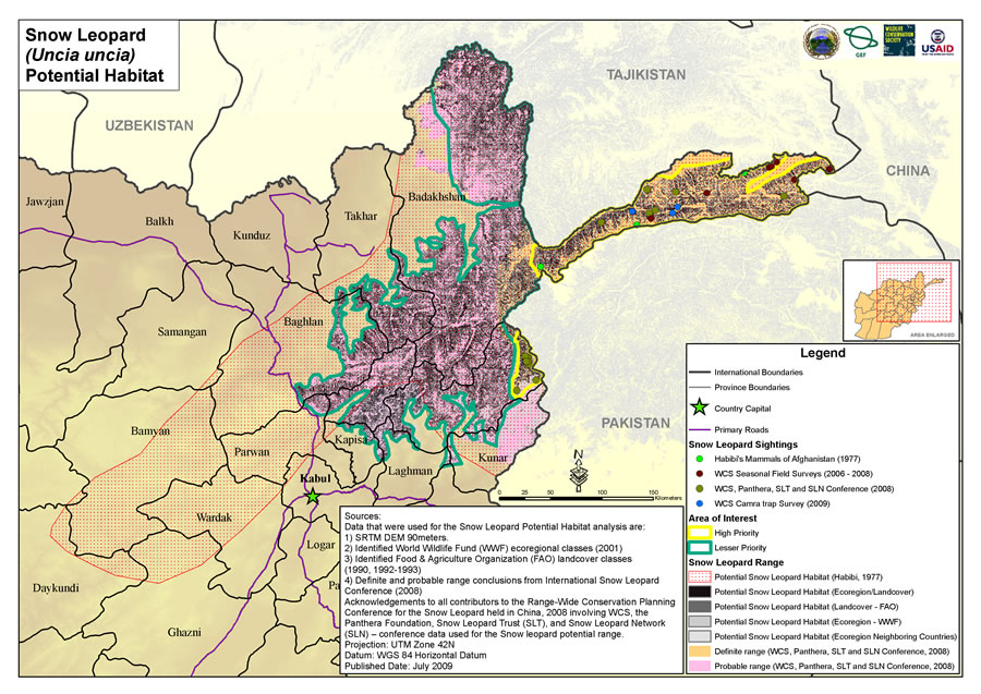
This potential habitat map also shows the location of snow leopard sightings, mostly in the Wakhan Corridor.
Elevations in the Afghan landscape change rapidly, and that affects water, soil, land, and climate. Therefore, the habitats in the country's ecoregions can contain a wider range of vegetation and wildlife species than, say, a flat expanse of desert. The team assigned priority ratings to the areas that had the widest ranges of biodiversity within the ecoregions of high mountain desert, plain deserts, or alpine and sabal pine forest land cover.
Another prioritizing criterion was the endangerment categories assigned to certain animals that roam Afghanistan. At the top of the list is the Marco Polo sheep (Ovis ammon polii), which is the largest mountain sheep in the world. The snow leopard was also high on the WCS priority list.
WCS used ArcGIS to calculate and rank ecosystems and show these areas on maps. Because the maps were going to be used as the foundation for discussing with stakeholders what areas to conserve, WCS experts also factored in security, logistics, budget, and history.
The Eastern Forests Complex, home to snow leopards and several other wild cat species, is a conservation priority.
When government policy makers were presented with these findings, they agreed to implement conservation plans at three major sites. First was the Wakhan Corridor, which is part of the Silk Road network between Afghanistan and China. Second was the Hazarajat Plateau, where Band-e-Amir National Park is located. Third was the Eastern Forest Complex, which contains some of the last temperate coniferous forest in the Greater Himalayan mountain range. It is home to the snow leopard and at least five other wild cat species. GIS was extensively used by researchers to analyze change, classify forest cover, and demonstrate forest degradation in that area.
The national government sanctioned Band-e-Amir as a national park, but it is up to the local people to manage it. With funding from USAID, WCS is working with citizens to develop the park's management plan and train rangers and game wardens. The WCS has also implemented an environmental education program for schools and works with local communities and central and provincial governments to ensure that wildlife and forestry protection policies are being developed and enforced.