USAID Development Data Available on ArcGIS Online
Mapped Data Provides Better Insight for Collaboration between Donors and Loan Recipients
August 13, 2012
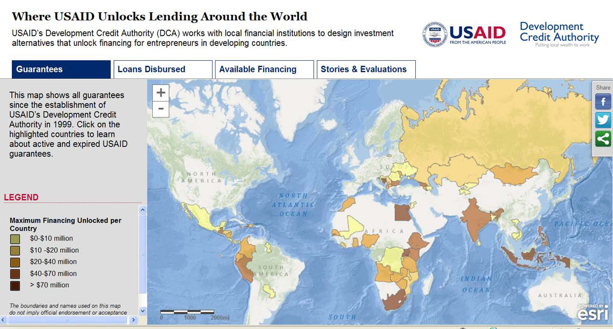
USAID data can be discovered through an Esri Story Map
Redlands, California—Last month, the US Agency for International Development (USAID) launched the agency's first-ever crowdsourcing initiative to clean and map development data such as guarantees, loans disbursed, and available financing. Volunteers used a simple crowdsourcing tool created with Esri technology to find the required location information. This data can now be easily visualized on an Esri Story Map and in ArcGIS Online, providing better insight for the private sector to explore new areas for collaboration with host countries, researchers, development organizations, and the public.
USAID's GeoCenter worked in cooperation with the agency's Development Credit Authority (DCA) to identify a global dataset of approximately 117,000 records to map and make available to the public. The data cleaning and geocoding process was crowdsourced to volunteer technical communities including the Standby Task Force (SBTF) and GISCorps. All the work was completed in just 16 hours—44 hours earlier than expected.
"By mapping guaranteed loan data, not only are we able to visually tell the story of cost-effective, private-sector-led development, but we are opening ourselves up to new opportunities and potential collaboration," said Ben Hubbard, director of USAID's DCA.
Visualizing this data on a map can change the way USAID's field missions plan for guarantees as well as where they invest development dollars to maximize their impact. By seeing where the loans are concentrated, USAID missions can better analyze whether the guarantees are fully reaching targeted regions.
"Mapping USAID-mobilized loans at the state level for each country allows USAID missions, for the first time, to analyze guarantees across country borders," said John Steffenson, director of federal, civilian, global affairs, and nonprofits, Esri. "We are pleased to continue partnering with USAID through this project." Making this data freely available on ArcGIS Online ensures that other donors can compare and even overlay their own guarantee data to identify opportunities to increase collaboration.
To view a Story Map application displaying the crowdsourced data and success stories, visit Esri Story Map. To make your own story map with the crowdsourced data and maps, visit Esri Story Map.
# # #
Press Information:
Karen Richardson, Esri
Tel.: 909-793-2853, extension 1-3491
E-mail (press only): press@esri.com
General Information: info@esri.com