ArcGIS Online
Understand your data in the context of location with intuitive analysis tools.

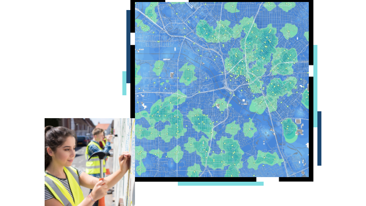

Data-rich maps help policymakers, decision-makers, and other stakeholders understand complex information that often gets lost in lengthy annual reports. ArcGIS serves as an analytics tool for big datasets, showing stakeholders what needs to be done where so they can make informed decisions and take necessary actions.
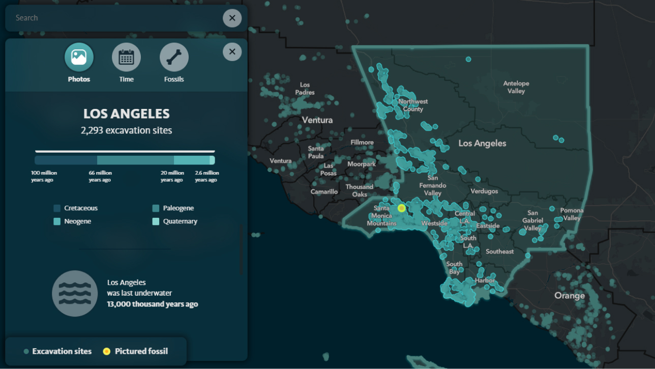
Understand a community’s lifestyles and demographics with ready-to-use content that can validate your program strategy. Location technology helps leaders gain insight on where goods or services are needed most, identify untapped resources, and prepare for the future. GIS shows a baseline of a community as it is today and provides predictive analytics about its future.
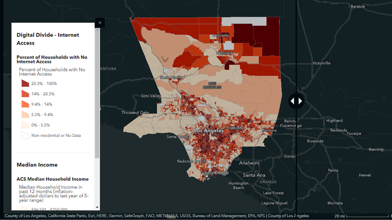

Measure ongoing program performance to ensure that current community needs are met equitably. Proactively identify emerging needs with spatial analysis of community conditions. Inform decision-makers, donors, and volunteers about the positive impacts of programs with maps and location-based dashboards.


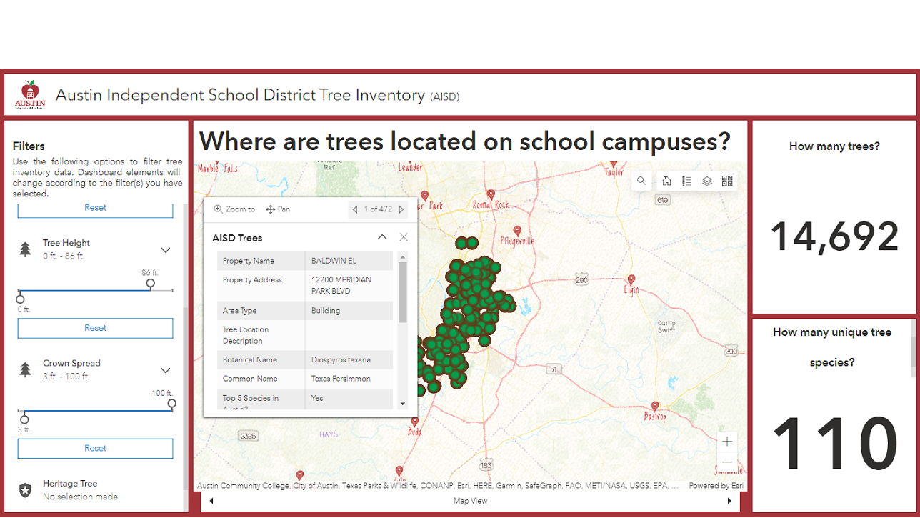
Use ArcGIS to analyze data and deliver maps, dashboards, apps, and other content related to your nonprofit’s program initiatives and success. In one place, you can inform volunteers and community champions about your areas of focus in real time, validate progress, and provide stakeholders access to review essential data and make informed decisions.

Ready-to-use GIS applications and content from authoritative data sources improve situational awareness and empower nonprofit teams to understand and address issues in real time. Use these apps to set baselines; monitor progress in at-risk areas; and provide transparent performance assessments to the community, volunteers, and stakeholders.
The Esri Nonprofit Organization Program provides nonprofit organizations with low-cost access to GIS software, training, content, and other resources. Join a vibrant community of nonprofits around the globe working to create a better world.