|
| |
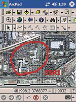
Add more visual representation by using the integrated camera support. |
In the fourth quarter of 2005, Esri plans to release the latest version of its mobile GIS solution, ArcPad 7. ArcPad is designed for organizations wanting to expand the benefits of GIS from the office to workers in the field. ArcPad allows field-workers to efficiently and accurately capture, analyze, and display geographic information in near real time.
At version 7, ArcPad expands the capabilities of mobile GIS applications with new features that dramatically improve the productivity of working with spatial data in the field. Some of the new features include
- Improved performance: updated platform support, greeking, and faster image rendering
- Enhanced and easy-to-use editing tools: snapping, offsets, undo, repeated attributes
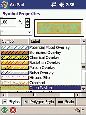
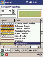
- Advanced symbology: a map legend in the table of contents, symbol editors, ArcGIS style sheets
- New labeling options: label expressions, angle and "smart" labels, placement options
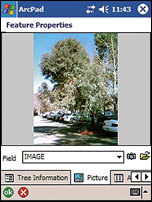
- Integrated camera support: picture page in Feature Properties, photo layer, EXIF support
- New range finder support and ability to build custom range finder extensions
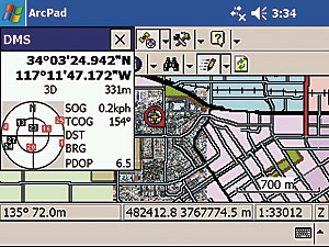
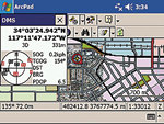
- Easier, automated GPS connectivity: Find GPS tool, capture controls
- Additional data formats: graphics layers, photo layers, additional image formats
- Additional projections and datum transformations and support for custom transformation DLLs
- Enhanced customization: QuickForm tool, expanded Object Model, and support for JScript
- ArcPad tools for ArcGIS Desktop: export style sheets and symbology for shapefiles, export/import graphics layers, and update symbology for ArcPad 7 from the Get Data for ArcPad tool
 |
 |
 |
| Take notes while in the field and use the sketch tool for freehand marking on maps. |
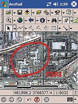
Use ArcGIS symbology and style sheets for clear feature representation. |
Streamline data collection with automated GPS connectivity. |
The development framework for building custom ArcPad applications for mobile GIS, called ArcPad Application Builder, has also been enhanced. The new features at version 7 make ArcPad Application Builder easier to use and offer many more customization options. Some new features include
- A wizard for creating forms
- Improved editing tools
- Support for JScript
- Tools to create, edit, and modify dBASE tables
- Expanded ArcPad object model: new range finder, FTP, archive, multimedia, and error objects
- Expanded extensions API: new interfaces for cameras, laser range finders, projections, and datum transformations
- Script editor enhancements
ArcPad 7 will undoubtedly streamline data collection and offer more options than ever for mobile GIS users. For more information, visit www.esri.com/arcpad or call 1-800-447-9778. To purchase ArcPad in the United States, visit store.esri.com or call 1-800-447-9778, call your Esri regional office, or contact your local reseller. Outside the United States, contact your local Esri distributor.
|