Fall 2005
Fall 2005 |
|||||||
|
|
|||||||
Ingenuity Fuels ArcWeb Services Challenge Winners |
|||||||
|
Esri's ArcWeb Services are enabling businesses to create innovative GIS Internet-based solutions for a variety of industries. This was never more apparent than during the ArcWeb Services Challenge, a competition held early in 2005 for companies using these hosted GIS services and data to create applications. Chosen from several contenders, the following three were selected for the usefulness, ease of use, and originality of their applications. Argo Navigation
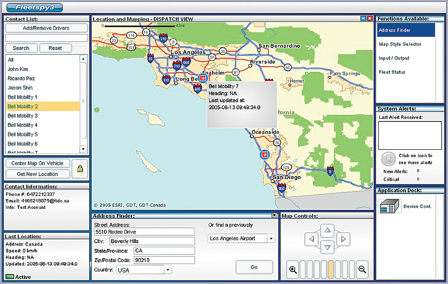
The first-place winner, Argo Navigation Inc. (www.argonav.com) of Anaheim, California, turned to ArcWeb Services when it wanted to provide an application for customers that allowed them to keep track of entire fleets with an easy-to-use interface. No matter the size of the fleet, Argo's Fleetspy3 plots it on a single map. Essential vehicle information is readily available with just a few mouse clicks. The user simply highlights a driver's name to find the driver's current status, such as phone number, e-mail address, and current traveling speed. An alert window will let the system operator know when a vehicle activates its preset speed or geofencing alerts. Fleetspy includes a fully functional route planning system. Users can choose locations based on street addresses, previously stored locations, or the current locations of mobile employees. Using these locations, the application can return route directions, including a route map and the respective trip totals. Information about current traffic conditions, including detailed descriptions and severity ratings, is available along the routes, saving drivers considerable time. Ecology and Environment, Inc.
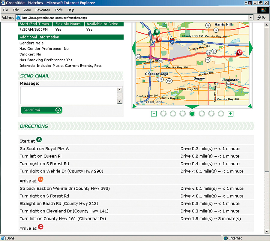
The second place winner, Esri Business Partner Ecology and Environment, Inc. (E&E) (www.ene.com), is a Lancaster, New York, firm founded in 1970. In fall 2004, E&E won a contract to update an electronic ride-share program called SmartTrips (smarttrips.org) for the North Front Range Metropolitan Planning Organization (NFRMPO) in Fort Collins, Colorado. NFRMPO wanted a Web-based ride-share system with online map content that would allow users the ability to search for their own matches. When E&E, in conjunction with sister firm Walsh Environmental, followed up the project with additional research and development and incorporated ArcWeb Services into the ride-share application, the result was GreenRide, a Web-based application designed to reduce automobile dependency and promote the use of alternative transportation. Sportsim
Sportsim (www.sportsim.com) is located in Norway. The creator of Sportsim, Terje Henriksen, realized in 1998 during the Norwegian cross-country skiing race Birkenbeinerrennet that the finish times of the race could be provided to participants in a more efficient manner. He created a small application that timed participants and gave the results almost immediately. The race time simulation became a regular service in the Birkenbeiner events and led to Henriksen's new company, Sportsim, founded in 2001. "We thought of this idea after seeing the increasing use of GPS, heart-rate monitors, time technology, and the Internet, especially in outdoor training and sporting events," says Gjermund Weisz, CEO, Sportsim. Like most small businesses, Sportsim wanted to find a way to deliver a competitive solution. While Sportsim had the expertise in the sports arena, providing an application that incorporated everything it needed was something it wasn't certain how to do. Sportsim needed to find a solution that would work anywhere in the world over the Internet for athletes to analyze their workout data. Sportsim contacted Esri and chose ArcWeb Services to build its application. "Sportsim cannot arrange special deals with 100 different mapmakers around the world," says Weisz. "Esri has helped us by arranging relationships with these mapmakers so we can focus on what we do best—making the end product." |