Fall 2007
Fall 2007 |
|||||||
|
|
|||||||
Planet Action Looks for Partners to Help Support Projects and Raise Awareness
Earth Observation and GIS Industries Take Action Against Climate Change |
|||
|
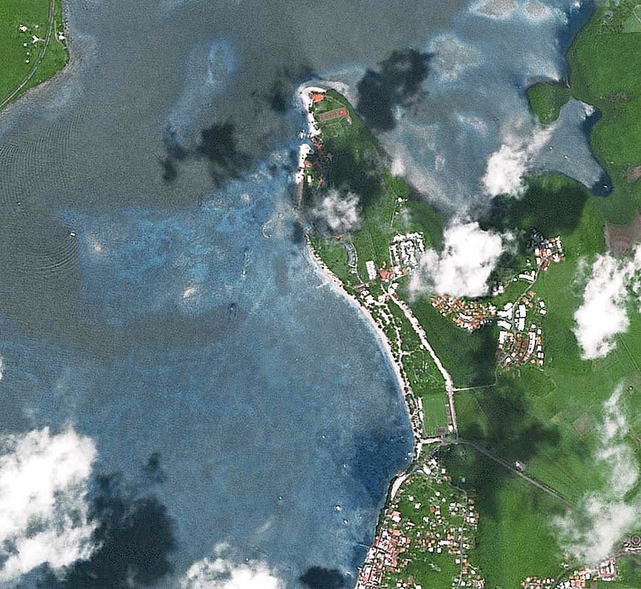
Climate change is rapidly becoming the most important environmental challenge facing mankind. Small temperature changes may seem inconsequential to the unwary, but only because small temperature shifts are often inconspicuous to people. In nature, temperature represents energy, and oceans and air move in response to energy and material flows. A small temperature change to the vast volume of oceans covering our earth represents immense changes in energy. These energy changes can become concentrated and focused, resulting in massive hurricanes and storms. Concurrently, at critical periods, insect life cycles often hinge on tiny changes in temperature. The slightest temperature change at the right moment can trigger outbreaks of insect pests or disease vectors, which can destroy entire landscapes, forests, or croplands. Everything in nature is related, so outbreaks or changes in one area trigger changes in other areas or organisms and the cycles expand. For example, Southern California's climate changes affected bark beetle outbreaks leading to many dead trees, while building accelerated in wild forest and scrub areas and what once was a natural fire-cycle community now becomes a source of increasing losses and human impacts. The immediate survival of many coastal areas, populations, forests, and wildlife may now depend on our ability to study, understand, and share the small changes we observe in the environments and ecosystems around us. The science of earth imagery possesses the ability to understand and visualize what is occurring, and at what pace, to our world. It combines different images of the same locations over time, thus demonstrating the rate at which glaciers recede, ice caps melt, and lakes and forests decline. Meanwhile, GIS technology has proven its utility across all areas of human endeavor and has attracted widespread public fascination with the latest generation of user-friendly software. Again and again, GIS has demonstrated that it is a potent tool for managing and facilitating the most advanced and complex research of the scientific community. When combined, earth imagery and GIS demonstrate a variety of clear and compelling spatial and interactive visualizations of our changing climate.
It is well documented and proven that a man-made climate of virtually uncontrolled and rapid technology evolution, compacted with unprecedented population growth, has contributed to the earth's climate change. Planet Action asserts that technology can contribute to the solution as well. Planet Action intends to make advanced spatial technologies available to thousands of conservation and environmental nonprofit organizations so that they can better utilize the best tools available to understand and act upon the environmental impacts of climate change. Planet Action is governed by three core principles. The first purpose is to support projects of any size from scientific or civil societies that analyze the impact of climate change and suggest ways for action. Planet Action's second purpose is to support collaboration among project teams, local communities, and global organizations and to use earth imagery and GIS as a link between each group. A final purpose is to help any individual or community take action and get involved in issues related to climate change. When met, Planet Action's objectives are meant to produce action, such as ongoing support of projects that meet the Planet Action criteria; the launch and management of an information and exchange Internet platform about climate change via a common depository of knowledge generated from Planet Action projects; and the facilitation of education and outreach programs supported by the Planet Action projects and Internet platform. Project CriteriaProjects must meet certain criteria before qualifying for support from Planet Action. Each project must assess climate change-related impacts and issues and initiate a course of action. The project must also concentrate on one of Planet Action's areas of focus, and each project must incorporate good scientific understanding, resources and methods. The project's team must have a local presence in the country where the project will take place, and project objectives and team members must be validated by the Planet Action scientific committee. In Planet Action's infancy, its plan is to support each qualified project on a first come, first served basis. Projects will be supported with grants from business sponsors, foundation members, partners, other foundations, or the general public. When its revenues exceed its operational needs, the Planet Action Foundation will reallocate funds to projects. Become a PartnerAny organization or business can become a Planet Action Partner. Along with cofounders Spot Image and Esri, these global partners will agree to provide Planet Action projects with discounted or free products or services and program funding. The partners will participate in the project selection and management process and have an active role in the Planet Action knowledge platform. Partnership is not limited to companies in the earth observation and GIS industries. Any organization that wishes and agrees to contribute to the Planet Action objectives is welcome to become a partner or an official member by contributing to the Planet Action Foundation. Scheduled to be incorporated in 2008, the Planet Action Foundation will manage a yearly call for projects, the exchange platform, and the education and outreach programs. The foundation will also coordinate various other project-related tasks, such as helping with satellite image analysis, supporting data collection and analysis, connecting scientific teams working on similar projects, providing guidance and mentoring, and taking part in the selection and analysis of projects. Fund-raising and the management of contributions from partners will also be a responsibility of the foundation. Until the foundation is incorporated into the Planet Action initiative, its responsibilities will be managed by an operational committee jointly established between the partners. More InformationTo become a Planet Action Partner or for more information on the effects of climate change, visit www.planet-action.org. See also "Ongoing Planet Action Projects." |
 Planet Action is a nonprofit collaborative initiative begun by satellite imagery industry leader Spot Image, and joined by Esri as a founding partner. Its purpose is to encourage the earth observation industry and GIS professional communities to address climate change by supporting projects that investigate and assess climate change environmental impacts in five areas of focus: human dimensions and habitation, drought and water resources, vegetation and ecosystems, oceans, and ice and snow cover. By assisting in and funding projects that will support understanding and action on environmental impacts, the Planet Action initiative, founded in June 2007, hopes to strengthen international cooperation and response to climate change problems.