GIS: A Language for Understanding
By Jack Dangermond
Esri has just completed another amazing International User Conference. I want to thank the more than 14,000 people who attended and made this our most successful conference ever. The theme of the conference was "GIS—Understanding Our World." For those who were unable to attend the conference this year, I'd like to share a few thoughts on this theme.
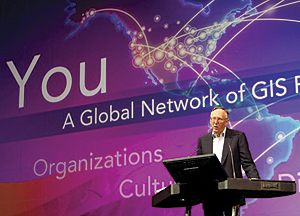
Jack Dangermond delivers the keynote presentation "GIS—Understanding Our World" at the 2011 Esri International User Conference in San Diego, California.
Today our world is changing rapidly and is facing many challenges. Climate change, urbanization, security, poverty, inequality—these are difficult problems we must deal with, and they're affecting us as individuals, as well as impacting our organizations and governments. We are also increasingly aware of the role humans are playing in that change. It's my sense that in order for us to really address these things, we can't just keep doing the same things; we need a different approach. We need collective intelligence, and our actions need to be based on this intelligence. This informed, science-based approach is our best hope for confronting these unprecedented challenges. As GIS professionals, you will play an increasingly important role in helping create a better understanding of our world.
What Is Understanding?
Understanding is about knowing. It's quite human, built on real experiences, reasoning, and thinking about things. Knowing enables us to understand, think, predict, explain, add meaning, and have insight. Our minds are the framework within which all of this happens. They organize and synthesize information for us, then integrate it into our lives. This is understanding.
GIS as a Language
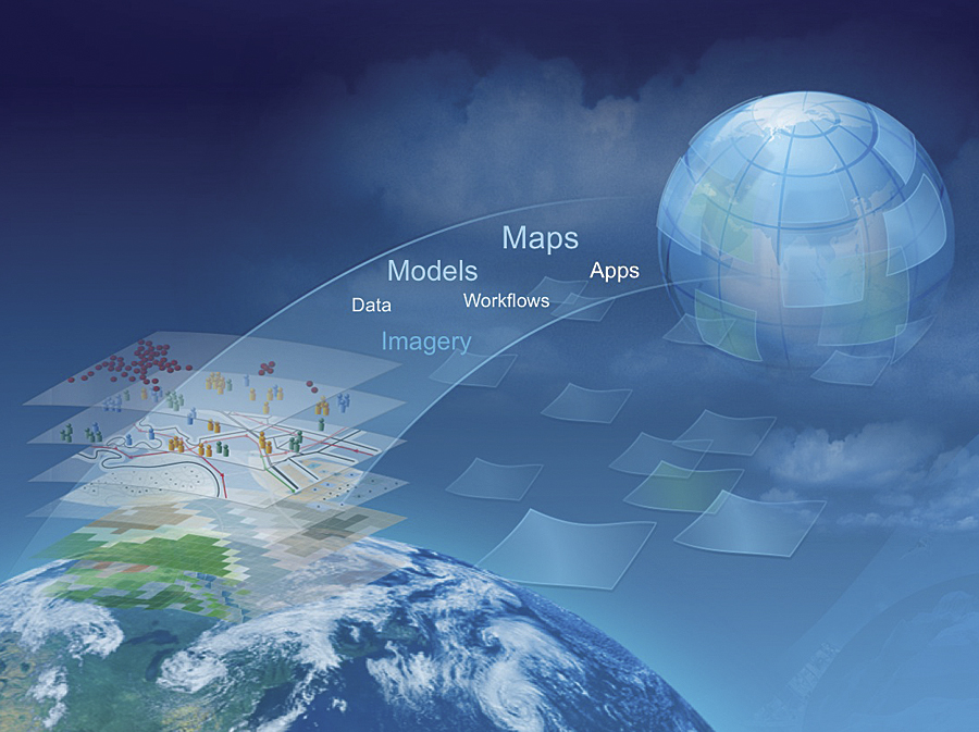
Geography has always been a critical type of information that humans—in fact, all animals—collect, organize, and use. Place-based information is vital to survival on our planet. As our world has become more complex and our ability to understand has grown, GIS technology has evolved to help us process information about place and put it in a context that allows us to act. GIS is actually extending our minds by abstracting our world into the knowledge objects that you create and maintain—data, imagery, models, maps, and apps. GIS is facilitating a systematic framework for knowing, and our shared work is leading to a collective understanding.
This is not just theoretical; remember that from the very beginning, GIS has always been a very practical technology. When Roger Tomlinson and his colleagues began to implement these ideas, it was about harnessing the power of information technology to gain an understanding of geography that the human mind could not deduce without the assistance of computers.
A new pattern is emerging that will open and extend GIS.
Today, GIS integrates and synthesizes information from many sources and does it in volumes we could not have imagined 30 years ago. The availability of new technologies and the growing concern for our planet mean that we are producing an ever-increasing store of data describing our earth. We're being bombarded with data from a combination of old and new sources—satellites, sensors, crowdsourcing ("human sensors"), models, digitization of historic records, and much more. Only when these billions of bits of information are combined and organized can we achieve a higher meaning—a true understanding of our world. This will require the right technology and culture for sharing our data and building a common geospatial infrastructure.
As a kind of language, GIS also facilitates communication and collaboration, breaking down barriers between individuals, organizations, institutions, and the world. This is part of its power. With the number and severity of problems facing our modern world, much of them having to do with place, GIS is becoming an essential new language for understanding. My sense is that our new ArcGIS Online platform provides such a framework and will enable our users, both in their organizations and beyond, to fully leverage the language of GIS.
An Evolving Ecosystem
GIS is changing rapidly. This evolution is not linear; it is organic and means that GIS is evolving alongside other components of the technology ecosystem. Measurement technologies and crowdsourcing are creating huge volumes of geospatial data. The data itself is growing in volume, and we have to find new ways to handle that volume. There are new issues, such as privacy and access, that we need to address.
And of course, computing technology itself continues to evolve. Connectivity is enabling new kinds of networking—social networking. Our science is also changing, becoming more quantitative in every discipline—more integrated, analytic, real time, and predictive. It also becomes more collaborative. These are very interesting progressions that we see in the computing ecosystem. And GIS itself is evolving within this ecosystem, becoming more adept at managing large datasets, multidimensional (3D/4D), and much easier to use.
So how can we evolve GIS so that anyone can leverage its power? It's an important question, because this evolution is the foundation for understanding our world.
A New Pattern
A new pattern for GIS is already emerging, making GIS available to everyone. A long progression of efforts is bringing our work—substantial, authoritative source information—to the web and blending it with social network and crowdsourced information. This new pattern is making all this work available through lightweight viewers and mobile devices, providing a broad context of understanding to individuals, organizations, and governments—to everyone.
GIS extends our minds, abstracting our world and providing a systematic framework for understanding.
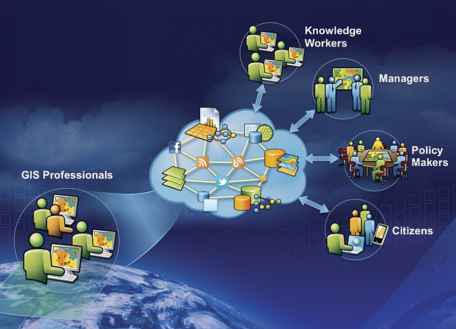
But will this new pattern be broadly adopted? Is it of interest just to GIS professionals, or will it be adopted by a broader audience? I think this pattern will be broadly adopted because the benefits are so great. It will connect you—the GIS professional—with knowledge workers, managers, policy makers, and citizens, extending your reach. It will empower citizens to participate in the same network environment, using the same infrastructure and sharing common services to create a collective understanding.
A Path Forward
I meet with hundreds of GIS professionals over the course of the year and am continually amazed at the creativity they display in using GIS to solve complex problems and support critical decisions. The User Conference is like magnifying this 100 times and condensing it all into one short week. The applications on display, the papers presented, and the maps shared exhibit an overwhelming case for the value of GIS. From sea-level rise to deforestation, from disaster recovery to disease monitoring, and from vehicle routing to demographic analysis, it's clear that GIS is already being widely used as a tool to help us understand.
Esri remains firmly committed to building tools you can use to understand and solve the pressing geographic problems the world is facing, because we firmly believe that acting responsibly requires understanding.