ArcGIS for AutoCAD: Maximize CAD and GIS Across the Enterprise
Free, New Version Available
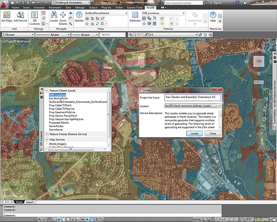
Use ArcGIS for AutoCAD to access a geolocation service and locate place-names in your drawing.
For engineers and planners who use AutoCAD to construct and maintain drawings of infrastructure and utilities, Esri's latest release of ArcGIS for AutoCAD simplifies the communication of information between the CAD and GIS platforms. ArcGIS for AutoCAD is a free plug-in that allows users to access, create, edit, and share GIS data inside AutoCAD. Through ArcGIS for AutoCAD, GIS and CAD users can share information throughout an organization without costly add-on software, conversion, or complex workflows. Most notably, ArcGIS for AutoCAD users with read/write access to ArcGIS for Server feature services can now edit geodatabases through AutoCAD.
ArcGIS for AutoCAD is the interface into the ArcGIS system for AutoCAD users. Through this interface, they can access all the data content, sharing, and data management available in ArcGIS. AutoCAD files created with ArcGIS for AutoCAD include GIS data stored completely within the AutoCAD file and are directly usable as ArcGIS datasets. The advantages of using this free plug-in are numerous: workflows are faster, duplicate efforts are eliminated, and everyone across the enterprise becomes more empowered in their daily work with this added access.
ArcGIS for AutoCAD users can do the following:
- Edit ArcGIS geodatabases through a feature service
- Add Esri map and imagery services, such as from ArcGIS Online
- Add maps from enterprise or cloud servers
- Navigate within drawings by using a street address
- Create ArcGIS feature classes in AutoCAD
- Extract GIS data from feature services
AutoCAD 2010/2011/2012 (32 bit and 64 bit) systems are supported.
Free download available—To learn more about ArcGIS for AutoCAD and to download it, visit esri.com/autocadapp.